TopoQuest Logo
Do you find TopoQuest useful?
Help keep TopoQuest running and adding new maps/features by donating!
Bitcoin:  19c7KJd3qBynnjoSw5npx9KScwjBe4ifkT
Litecoin:  LXs6TkuXGGXo1vDsWCkWVdjQX94eUKd6ui
Home View Maps Find Maps Find Places Resources & Links


Union, Indiana Topographic Map

USGS Map Title: Union, IN
USGS Map MRC: 38087D4
DRG (GeoTIFF) Download: o38087d4.tif


Neighboring USGS Topographic Map Quads:


  Decker, IN  
38087E5
 

  Iona, IN  
38087E4
 

  Monroe City, IN  
38087E3
 

  Patoka, IN  
38087D5
 

  Union, IN  
38087D4
 

  Petersburg, IN  
38087D3
 

  Princeton, IN  
38087C5
 

  Francisco, IN  
38087C4
 

  Oakland City, IN  
38087C3


Map MRC Location:

N39°
W88°
N39°
W87°
H8 H7 H6 H5 H4 H3 H2 H1
G8 G7 G6 G5 G4 G3 G2 G1
F8 F7 F6 F5 F4 F3 F2 F1
E8 E7 E6 E5 E4 E3 E2 E1
D8 D7 D6 D5 D4 D3 D2 D1
C8 C7 C6 C5 C4 C3 C2 C1
B8 B7 B6 B5 B4 B3 B2 B1
A8 A7 A6 A5 A4 A3 A2 A1
N38°
W88°
N38°
W87°

Union, IN USGS 1:24K Topographic Map Preview:
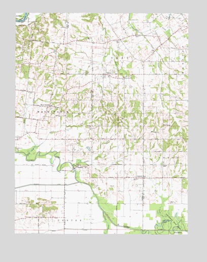
Union, IN USGS Topographic Map
Click on map above to begin viewing in our Map Viewer.

This topographic map contains these locations and features:
Feature Name Type Latitude Longitude GNIS ID View Map
Armstrong CemeteryCemeteryN38.4550°W87.4872°430260View Map
Atkinson ChapelChurchN38.4145°W87.3931°430326View Map
Barnes CemeteryCemeteryN38.3928°W87.3875°430498View Map
Bethlehem CemeteryCemeteryN38.4859°W87.4486°430974View Map
Big CreekStreamN38.3828°W87.3903°431024View Map
Buck CreekStreamN38.3767°W87.3889°431717View Map
Catt CemeteryCemeteryN38.4887°W87.3981°432244View Map
Coats SpringPopulated PlaceN38.4375°W87.3906°432715View Map
Decker BranchStreamN38.4970°W87.4925°433403View Map
Frederick CemeteryCemeteryN38.4964°W87.4170°434792View Map
Goose CreekStreamN38.4195°W87.4920°435184View Map
Houchins DitchCanalN38.4028°W87.4761°436510View Map
Independent Order of Odd Fellows CemeteryCemeteryN38.4660°W87.4477°436677View Map
Indian CreekStreamN38.4242°W87.4861°436733View Map
Keg CreekStreamN38.3770°W87.4083°437195View Map
Kirk CemeteryCemeteryN38.4023°W87.4314°437352View Map
Kirk-McRoberts CemeteryCemeteryN38.4237°W87.4997°437353View Map
Little Conger CreekStreamN38.4889°W87.4095°438017View Map
Lost CreekStreamN38.3875°W87.4361°438313View Map
Miller SchoolSchoolN38.4070°W87.3786°439227View Map
Morrow LateralCanalN38.3775°W87.4586°439468View Map
Mount Olive ChurchChurchN38.4470°W87.4717°439618View Map
Mount OlympusPopulated PlaceN38.4473°W87.4750°439635View Map
Mount Pleasant ChurchChurchN38.4328°W87.3975°439672View Map
Mount Tabor ChurchChurchN38.4356°W87.4450°439708View Map
New Butler ChapelChurchN38.4881°W87.4131°440030View Map
OatsvillePopulated PlaceN38.4070°W87.4075°440490View Map
Phillips CemeteryCemeteryN38.4803°W87.4953°441083View Map
Richardson CemeteryCemeteryN38.4064°W87.4145°441953View Map
Salem ChurchChurchN38.4920°W87.4642°442903View Map
Stewart CemeteryCemeteryN38.4973°W87.3833°444147View Map
Township of ClayCivilN38.4898°W87.4242°453217View Map
Township of WashingtonCivilN38.4435°W87.4777°453995View Map
UnionPopulated PlaceN38.4653°W87.4347°445046View Map
Union Bethel ChurchChurchN38.4287°W87.4986°445048View Map
WheelingPopulated PlaceN38.4131°W87.4553°445894View Map
Yellow CreekStreamN38.4139°W87.4586°446376View Map

Note: Coordinates in the location and feature list above are referenced to NAD83 datum.


Copyright (C) 2008-2024 Ryan Niemi / Sunset Dynamics ... All Rights Reserved