TopoQuest Logo
Do you find TopoQuest useful?
Help keep TopoQuest running and adding new maps/features by donating!
Bitcoin:  19c7KJd3qBynnjoSw5npx9KScwjBe4ifkT
Litecoin:  LXs6TkuXGGXo1vDsWCkWVdjQX94eUKd6ui
Home View Maps Find Maps Find Places Resources & Links


Winslow, Indiana Topographic Map

USGS Map Title: Winslow, IN
USGS Map MRC: 38087D2
DRG (GeoTIFF) Download: o38087d2.tif


Neighboring USGS Topographic Map Quads:


  Monroe City, IN  
38087E3
 

  Sandy Hook, IN  
38087E2
 

  Glendale, IN  
38087E1
 

  Petersburg, IN  
38087D3
 

  Winslow, IN  
38087D2
 

  Otwell, IN  
38087D1
 

  Oakland City, IN  
38087C3
 

  Augusta, IN  
38087C2
 

  Velpen, IN  
38087C1


Map MRC Location:

N39°
W88°
N39°
W87°
H8 H7 H6 H5 H4 H3 H2 H1
G8 G7 G6 G5 G4 G3 G2 G1
F8 F7 F6 F5 F4 F3 F2 F1
E8 E7 E6 E5 E4 E3 E2 E1
D8 D7 D6 D5 D4 D3 D2 D1
C8 C7 C6 C5 C4 C3 C2 C1
B8 B7 B6 B5 B4 B3 B2 B1
A8 A7 A6 A5 A4 A3 A2 A1
N38°
W88°
N38°
W87°

Winslow, IN USGS 1:24K Topographic Map Preview:
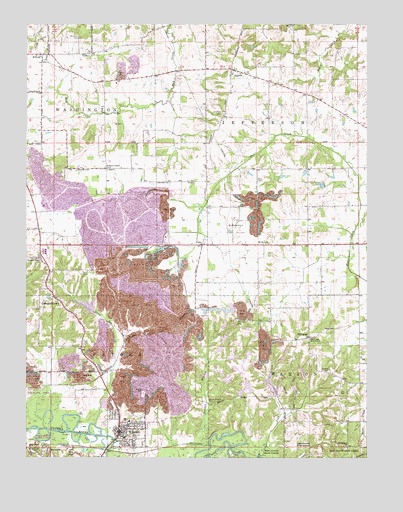
Winslow, IN USGS Topographic Map
Click on map above to begin viewing in our Map Viewer.

This topographic map contains these locations and features:
Feature Name Type Latitude Longitude GNIS ID View Map
AlfordPopulated PlaceN38.4914°W87.2428°430070View Map
AlgiersPopulated PlaceN38.4873°W87.1750°430075View Map
Beadles CemeteryCemeteryN38.4006°W87.1386°430601View Map
Brenton ChapelChurchN38.4584°W87.2206°431484View Map
Bruster BranchStreamN38.3787°W87.1825°431695View Map
Bruster Branch CemeteryCemeteryN38.3909°W87.1822°431696View Map
CampbelltownPopulated PlaceN38.4214°W87.2400°432088View Map
CatoPopulated PlaceN38.4367°W87.1856°432243View Map
Flat Creek CemeteryCemeteryN38.4145°W87.1731°434562View Map
Flat Creek Memorial ChurchChurchN38.4101°W87.1461°434563View Map
Hayes CemeteryCemeteryN38.4123°W87.1369°435918View Map
Lick CreekStreamN38.3751°W87.1645°437854View Map
McClure CemeteryCemeteryN38.4742°W87.1781°438799View Map
Morrison CemeteryCemeteryN38.4959°W87.2306°439455View Map
Mount Heaborn ChurchChurchN38.3767°W87.2458°439571View Map
Mount Olive ChurchChurchN38.4367°W87.1611°439616View Map
North Patoka Township Volunteer Fire Department Station 1BuildingN38.3995°W87.2238°2626466View Map
Oak Hill CemeteryCemeteryN38.3809°W87.2125°440429View Map
Pike CountyCivilN38.3988°W87.2322°450381View Map
Pleasant Ridge ChurchChurchN38.4328°W87.2456°441298View Map
Riverside ParkParkN38.3789°W87.2172°442098View Map
Spraggans ChurchChurchN38.3784°W87.1319°443963View Map
Stone Coe CreekStreamN38.3845°W87.2250°444202View Map
Sunset CemeteryCemeteryN38.3934°W87.2069°444422View Map
Town of WinslowCivilN38.3827°W87.2129°2397752View Map
Township of JeffersonCivilN38.4775°W87.1406°453495View Map
Township of MarionCivilN38.3783°W87.1279°453611View Map
Township of PatokaCivilN38.3776°W87.2493°453710View Map
White Oak LakeReservoirN38.3961°W87.1600°448533View Map
White Oak Lake DamDamN38.3934°W87.1583°448532View Map
WhiteoakPopulated PlaceN38.4095°W87.1464°445976View Map
Willis CemeteryCemeteryN38.4548°W87.1653°446092View Map
WinslowPopulated PlaceN38.3823°W87.2128°446190View Map
Winslow Elementary SchoolSchoolN38.3859°W87.2122°447181View Map
Winslow Police DepartmentBuildingN38.3824°W87.2164°2758292View Map
Winslow Volunteer Fire DepartmentBuildingN38.3810°W87.2151°2625622View Map

Note: Coordinates in the location and feature list above are referenced to NAD83 datum.


Copyright (C) 2008-2025 Ryan Niemi / Sunset Dynamics ... All Rights Reserved