TopoQuest Logo
Do you find TopoQuest useful?
Help keep TopoQuest running and adding new maps/features by donating!
Bitcoin:  19c7KJd3qBynnjoSw5npx9KScwjBe4ifkT
Litecoin:  LXs6TkuXGGXo1vDsWCkWVdjQX94eUKd6ui
Home View Maps Find Maps Find Places Resources & Links


Petes Mountain, Oregon Topographic Map

USGS Map Title: Petes Mountain, OR
USGS Map MRC: 43118G2
DRG (GeoTIFF) Download: o43118g2.tif


Neighboring USGS Topographic Map Quads:


  Cottonwood Reservoir, OR  
43118H3
 

  Beulah, OR  
43118H2
 

  De Armond Mountain, OR  
43118H1
 

  Drinkwater Pass, OR  
43118G3
 

  Petes Mountain, OR  
43118G2
 

  Stemler Ridge, OR  
43118G1
 

  Upton Mountain, OR  
43118F3
 

  Selle Gap, OR  
43118F2
 

  Juntura, OR  
43118F1


Map MRC Location:

N44°
W119°
N44°
W118°
H8 H7 H6 H5 H4 H3 H2 H1
G8 G7 G6 G5 G4 G3 G2 G1
F8 F7 F6 F5 F4 F3 F2 F1
E8 E7 E6 E5 E4 E3 E2 E1
D8 D7 D6 D5 D4 D3 D2 D1
C8 C7 C6 C5 C4 C3 C2 C1
B8 B7 B6 B5 B4 B3 B2 B1
A8 A7 A6 A5 A4 A3 A2 A1
N43°
W119°
N43°
W118°

Petes Mountain, OR USGS 1:24K Topographic Map Preview:
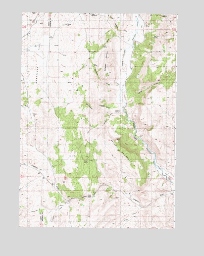
Petes Mountain, OR USGS Topographic Map
Click on map above to begin viewing in our Map Viewer.

This topographic map contains these locations and features:
Feature Name Type Latitude Longitude GNIS ID View Map
Chimney CreekStreamN43.7652°W118.2116°1118896View Map
China RockCliffN43.8018°W118.1724°1118916View Map
Chitsey SpringSpringN43.7891°W118.1957°1118925View Map
Chukar ParkParkN43.8032°W118.1557°1157283View Map
Cottonwood GulchValleyN43.8202°W118.1749°1119337View Map
Cottonwood SpringSpringN43.8208°W118.1825°1119349View Map
County Line ReservoirReservoirN43.8424°W118.2288°1131759View Map
Cripple GulchValleyN43.7624°W118.1521°1119550View Map
Davis SpringSpringN43.7591°W118.2406°1157282View Map
Halladay GulchValleyN43.8168°W118.1766°1121523View Map
Halladay SpringSpringN43.8173°W118.1742°1121524View Map
Jack SpringSpringN43.8737°W118.1368°1122334View Map
Juniper Tree ReservoirReservoirN43.8173°W118.1340°1131767View Map
Kingsbury GulchValleyN43.7724°W118.1274°1122768View Map
McClellan GulchValleyN43.8315°W118.1749°1123907View Map
McClellan MountainSummitN43.8446°W118.1827°1123908View Map
Moonshine SpringSpringN43.8615°W118.1440°1124330View Map
Mud SpringSpringN43.8681°W118.1506°1124485View Map
Mud Springs GulchValleyN43.8632°W118.1652°1124501View Map
Petes MountainSummitN43.7954°W118.1696°1125331View Map
Sagebrush FlatFlatN43.8463°W118.2349°1126440View Map
Scab GulchValleyN43.8585°W118.1677°1126631View Map
Scab SpringSpringN43.8557°W118.1848°1126632View Map
Tub SpringSpringN43.8597°W118.2266°1128262View Map
Upper Mud SpringSpringN43.8746°W118.1943°1128465View Map
Whitley CanyonValleyN43.8282°W118.1644°1129018View Map
Willow SpringSpringN43.7678°W118.1932°1129166View Map
Zink SpringSpringN43.8448°W118.1919°1129412View Map

Note: Coordinates in the location and feature list above are referenced to NAD83 datum.


Copyright (C) 2008-2025 Ryan Niemi / Sunset Dynamics ... All Rights Reserved