TopoQuest Logo
Do you find TopoQuest useful?
Help keep TopoQuest running and adding new maps/features by donating!
Bitcoin:  19c7KJd3qBynnjoSw5npx9KScwjBe4ifkT
Litecoin:  LXs6TkuXGGXo1vDsWCkWVdjQX94eUKd6ui
Home View Maps Find Maps Find Places Resources & Links


Day Basin, Oregon Topographic Map

USGS Map Title: Day Basin, OR
USGS Map MRC: 44119D6
DRG (GeoTIFF) Download: o44119d6.tif


Neighboring USGS Topographic Map Quads:


  Tubb Spring, OR  
44119E7
 

  Picture Gorge West, OR  
44119E6
 

  Picture Gorge East, OR  
44119E5
 

  Antone, OR  
44119D7
 

  Day Basin, OR  
44119D6
 

  Dayville, OR  
44119D5
 

  Six Corners, OR  
44119C7
 

  Wolf Mountain, OR  
44119C6
 

  Aldrich Gulch, OR  
44119C5


Map MRC Location:

N45°
W120°
N45°
W119°
H8 H7 H6 H5 H4 H3 H2 H1
G8 G7 G6 G5 G4 G3 G2 G1
F8 F7 F6 F5 F4 F3 F2 F1
E8 E7 E6 E5 E4 E3 E2 E1
D8 D7 D6 D5 D4 D3 D2 D1
C8 C7 C6 C5 C4 C3 C2 C1
B8 B7 B6 B5 B4 B3 B2 B1
A8 A7 A6 A5 A4 A3 A2 A1
N44°
W120°
N44°
W119°

Day Basin, OR USGS 1:24K Topographic Map Preview:
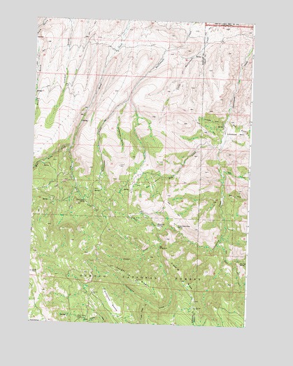
Day Basin, OR USGS Topographic Map
Click on map above to begin viewing in our Map Viewer.

This topographic map contains these locations and features:
Feature Name Type Latitude Longitude GNIS ID View Map
A and M RidgeRidgeN44.3929°W119.6611°1116745View Map
Back CreekStreamN44.4132°W119.6758°1117127View Map
Barite Post Office (historical)Post OfficeN44.4485°W119.7289°1164882View Map
Big BedgroundFlatN44.4065°W119.6766°1117585View Map
Black Canyon CampLocaleN44.3765°W119.7208°1117756View Map
Breathing SpringSpringN44.4159°W119.6777°1118053View Map
China Camp SpringSpringN44.4255°W119.7195°1118904View Map
Cottonwood BasinBasinN44.4540°W119.6330°1140167View Map
Cougar CreekStreamN44.4074°W119.6769°1119371View Map
Cougar RidgeRidgeN44.3949°W119.6941°1119388View Map
Day BasinBasinN44.4332°W119.6844°1119718View Map
Day CreekStreamN44.4476°W119.6425°1119720View Map
Dyke CreekStreamN44.4388°W119.6430°1141455View Map
East Birch CreekStreamN44.4474°W119.7286°1120277View Map
East Fork Cottonwood CreekStreamN44.4085°W119.6425°1141548View Map
Home Sweet Home SpringSpringN44.4155°W119.6662°1121941View Map
Kangaroo BasinValleyN44.4660°W119.6983°1122632View Map
Lost Cabin CreekStreamN44.3843°W119.6816°1145500View Map
McClanahan MeadowFlatN44.3835°W119.7028°1123905View Map
Red GulchValleyN44.4618°W119.6386°1148299View Map
Still GulchValleyN44.4299°W119.6414°1127608View Map
Tennessee GulchValleyN44.4585°W119.6416°1127934View Map
Tin Cup SpringSpringN44.4008°W119.6296°1128122View Map
West Birch CreekStreamN44.4485°W119.7289°1152025View Map
Windy PointSummitN44.3957°W119.7489°1129227View Map

Note: Coordinates in the location and feature list above are referenced to NAD83 datum.


Copyright (C) 2008-2025 Ryan Niemi / Sunset Dynamics ... All Rights Reserved