TopoQuest Logo
Do you find TopoQuest useful?
Help keep TopoQuest running and adding new maps/features by donating!
Bitcoin:  19c7KJd3qBynnjoSw5npx9KScwjBe4ifkT
Litecoin:  LXs6TkuXGGXo1vDsWCkWVdjQX94eUKd6ui
Home View Maps Find Maps Find Places Resources & Links


Dayville, Oregon Topographic Map

USGS Map Title: Dayville, OR
USGS Map MRC: 44119D5
DRG (GeoTIFF) Download: o44119d5.tif


Neighboring USGS Topographic Map Quads:


  Picture Gorge West, OR  
44119E6
 

  Picture Gorge East, OR  
44119E5
 

  Sheep Ridge, OR  
44119E4
 

  Day Basin, OR  
44119D6
 

  Dayville, OR  
44119D5
 

  Aldrich Mountain North, OR  
44119D4
 

  Wolf Mountain, OR  
44119C6
 

  Aldrich Gulch, OR  
44119C5
 

  Aldrich Mountain South, OR  
44119C4


Map MRC Location:

N45°
W120°
N45°
W119°
H8 H7 H6 H5 H4 H3 H2 H1
G8 G7 G6 G5 G4 G3 G2 G1
F8 F7 F6 F5 F4 F3 F2 F1
E8 E7 E6 E5 E4 E3 E2 E1
D8 D7 D6 D5 D4 D3 D2 D1
C8 C7 C6 C5 C4 C3 C2 C1
B8 B7 B6 B5 B4 B3 B2 B1
A8 A7 A6 A5 A4 A3 A2 A1
N44°
W120°
N44°
W119°

Dayville, OR USGS 1:24K Topographic Map Preview:
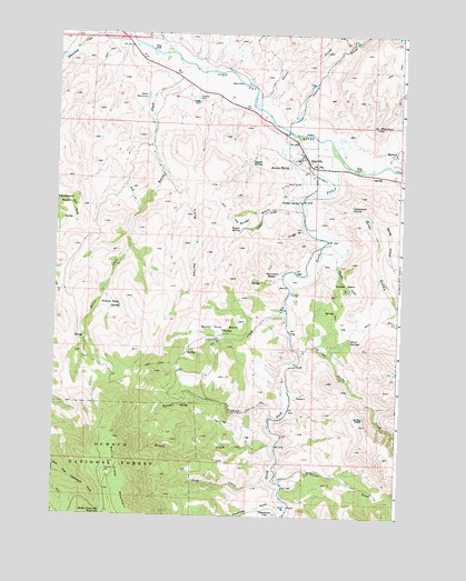
Dayville, OR USGS Topographic Map
Click on map above to begin viewing in our Map Viewer.

This topographic map contains these locations and features:
Feature Name Type Latitude Longitude GNIS ID View Map
Battle CreekStreamN44.4899°W119.5811°1137581View Map
Battle Creek Mountain ReservoirReservoirN44.3754°W119.6066°1137590View Map
Birch SpringsSpringN44.4210°W119.5184°1138153View Map
Bottle RockPillarN44.4007°W119.5130°1138456View Map
Bracket SpringSpringN44.4654°W119.5414°1138553View Map
Brown CreekStreamN44.3935°W119.5453°1138666View Map
Camp Lincoln (historical)MilitaryN44.4500°W119.5167°1851662View Map
Conner CreekStreamN44.4563°W119.5366°1140043View Map
Conner SpringSpringN44.4566°W119.5375°1140044View Map
Connor Creek ReservoirReservoirN44.4569°W119.5377°1153767View Map
Cottonwood SpringSpringN44.4544°W119.5183°1140196View Map
Cougar GulchValleyN44.4496°W119.5358°1140229View Map
Cummings DitchCanalN44.4485°W119.5344°1153770View Map
DayvillePopulated PlaceN44.4682°W119.5358°1140680View Map
Dayville CemeteryCemeteryN44.4834°W119.5749°1140681View Map
Dayville City HallBuildingN44.4670°W119.5338°2700278View Map
Dayville Fire DepartmentBuildingN44.4679°W119.5360°2577135View Map
Dayville LibraryBuildingN44.4669°W119.5340°2700279View Map
Dayville Post OfficePost OfficeN44.4674°W119.5345°1165134View Map
Dayville Public Works Department OfficeBuildingN44.4670°W119.5338°2700280View Map
Dayville SchoolSchoolN44.4675°W119.5381°2417170View Map
Dayville Sewage TreatmentLocaleN44.4634°W119.5117°2697051View Map
Deadman GulchValleyN44.3776°W119.5425°1140742View Map
Deep CreekStreamN44.3843°W119.5464°1140794View Map
Dexter RanchLocaleN44.4435°W119.5255°1156323View Map
Ferris CreekStreamN44.4843°W119.5544°1142074View Map
Fort Basin SpringsSpringN44.4234°W119.5645°1158700View Map
Franks CreekStreamN44.4743°W119.5389°1142413View Map
Gray GulchValleyN44.4557°W119.5319°1143004View Map
Guyon BasinBasinN44.4524°W119.5547°1143169View Map
Guyon SpringSpringN44.4495°W119.5582°1143170View Map
Johnson CreekStreamN44.4260°W119.5416°1144331View Map
Keeton SpringSpringN44.4670°W119.5550°1122653View Map
Kennedy GulchValleyN44.4971°W119.6011°1158699View Map
Long HollowValleyN44.4651°W119.5872°1145410View Map
McIntire BasinBasinN44.4376°W119.5447°1145987View Map
McNulty BasinBasinN44.4288°W119.6058°1146032View Map
Munjar Place (historical)LocaleN44.4249°W119.5650°1167363View Map
Murray DitchCanalN44.4957°W119.5803°1153771View Map
Nash ReservoirReservoirN44.4837°W119.5930°1146732View Map
Oliver CreekStreamN44.3835°W119.5441°1147215View Map
Ringsmeyer DitchCanalN44.4838°W119.5650°1153769View Map
Sandy HollowValleyN44.4524°W119.5119°1149057View Map
Smoky CreekStreamN44.4168°W119.5369°1149778View Map
South Fork BasinBasinN44.4238°W119.5639°1149925View Map
South Fork John Day RiverStreamN44.4738°W119.5361°1149981View Map
Table RockSummitN44.4760°W119.5100°1150825View Map
Throop DitchCanalN44.4782°W119.5330°1153768View Map
Town of DayvilleCivilN44.4668°W119.5322°2412411View Map
Tunnel CreekStreamN44.4007°W119.5464°1151513View Map
Vanata BasinBasinN44.4351°W119.5203°1151728View Map
Vanata CreekStreamN44.4438°W119.5203°1151729View Map

Note: Coordinates in the location and feature list above are referenced to NAD83 datum.


Copyright (C) 2008-2025 Ryan Niemi / Sunset Dynamics ... All Rights Reserved