TopoQuest Logo
Do you find TopoQuest useful?
Help keep TopoQuest running and adding new maps/features by donating!
Bitcoin:  19c7KJd3qBynnjoSw5npx9KScwjBe4ifkT
Litecoin:  LXs6TkuXGGXo1vDsWCkWVdjQX94eUKd6ui
Home View Maps Find Maps Find Places Resources & Links


Piedmont SE, Missouri Topographic Map

USGS Map Title: Piedmont SE, MO
USGS Map MRC: 37090A5
DRG (GeoTIFF) Download: o37090a5.tif


Neighboring USGS Topographic Map Quads:


  Piedmont, MO  
37090B6
 

  Patterson, MO  
37090B5
 

  Greenville, MO  
37090B4
 

  Mill Spring, MO  
37090A6
 

  Piedmont SE, MO  
37090A5
 

  Greenville SW, MO  
37090A4
 

  Ellsinore, MO  
36090H6
 

  Williamsville, MO  
36090H5
 

  Hendrickson, MO  
36090H4


Map MRC Location:

N38°
W91°
N38°
W90°
H8 H7 H6 H5 H4 H3 H2 H1
G8 G7 G6 G5 G4 G3 G2 G1
F8 F7 F6 F5 F4 F3 F2 F1
E8 E7 E6 E5 E4 E3 E2 E1
D8 D7 D6 D5 D4 D3 D2 D1
C8 C7 C6 C5 C4 C3 C2 C1
B8 B7 B6 B5 B4 B3 B2 B1
A8 A7 A6 A5 A4 A3 A2 A1
N37°
W91°
N37°
W90°

Piedmont SE, MO USGS 1:24K Topographic Map Preview:
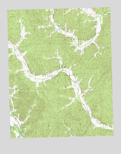
Piedmont SE, MO USGS Topographic Map
Click on map above to begin viewing in our Map Viewer.

This topographic map contains these locations and features:
Feature Name Type Latitude Longitude GNIS ID View Map
Barlow (historical)Populated PlaceN37.0139°W90.6140°753116View Map
Barren ForkStreamN37.0839°W90.6154°748686View Map
Big Lake ChurchChurchN37.1026°W90.5537°748843View Map
Blackwell RidgeRidgeN37.0153°W90.5415°748899View Map
Bollinger CemeteryCemeteryN37.1184°W90.5009°748955View Map
Center Lake CreekStreamN37.1164°W90.5115°749314View Map
Childs HollowValleyN37.0862°W90.5157°749346View Map
Dees CemeteryCemeteryN37.0503°W90.5479°749613View Map
Dees ChapelChurchN37.0531°W90.5440°749614View Map
Dees Chapel SchoolSchoolN37.0464°W90.5382°747863View Map
Dees TownPopulated PlaceN37.0537°W90.5437°730473View Map
Don Manetz DamDamN37.1067°W90.5835°764376View Map
Don Manetz LakeReservoirN37.1071°W90.5847°764377View Map
Duncan CemeteryCemeteryN37.0617°W90.5790°749746View Map
Eads CreekStreamN37.0126°W90.6198°749759View Map
Eads Creek CemeteryCemeteryN37.0298°W90.6196°749760View Map
Eads Creek School (historical)SchoolN37.0292°W90.6196°747858View Map
Gentry CemeteryCemeteryN37.0839°W90.5337°750035View Map
Granite BendBendN37.0070°W90.6146°754401View Map
Green CemeteryCemeteryN37.0898°W90.5201°750135View Map
Green Hill CemeteryCemeteryN37.0873°W90.5429°750140View Map
Green Hill SchoolSchoolN37.0884°W90.5396°747862View Map
Handy HollowValleyN37.1078°W90.5718°750214View Map
Henson CemeteryCemeteryN37.0425°W90.5373°750295View Map
HubertLocaleN37.0553°W90.5146°740099View Map
Julian BranchStreamN37.1217°W90.5701°750550View Map
Kerrigan (historical)Populated PlaceN37.0056°W90.6087°730472View Map
Knox BranchStreamN37.0084°W90.6146°750636View Map
Lake Creek School (historical)SchoolN37.1123°W90.5668°747860View Map
Liberty Hill CemeteryCemeteryN37.1081°W90.5171°750699View Map
Liberty Hill Church (historical)ChurchN37.1087°W90.5171°730474View Map
Liberty SchoolSchoolN37.1081°W90.5184°747861View Map
Marler BranchStreamN37.0656°W90.5590°750937View Map
Meador ValleyValleyN37.1089°W90.5709°730471View Map
Meadors CemeteryCemeteryN37.1087°W90.5701°751014View Map
Mount Pleasant ChurchChurchN37.0845°W90.6110°751194View Map
Mount Pleasant SchoolSchoolN37.0623°W90.5948°747857View Map
New Liberty ChurchChurchN37.1081°W90.5637°751298View Map
Persimmon BranchStreamN37.1048°W90.5640°751555View Map
Pigg CemeteryCemeteryN37.0856°W90.6115°751581View Map
Pleasant Hill School (historical)SchoolN37.0989°W90.6185°747856View Map
Risby CemeteryCemeteryN37.0514°W90.5390°751888View Map
Seitz BranchStreamN37.1198°W90.5054°730470View Map
Warrens Store (historical)LocaleN37.0228°W90.6226°747859View Map
Wet ForkStreamN37.1245°W90.5343°752835View Map
Wolf BranchStreamN37.1062°W90.5668°752945View Map

Note: Coordinates in the location and feature list above are referenced to NAD83 datum.


Copyright (C) 2008-2024 Ryan Niemi / Sunset Dynamics ... All Rights Reserved