TopoQuest Logo
Do you find TopoQuest useful?
Help keep TopoQuest running and adding new maps/features by donating!
Bitcoin:  19c7KJd3qBynnjoSw5npx9KScwjBe4ifkT
Litecoin:  LXs6TkuXGGXo1vDsWCkWVdjQX94eUKd6ui
Home View Maps Find Maps Find Places Resources & Links


Pierceville, Indiana Topographic Map

USGS Map Title: Pierceville, IN
USGS Map MRC: 39085B2
DRG (GeoTIFF) Download: o39085b2.tif


Neighboring USGS Topographic Map Quads:


  New Point, IN  
39085C3
 

  Batesville, IN  
39085C2
 

  Spades, IN  
39085C1
 

  Osgood, IN  
39085B3
 

  Pierceville, IN  
39085B2
 

  Sunman, IN  
39085B1
 

  Versailles, IN  
39085A3
 

  Milan, IN  
39085A2
 

  Dillsboro, IN  
39085A1


Map MRC Location:

N40°
W86°
N40°
W85°
H8 H7 H6 H5 H4 H3 H2 H1
G8 G7 G6 G5 G4 G3 G2 G1
F8 F7 F6 F5 F4 F3 F2 F1
E8 E7 E6 E5 E4 E3 E2 E1
D8 D7 D6 D5 D4 D3 D2 D1
C8 C7 C6 C5 C4 C3 C2 C1
B8 B7 B6 B5 B4 B3 B2 B1
A8 A7 A6 A5 A4 A3 A2 A1
N39°
W86°
N39°
W85°

Pierceville, IN USGS 1:24K Topographic Map Preview:
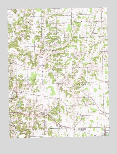
Pierceville, IN USGS Topographic Map
Click on map above to begin viewing in our Map Viewer.

This topographic map contains these locations and features:
Feature Name Type Latitude Longitude GNIS ID View Map
Adams CemeteryCemeteryN39.2215°W85.1783°430004View Map
Adams ChurchChurchN39.2201°W85.1891°430008View Map
Behlmer CornerPopulated PlaceN39.2026°W85.1697°430747View Map
Broughton LakeReservoirN39.2117°W85.1916°448887View Map
Broughton Lake DamDamN39.2117°W85.1916°448886View Map
Buell AirportAirportN39.1967°W85.1358°2677025View Map
Castators CreekStreamN39.1470°W85.2483°432223View Map
ClintonPopulated PlaceN39.2106°W85.1319°432670View Map
DelawarePopulated PlaceN39.1478°W85.2072°433448View Map
Delaware CemeteryCemeteryN39.1503°W85.2205°433450View Map
Delaware Community Volunteer Fire DepartmentBuildingN39.1505°W85.2063°2626357View Map
La Sarre Lake DamDamN39.1567°W85.2383°447853View Map
Laughery Bridge ChurchChurchN39.1981°W85.2436°437646View Map
Laughery SwitchPopulated PlaceN39.1495°W85.2413°452119View Map
Lewis AirfieldAirportN39.1788°W85.1519°2676975View Map
Little Laughery CreekStreamN39.2423°W85.2405°438088View Map
Little Memory Church CemeteryCemeteryN39.2436°W85.1572°438095View Map
LookoutPopulated PlaceN39.1953°W85.2075°438298View Map
Melissaville (historical)LocaleN39.1906°W85.2172°452116View Map
Milan Junior and Senior High SchoolSchoolN39.1292°W85.1286°447134View Map
Milan Volunteer Fire DepartmentBuildingN39.1263°W85.1306°2625768View Map
Mud Pike ChurchChurchN39.1689°W85.2341°439841View Map
North Branch Ripley CreekStreamN39.2101°W85.2086°440227View Map
Old MilanPopulated PlaceN39.1464°W85.1325°440578View Map
Paradise LakeReservoirN39.1573°W85.2372°447852View Map
PiercevillePopulated PlaceN39.1334°W85.1797°441112View Map
PrattsburgPopulated PlaceN39.1617°W85.1880°449039View Map
Prattsburg CemeteryCemeteryN39.1603°W85.1852°441569View Map
Ripley County Emergency Medical ServicesBuildingN39.1487°W85.2042°2719363View Map
Saint Nicholas SchoolSchoolN39.2256°W85.1425°442747View Map
Saint Pauls ChurchChurchN39.1776°W85.1258°442775View Map
Saint Pius ChurchChurchN39.1914°W85.1694°442828View Map
Stumpke CornerPopulated PlaceN39.1778°W85.1319°449736View Map
Town of MilanCivilN39.1255°W85.1270°2396761View Map
Township of DelawareCivilN39.1838°W85.2454°453262View Map
Township of FranklinCivilN39.1724°W85.1394°453314View Map

Note: Coordinates in the location and feature list above are referenced to NAD83 datum.


Copyright (C) 2008-2025 Ryan Niemi / Sunset Dynamics ... All Rights Reserved