TopoQuest Logo
Do you find TopoQuest useful?
Help keep TopoQuest running and adding new maps/features by donating!
Bitcoin:  19c7KJd3qBynnjoSw5npx9KScwjBe4ifkT
Litecoin:  LXs6TkuXGGXo1vDsWCkWVdjQX94eUKd6ui
Home View Maps Find Maps Find Places Resources & Links


Valley Ridge, Missouri Topographic Map

USGS Map Title: Valley Ridge, MO
USGS Map MRC: 36090E1
DRG (GeoTIFF) Download: o36090e1.tif


Neighboring USGS Topographic Map Quads:


  Broseley, MO  
36090F2
 

  Powe, MO  
36090F1
 

  Bernie, MO  
36089F8
 

  Glennonville, MO  
36090E2
 

  Valley Ridge, MO  
36090E1
 

  Malden, MO  
36089E8
 

  Piggott, AR  
36090D2
 

  Campbell, MO  
36090D1
 

  Gideon, MO  
36089D8


Map MRC Location:

N37°
W91°
N37°
W90°
H8 H7 H6 H5 H4 H3 H2 H1
G8 G7 G6 G5 G4 G3 G2 G1
F8 F7 F6 F5 F4 F3 F2 F1
E8 E7 E6 E5 E4 E3 E2 E1
D8 D7 D6 D5 D4 D3 D2 D1
C8 C7 C6 C5 C4 C3 C2 C1
B8 B7 B6 B5 B4 B3 B2 B1
A8 A7 A6 A5 A4 A3 A2 A1
N36°
W91°
N36°
W90°

Valley Ridge, MO USGS 1:24K Topographic Map Preview:
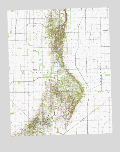
Valley Ridge, MO USGS Topographic Map
Click on map above to begin viewing in our Map Viewer.

This topographic map contains these locations and features:
Feature Name Type Latitude Longitude GNIS ID View Map
Baker SchoolSchoolN36.5637°W90.0009°713576View Map
Beechwell ChurchChurchN36.5506°W90.1009°713878View Map
BethanyPopulated PlaceN36.6117°W90.0693°714010View Map
Bethany ChurchChurchN36.6153°W90.0679°730264View Map
Bethany School (historical)SchoolN36.6089°W90.0634°730263View Map
BrianPopulated PlaceN36.6067°W90.0932°740691View Map
Brian School (historical)SchoolN36.6070°W90.0979°730262View Map
Cane Creek ChurchChurchN36.5131°W90.0531°715345View Map
Cane Creek School (historical)SchoolN36.5131°W90.0523°715348View Map
Craig School (historical)SchoolN36.5284°W90.0034°746873View Map
Devasia LakeReservoirN36.5730°W90.0627°765538View Map
Ditch Number 16CanalN36.5162°W90.0004°755063View Map
Ditch YCanalN36.5067°W90.0387°716917View Map
Elder CemeteryCemeteryN36.5573°W90.0493°717432View Map
Four Mile CemeteryCemeteryN36.5078°W90.0945°718127View Map
Four Mile SchoolSchoolN36.5184°W90.0848°718128View Map
Hilltop Fishing Lake DamDamN36.5117°W90.0884°765571View Map
Hopkins ChapelChurchN36.5359°W90.0487°719820View Map
Hopkins School (historical)SchoolN36.5445°W90.0470°719822View Map
Hopwood CemeteryCemeteryN36.5248°W90.0656°719826View Map
Lateral Number 1CanalN36.5839°W90.0248°755264View Map
Lateral Number 2CanalN36.5542°W90.1182°755274View Map
Lone Oak ChurchChurchN36.6078°W90.0156°721453View Map
Main DitchCanalN36.6117°W90.0354°721767View Map
Rush Creek Church (historical)ChurchN36.5651°W90.0693°746870View Map
Rush Creek SchoolSchoolN36.5653°W90.1109°725672View Map
Slicer School (historical)SchoolN36.6078°W90.0012°746871View Map
Snider CemeteryCemeteryN36.5656°W90.0584°730219View Map
Snyder SchoolSchoolN36.5720°W90.0568°746872View Map
Sunny Vale ChurchChurchN36.5756°W90.0301°730226View Map
Sunnyside SchoolSchoolN36.5148°W90.1207°727310View Map
Tompkins School (historical)SchoolN36.5426°W90.0959°730233View Map
Township of UnionCivilN36.5391°W90.1093°766642View Map
Tucker CemeteryCemeteryN36.5170°W90.0640°727825View Map
Valley RidgePopulated PlaceN36.5648°W90.0837°728100View Map
Vincent CemeteryCemeteryN36.5912°W90.0587°728204View Map
Waller Lake DamDamN36.5701°W90.0618°765537View Map
Woodlawn CemeteryCemeteryN36.5003°W90.0862°729109View Map

Note: Coordinates in the location and feature list above are referenced to NAD83 datum.


Copyright (C) 2008-2024 Ryan Niemi / Sunset Dynamics ... All Rights Reserved