TopoQuest Logo
Do you find TopoQuest useful?
Help keep TopoQuest running and adding new maps/features by donating!
Bitcoin:  19c7KJd3qBynnjoSw5npx9KScwjBe4ifkT
Litecoin:  LXs6TkuXGGXo1vDsWCkWVdjQX94eUKd6ui
Home View Maps Find Maps Find Places Resources & Links


Pinal Peak, Arizona Topographic Map

USGS Map Title: Pinal Peak, AZ
USGS Map MRC: 33110C7
DRG (GeoTIFF) Download: o33110c7.tif


Neighboring USGS Topographic Map Quads:


  Inspiration, AZ  
33110D8
 

  Globe, AZ  
33110D7
 

  Cammerman Wash, AZ  
33110D6
 

  Pinal Ranch, AZ  
33110C8
 

  Pinal Peak, AZ  
33110C7
 

  Cutter, AZ  
33110C6
 

  Hot Tamale Peak, AZ  
33110B8
 

  El Capitan Mountain, AZ  
33110B7
 

  Mescal Warm Spring, AZ  
33110B6


Map MRC Location:

N34°
W111°
N34°
W110°
H8 H7 H6 H5 H4 H3 H2 H1
G8 G7 G6 G5 G4 G3 G2 G1
F8 F7 F6 F5 F4 F3 F2 F1
E8 E7 E6 E5 E4 E3 E2 E1
D8 D7 D6 D5 D4 D3 D2 D1
C8 C7 C6 C5 C4 C3 C2 C1
B8 B7 B6 B5 B4 B3 B2 B1
A8 A7 A6 A5 A4 A3 A2 A1
N33°
W111°
N33°
W110°

Pinal Peak, AZ USGS 1:24K Topographic Map Preview:
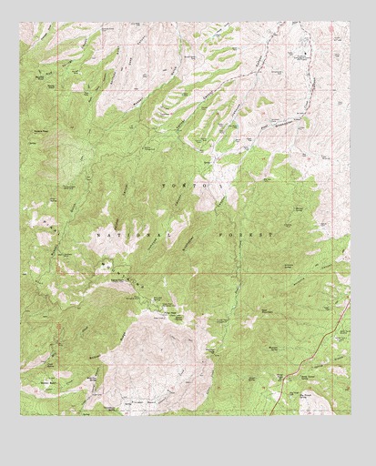
Pinal Peak, AZ USGS Topographic Map
Click on map above to begin viewing in our Map Viewer.

This topographic map contains these locations and features:
Feature Name Type Latitude Longitude GNIS ID View Map
Arrastra SpringSpringN33.2976°W110.7763°25763View Map
Ashby SpringSpringN33.2748°W110.8282°39240View Map
August Hills Mobile Home ParkPopulated PlaceN33.3724°W110.7787°2669811View Map
Azurite MineMineN33.3595°W110.8532°25857View Map
Baldy Tunnel SpringSpringN33.2626°W110.7696°25931View Map
Big Spur TankReservoirN33.3243°W110.7837°26300View Map
Blondy WaterSpringN33.3548°W110.8620°26493View Map
Blue TankReservoirN33.3340°W110.8081°26537View Map
Bobtail BasinBasinN33.2603°W110.8643°26567View Map
Bobtail RidgeRidgeN33.2712°W110.8409°26568View Map
Bobtail SpringSpringN33.2539°W110.8362°39280View Map
Camp Carlock Water TankReservoirN33.3231°W110.8590°27198View Map
Captain Pass Family Picnic AreaLocaleN33.2633°W110.7718°2669520View Map
CCC One TankReservoirN33.3371°W110.8070°27137View Map
CCC Two TankReservoirN33.3376°W110.8047°27138View Map
Cedar Creek TankReservoirN33.2587°W110.8623°39326View Map
Center TankReservoirN33.3421°W110.7983°27465View Map
Convict TankReservoirN33.3475°W110.8073°27867View Map
Daou TankReservoirN33.3642°W110.7566°28276View Map
Doak SpringSpringN33.2662°W110.8657°28506View Map
Dog House SpringSpringN33.3114°W110.8190°39414View Map
East MountainSummitN33.2831°W110.7846°28776View Map
East TankReservoirN33.3486°W110.7555°28790View Map
Ferndell SpringSpringN33.2867°W110.8252°28977View Map
Forest Ranch WindmillLocaleN33.2773°W110.7534°29099View Map
Fork TankReservoirN33.2709°W110.8696°39442View Map
Frio SpringSpringN33.3188°W110.8642°29207View Map
Gap TankReservoirN33.3327°W110.7670°29247View Map
Gap WindmillLocaleN33.3323°W110.7615°29248View Map
Gila Community College Gila Pueblo CampusSchoolN33.3650°W110.7676°39455View Map
Greenhouse SpringSpringN33.2517°W110.8396°29590View Map
Greer SpringSpringN33.2621°W110.7865°29596View Map
Hagen TankReservoirN33.3374°W110.7874°29680View Map
Harvey Mill WellWellN33.3145°W110.7729°39493View Map
Harvey MineMineN33.3106°W110.7757°29779View Map
Harvey SpringSpringN33.3156°W110.7719°29780View Map
Harvey TankReservoirN33.3104°W110.7623°29781View Map
Hayes TankReservoirN33.3706°W110.8019°29804View Map
Hensen Tank OneReservoirN33.2746°W110.7568°29898View Map
Hog Trough SpringSpringN33.2565°W110.7701°30032View Map
Hog Trough TankReservoirN33.2562°W110.7735°30033View Map
Ice House CCC CampgroundLocaleN33.3239°W110.8032°41286View Map
Icehouse Canyon Census Designated PlaceCensusN33.3553°W110.7966°2582800View Map
Kellner CampgroundLocaleN33.3351°W110.8290°30722View Map
Kellner CanyonValleyN33.3598°W110.7868°30723View Map
Kellner Canyon SpringSpringN33.3081°W110.8396°39554View Map
KGRX-FM (Globe)TowerN33.2898°W110.8654°45189View Map
KIKO-FM (Globe)TowerN33.2889°W110.8298°43458View Map
Little Summit (historical)SummitN33.3334°W110.8007°23981View Map
Long Ridge TankReservoirN33.3742°W110.8295°31258View Map
Madera PeakSummitN33.3401°W110.8707°31432View Map
Maverick SpringSpringN33.3026°W110.8632°39593View Map
Maverick SpringSpringN33.2712°W110.7779°31587View Map
Mill Creek SpringSpringN33.2851°W110.8398°39628View Map
Mud SpringSpringN33.3656°W110.8540°39642View Map
Muskhog WaterSpringN33.3573°W110.8661°32214View Map
O'Banion Mobile Home ParkPopulated PlaceN33.3684°W110.7649°2670079View Map
Old Pond TankReservoirN33.3421°W110.7933°32512View Map
Parker TankReservoirN33.3349°W110.7885°32698View Map
Pinal CampgroundParkN33.2873°W110.8304°32913View Map
Pinal MountainsSummitN33.2823°W110.8212°32908View Map
Pinal PassGapN33.2617°W110.7757°32909View Map
Pinal PeakSummitN33.2823°W110.8212°32910View Map
Pioneer BasinBasinN33.2526°W110.8284°33020View Map
Pioneer PassGapN33.2701°W110.8018°33022View Map
Pioneer Pass CampgroundLocaleN33.2806°W110.7968°33023View Map
Pueblo TankReservoirN33.3648°W110.7719°41283View Map
Rock Tank CanyonValleyN33.3609°W110.8393°33746View Map
Rock TanksReservoirN33.3526°W110.8493°33749View Map
Russell Gulch TankReservoirN33.3638°W110.8088°33880View Map
Schoolhouse TankReservoirN33.3591°W110.7763°34145View Map
Signal PeakSummitN33.2931°W110.8359°34421View Map
Signal Peak Lookout TowerTowerN33.2931°W110.8359°39794View Map
Six Shooter Canyon Census Designated PlaceCensusN33.3569°W110.7719°2582866View Map
Sixty Six RanchLocaleN33.3445°W110.7693°34480View Map
Solitude Gulch TankReservoirN33.3724°W110.8450°34631View Map
Southwest Archeological CenterBuildingN33.3648°W110.7676°34693View Map
Squaw SpringSpringN33.2809°W110.8168°34785View Map
Stegal TankReservoirN33.2849°W110.7589°34825View Map
Sulphide Del Ray CampgroundLocaleN33.2937°W110.8673°41284View Map
Turnaround TankReservoirN33.3455°W110.8226°35588View Map
Twin TankReservoirN33.3401°W110.8003°35629View Map
Two VF TankReservoirN33.3579°W110.8273°35646View Map
Upper Pinal CampgroundParkN33.2845°W110.8218°35705View Map
VF TankReservoirN33.3417°W110.8323°35745View Map
West TankReservoirN33.3519°W110.8139°36023View Map
Westlake MineMineN33.3006°W110.8590°36032View Map
White TankReservoirN33.3377°W110.7942°36112View Map
Wild Cow SpringSpringN33.2614°W110.8462°36159View Map
Windmill TankReservoirN33.3435°W110.7809°36301View Map
Wyatt TankReservoirN33.3666°W110.7932°36412View Map

Note: Coordinates in the location and feature list above are referenced to NAD83 datum.


Copyright (C) 2008-2024 Ryan Niemi / Sunset Dynamics ... All Rights Reserved