TopoQuest Logo
Do you find TopoQuest useful?
Help keep TopoQuest running and adding new maps/features by donating!
Bitcoin:  19c7KJd3qBynnjoSw5npx9KScwjBe4ifkT
Litecoin:  LXs6TkuXGGXo1vDsWCkWVdjQX94eUKd6ui
Home View Maps Find Maps Find Places Resources & Links


El Capitan Mountain, Arizona Topographic Map

USGS Map Title: El Capitan Mountain, AZ
USGS Map MRC: 33110B7
DRG (GeoTIFF) Download: o33110b7.tif


Neighboring USGS Topographic Map Quads:


  Pinal Ranch, AZ  
33110C8
 

  Pinal Peak, AZ  
33110C7
 

  Cutter, AZ  
33110C6
 

  Hot Tamale Peak, AZ  
33110B8
 

  El Capitan Mountain, AZ  
33110B7
 

  Mescal Warm Spring, AZ  
33110B6
 

  Kearny, AZ  
33110A8
 

  Hayden, AZ  
33110A7
 

  Christmas, AZ  
33110A6


Map MRC Location:

N34°
W111°
N34°
W110°
H8 H7 H6 H5 H4 H3 H2 H1
G8 G7 G6 G5 G4 G3 G2 G1
F8 F7 F6 F5 F4 F3 F2 F1
E8 E7 E6 E5 E4 E3 E2 E1
D8 D7 D6 D5 D4 D3 D2 D1
C8 C7 C6 C5 C4 C3 C2 C1
B8 B7 B6 B5 B4 B3 B2 B1
A8 A7 A6 A5 A4 A3 A2 A1
N33°
W111°
N33°
W110°

El Capitan Mountain, AZ USGS 1:24K Topographic Map Preview:
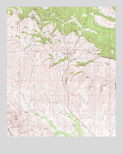
El Capitan Mountain, AZ USGS Topographic Map
Click on map above to begin viewing in our Map Viewer.

This topographic map contains these locations and features:
Feature Name Type Latitude Longitude GNIS ID View Map
Cowboy MineMineN33.1312°W110.8462°3459View Map
Crow CanyonValleyN33.2337°W110.8368°3598View Map
Dripping SpringSpringN33.1423°W110.8629°4107View Map
Dripping SpringsLocaleN33.1459°W110.8590°23857View Map
El Capitan (historical)LocaleN33.2051°W110.8090°42764View Map
El Capitan CanyonValleyN33.1445°W110.7987°4371View Map
El Capitan Census Designated PlaceCensusN33.2383°W110.7833°2582779View Map
El Capitan MineMineN33.2051°W110.8087°4373View Map
El Capitan MountainSummitN33.2001°W110.7562°4374View Map
Gilson WashValleyN33.2292°W110.7648°40941View Map
Little RS SpringSpringN33.1823°W110.7843°7161View Map
Oak Spring TankReservoirN33.2278°W110.8472°8887View Map
Old BaldySummitN33.2270°W110.7990°8928View Map
Pasadera MountainSummitN33.2148°W110.8343°9235View Map
Pioneer CreekStreamN33.1967°W110.8187°33021View Map
Pioneer MineMineN33.2345°W110.8379°9520View Map
Pioneer MountainSummitN33.2470°W110.8443°9522View Map
RS SpringSpringN33.1828°W110.7740°9890View Map
Silver Creek MineMineN33.2153°W110.8054°11325View Map
Silver Dime MineMineN33.2051°W110.8029°11328View Map
Stone Cabin MountainSummitN33.2392°W110.8484°11871View Map
Sycamore CreekStreamN33.2195°W110.8257°12078View Map
Trap Corral CanyonValleyN33.2242°W110.8668°35446View Map
Vanadium MineMineN33.1328°W110.8329°13193View Map
Winkelman DivisionCivilN33.1467°W110.8047°1934994View Map
Yellowjacket SpringSpringN33.1948°W110.7579°14079View Map

Note: Coordinates in the location and feature list above are referenced to NAD83 datum.


Copyright (C) 2008-2024 Ryan Niemi / Sunset Dynamics ... All Rights Reserved