TopoQuest Logo
Do you find TopoQuest useful?
Help keep TopoQuest running and adding new maps/features by donating!
Bitcoin:  19c7KJd3qBynnjoSw5npx9KScwjBe4ifkT
Litecoin:  LXs6TkuXGGXo1vDsWCkWVdjQX94eUKd6ui
Home View Maps Find Maps Find Places Resources & Links


Pinchout Creek, Montana Topographic Map

USGS Map Title: Pinchout Creek, MT
USGS Map MRC: 46110E7
DRG (GeoTIFF) Download: o46110e7.tif


Neighboring USGS Topographic Map Quads:


  Coxcombe Butte, MT  
46110F8
 

  Charcoal Gulch, MT  
46110F7
 

  Volcano Butte, MT  
46110F6
 

  White Sulphur Springs, MT  
46110E8
 

  Pinchout Creek, MT  
46110E7
 

  Fourmile Spring, MT  
46110E6
 

  Catlin Spring, MT  
46110D8
 

  Manger Park, MT  
46110D7
 

  Castle Town, MT  
46110D6


Map MRC Location:

N47°
W111°
N47°
W110°
H8 H7 H6 H5 H4 H3 H2 H1
G8 G7 G6 G5 G4 G3 G2 G1
F8 F7 F6 F5 F4 F3 F2 F1
E8 E7 E6 E5 E4 E3 E2 E1
D8 D7 D6 D5 D4 D3 D2 D1
C8 C7 C6 C5 C4 C3 C2 C1
B8 B7 B6 B5 B4 B3 B2 B1
A8 A7 A6 A5 A4 A3 A2 A1
N46°
W111°
N46°
W110°

Pinchout Creek, MT USGS 1:24K Topographic Map Preview:
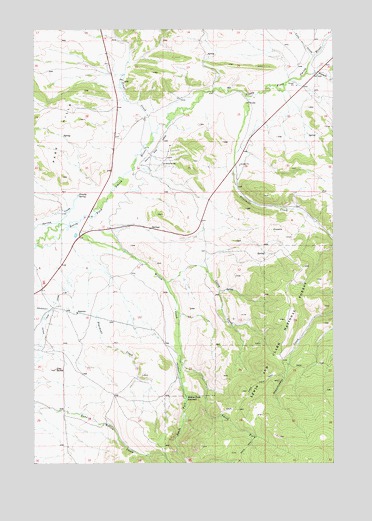
Pinchout Creek, MT USGS Topographic Map
Click on map above to begin viewing in our Map Viewer.

This topographic map contains these locations and features:
Feature Name Type Latitude Longitude GNIS ID View Map
09N07E04DC__01 WellWellN46.5638°W110.8510°816842View Map
09N07E05AD__01 WellWellN46.5711°W110.8669°816872View Map
09N07E08AC__01 WellWellN46.5563°W110.8722°816808View Map
10N07E25C___01 WellWellN46.5944°W110.7952°817001View Map
10N07E27AC__01 WellWellN46.5997°W110.8294°817047View Map
10N07E35B___01 WellWellN46.5872°W110.8160°816947View Map
Casey CreekStreamN46.5527°W110.8208°781005View Map
Clay ButteSummitN46.5269°W110.8666°781337View Map
Cut Bank MineMineN46.5174°W110.8052°804685View Map
Fivemile CreekStreamN46.6122°W110.7622°783481View Map
Fourmile CreekStreamN46.6058°W110.7874°783648View Map
Lake CreekStreamN46.6172°W110.7594°785905View Map
NW NW Section 19 MineMineN46.5313°W110.7733°804668View Map
NW SE Section 23 MineMineN46.5261°W110.8083°804684View Map
Pinchout CreekStreamN46.5647°W110.8560°788870View Map
Ringling MineMineN46.5169°W110.8088°804686View Map
Smith ForkStreamN46.5294°W110.8147°790724View Map
South Fork Willow CreekStreamN46.5294°W110.8147°791090View Map
South Side CanalCanalN46.5411°W110.8722°791112View Map
Trinity SpringSpringN46.5774°W110.8569°777765View Map
Trout CreekStreamN46.5952°W110.8269°792397View Map
Willow CreekStreamN46.5627°W110.8747°793343View Map
Willow Creek ReservoirReservoirN46.5188°W110.8119°793366View Map

Note: Coordinates in the location and feature list above are referenced to NAD83 datum.


Copyright (C) 2008-2025 Ryan Niemi / Sunset Dynamics ... All Rights Reserved