TopoQuest Logo
Do you find TopoQuest useful?
Help keep TopoQuest running and adding new maps/features by donating!
Bitcoin:  19c7KJd3qBynnjoSw5npx9KScwjBe4ifkT
Litecoin:  LXs6TkuXGGXo1vDsWCkWVdjQX94eUKd6ui
Home View Maps Find Maps Find Places Resources & Links


Fourmile Spring, Montana Topographic Map

USGS Map Title: Fourmile Spring, MT
USGS Map MRC: 46110E6
DRG (GeoTIFF) Download: o46110e6.tif


Neighboring USGS Topographic Map Quads:


  Charcoal Gulch, MT  
46110F7
 

  Volcano Butte, MT  
46110F6
 

  Hoover Spring, MT  
46110F5
 

  Pinchout Creek, MT  
46110E7
 

  Fourmile Spring, MT  
46110E6
 

  Checkerboard, MT  
46110E5
 

  Manger Park, MT  
46110D7
 

  Castle Town, MT  
46110D6
 

  Lennep, MT  
46110D5


Map MRC Location:

N47°
W111°
N47°
W110°
H8 H7 H6 H5 H4 H3 H2 H1
G8 G7 G6 G5 G4 G3 G2 G1
F8 F7 F6 F5 F4 F3 F2 F1
E8 E7 E6 E5 E4 E3 E2 E1
D8 D7 D6 D5 D4 D3 D2 D1
C8 C7 C6 C5 C4 C3 C2 C1
B8 B7 B6 B5 B4 B3 B2 B1
A8 A7 A6 A5 A4 A3 A2 A1
N46°
W111°
N46°
W110°

Fourmile Spring, MT USGS 1:24K Topographic Map Preview:
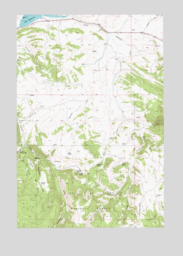
Fourmile Spring, MT USGS Topographic Map
Click on map above to begin viewing in our Map Viewer.

This topographic map contains these locations and features:
Feature Name Type Latitude Longitude GNIS ID View Map
Bair SpringSpringN46.5390°W110.7133°779263View Map
Copper (historical)LocaleN46.6166°W110.6674°1762766View Map
Copper Post Office (historical)Post OfficeN46.6166°W110.6674°1762700View Map
Copper School (historical)SchoolN46.6166°W110.6674°1762765View Map
Copperopolis (historical)LocaleN46.6166°W110.6674°1762764View Map
Copperopolis Post Office (historical)Post OfficeN46.6166°W110.6674°1762701View Map
East Fork Checkerboard CreekStreamN46.5341°W110.6544°782822View Map
East Fork Grasshopper CreekStreamN46.5449°W110.7474°782850View Map
Fourmile SpringSpringN46.5338°W110.6971°783651View Map
Grasshopper CampgroundLocaleN46.5441°W110.7485°784204View Map
Grasshopper CreekStreamN46.5494°W110.7458°784205View Map
Hall CreekStreamN46.5597°W110.6408°784479View Map
Hall Creek SpringSpringN46.5369°W110.6829°784483View Map
Harris SpringSpringN46.5371°W110.6617°784572View Map
Horse ParkFlatN46.5269°W110.7277°785055View Map
Lake SutherlinReservoirN46.6249°W110.7348°791747View Map
Lake Sutherlin Recreation SiteLocaleN46.6208°W110.7485°798885View Map
Limestone RidgeRidgeN46.5102°W110.6446°786156View Map
NE NE Section 36 MineMineN46.5036°W110.6544°804672View Map
North Fork of Smith River DamDamN46.6233°W110.7474°794967View Map
Richardson CampgroundLocaleN46.5405°W110.7308°789570View Map
Richardson CreekStreamN46.5416°W110.7308°789572View Map
Richardson ParkFlatN46.5372°W110.7388°789573View Map
Ridge SpringSpringN46.5433°W110.7075°789585View Map
Spring CreekStreamN46.5627°W110.7485°791215View Map
SW SW Section 29 MineMineN46.5950°W110.6271°804650View Map
SW SW Section 30 MineMineN46.5152°W110.6474°804675View Map
Upper Fourmile SpringSpringN46.5317°W110.6952°792635View Map
Waterloo MineMineN46.5074°W110.6619°804673View Map
West Fork Checkerboard CreekStreamN46.5338°W110.6541°792997View Map

Note: Coordinates in the location and feature list above are referenced to NAD83 datum.


Copyright (C) 2008-2024 Ryan Niemi / Sunset Dynamics ... All Rights Reserved