TopoQuest Logo
Do you find TopoQuest useful?
Help keep TopoQuest running and adding new maps/features by donating!
Bitcoin:  19c7KJd3qBynnjoSw5npx9KScwjBe4ifkT
Litecoin:  LXs6TkuXGGXo1vDsWCkWVdjQX94eUKd6ui
Home View Maps Find Maps Find Places Resources & Links


Castle Town, Montana Topographic Map

USGS Map Title: Castle Town, MT
USGS Map MRC: 46110D6
DRG (GeoTIFF) Download: o46110d6.tif


Neighboring USGS Topographic Map Quads:


  Pinchout Creek, MT  
46110E7
 

  Fourmile Spring, MT  
46110E6
 

  Checkerboard, MT  
46110E5
 

  Manger Park, MT  
46110D7
 

  Castle Town, MT  
46110D6
 

  Lennep, MT  
46110D5
 

  Ringling, MT  
46110C7
 

  Hamen, MT  
46110C6
 

  Rimrock Divide, MT  
46110C5


Map MRC Location:

N47°
W111°
N47°
W110°
H8 H7 H6 H5 H4 H3 H2 H1
G8 G7 G6 G5 G4 G3 G2 G1
F8 F7 F6 F5 F4 F3 F2 F1
E8 E7 E6 E5 E4 E3 E2 E1
D8 D7 D6 D5 D4 D3 D2 D1
C8 C7 C6 C5 C4 C3 C2 C1
B8 B7 B6 B5 B4 B3 B2 B1
A8 A7 A6 A5 A4 A3 A2 A1
N46°
W111°
N46°
W110°

Castle Town, MT USGS 1:24K Topographic Map Preview:
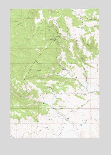
Castle Town, MT USGS Topographic Map
Click on map above to begin viewing in our Map Viewer.

This topographic map contains these locations and features:
Feature Name Type Latitude Longitude GNIS ID View Map
Belle of the Castle MineMineN46.4822°W110.6913°779670View Map
Blackhawk (historical)LocaleN46.4624°W110.6508°1762820View Map
Blackhawk CabinLocaleN46.4986°W110.6649°780038View Map
Blackhawk Post Office (historical)Post OfficeN46.4624°W110.6508°1762821View Map
Bond Holder MineMineN46.4927°W110.6580°804661View Map
Boulder CreekStreamN46.4352°W110.6858°780257View Map
Broadway MineMineN46.4552°W110.6824°804663View Map
California MineMineN46.4763°W110.6702°804654View Map
Castle CemeteryCemeteryN46.4377°W110.6619°781012View Map
Castle CreekStreamN46.4319°W110.6619°781016View Map
Castle LakeLakeN46.4403°W110.7128°781025View Map
Castle MountainSummitN46.4613°W110.7116°781028View Map
Castle Post Office (historical)Post OfficeN46.4413°W110.6719°1762697View Map
Castle School (historical)SchoolN46.4413°W110.6719°1762810View Map
Castle TownPopulated PlaceN46.4413°W110.6719°806915View Map
Compromise MineMineN46.4686°W110.6777°804656View Map
Cornelius Stone Placer MineMineN46.4466°W110.6819°804651View Map
Cumberland MineMineN46.4522°W110.6833°804625View Map
Cumberland MinesMineN46.4536°W110.6838°781986View Map
Golden Eagle MineMineN46.4855°W110.6849°804653View Map
Grande DamDamN46.3833°W110.6524°796214View Map
Great Western MineMineN46.4683°W110.6835°804671View Map
Hamilton CreekStreamN46.4619°W110.6733°784497View Map
Hamilton MineMineN46.4711°W110.6871°784503View Map
Hensley CreekStreamN46.4194°W110.6416°784789View Map
Hidden Treasure MineMineN46.4747°W110.6752°804630View Map
Hillside MineMineN46.4683°W110.6702°804660View Map
Homestake MineMineN46.4672°W110.6660°804657View Map
Iron Chief MineMineN46.4783°W110.6710°785319View Map
Judge MineMineN46.4969°W110.6524°785580View Map
Lamar MineMineN46.4744°W110.6896°804665View Map
Leadboro (historical)LocaleN46.4249°W110.6480°1762748View Map
Leadboro Junction (historical)LocaleN46.3755°W110.6841°1762747View Map
Leadboro Post Office (historical)Post OfficeN46.4249°W110.6480°1762706View Map
Legal Tender MineMineN46.4986°W110.6585°804679View Map
Lucky Dollar MineMineN46.4691°W110.6585°786702View Map
Meadow CreekStreamN46.4186°W110.6399°787132View Map
Methodist Church (historical)ChurchN46.4413°W110.6719°1762839View Map
Morning Star MineMineN46.4838°W110.6891°804655View Map
NE NE Section 11 MineMineN46.4730°W110.6846°804677View Map
NW NW Section 27 MineMineN46.4291°W110.7213°804670View Map
NW SE Section 11 MineMineN46.4658°W110.6849°804680View Map
P K SpringSpringN46.4274°W110.6795°788552View Map
Rattler CreekStreamN46.4133°W110.7285°789399View Map
Reynolds CreekStreamN46.4058°W110.6944°789545View Map
RobinsonPopulated PlaceN46.4738°W110.6683°806967View Map
Robinson Post Office (historical)Post OfficeN46.4738°W110.6683°1762716View Map
Robinson School (historical)SchoolN46.4738°W110.6683°1762734View Map
Saint Andrews Episcopal Church (historical)ChurchN46.4413°W110.6719°1762840View Map
SE NE Section 11 MineMineN46.4711°W110.6833°804664View Map
SE SE Section 11 MineMineN46.4641°W110.6841°804662View Map
SE SE Section 22 MineMineN46.4358°W110.7038°804669View Map
SE SW Section 2 MineMineN46.4794°W110.6930°804674View Map
SE SW Section 34 MineMineN46.4913°W110.7044°804678View Map
Silver Star MineMineN46.4672°W110.6616°804658View Map
Solid Silver MineMineN46.4730°W110.6774°804659View Map
SW NE Section 2 MineMineN46.4827°W110.6863°804676View Map
SW SW Section 2 MineMineN46.4797°W110.6955°804666View Map
SW SW Section 35 MineMineN46.4913°W110.6919°804667View Map
SW SW Section 36 MineMineN46.4911°W110.6708°804652View Map
Yankee Jim RidgeRidgeN46.4866°W110.6874°793594View Map
Yellowstone MineMineN46.4730°W110.6863°793608View Map
Yellowstone MineMineN46.4727°W110.6866°804636View Map

Note: Coordinates in the location and feature list above are referenced to NAD83 datum.


Copyright (C) 2008-2025 Ryan Niemi / Sunset Dynamics ... All Rights Reserved