TopoQuest Logo
Do you find TopoQuest useful?
Help keep TopoQuest running and adding new maps/features by donating!
Bitcoin:  19c7KJd3qBynnjoSw5npx9KScwjBe4ifkT
Litecoin:  LXs6TkuXGGXo1vDsWCkWVdjQX94eUKd6ui
Home View Maps Find Maps Find Places Resources & Links


Pine City, Arkansas Topographic Map

USGS Map Title: Pine City, AR
USGS Map MRC: 34091E1
DRG (GeoTIFF) Download: o34091e1.tif


Neighboring USGS Topographic Map Quads:


  Park Grove, AR  
34091F2
 

  Monroe, AR  
34091F1
 

  Aubrey, AR  
34090F8
 

  Holly Grove, AR  
34091E2
 

  Pine City, AR  
34091E1
 

  Marvell, AR  
34090E8
 

  Crocketts Bluff, AR  
34091D2
 

  Turner, AR  
34091D1
 

  Watkins Corner, AR  
34090D8


Map MRC Location:

N35°
W92°
N35°
W91°
H8 H7 H6 H5 H4 H3 H2 H1
G8 G7 G6 G5 G4 G3 G2 G1
F8 F7 F6 F5 F4 F3 F2 F1
E8 E7 E6 E5 E4 E3 E2 E1
D8 D7 D6 D5 D4 D3 D2 D1
C8 C7 C6 C5 C4 C3 C2 C1
B8 B7 B6 B5 B4 B3 B2 B1
A8 A7 A6 A5 A4 A3 A2 A1
N34°
W92°
N34°
W91°

Pine City, AR USGS 1:24K Topographic Map Preview:
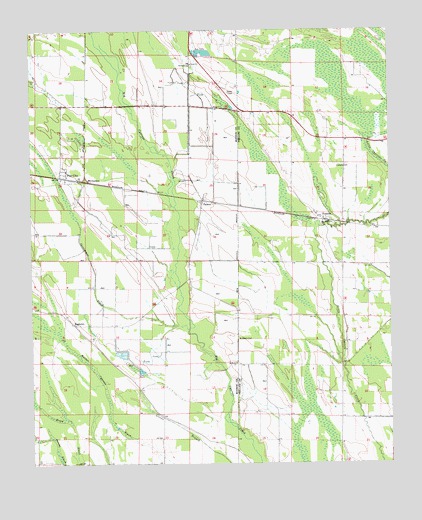
Pine City, AR USGS Topographic Map
Click on map above to begin viewing in our Map Viewer.

This topographic map contains these locations and features:
Feature Name Type Latitude Longitude GNIS ID View Map
B B JunctionPopulated PlaceN34.5815°W91.1048°57297View Map
Cypress SwampSwampN34.6116°W91.0344°65541View Map
Long Grove ChurchChurchN34.5712°W91.0251°65540View Map
PalmerPopulated PlaceN34.5762°W91.0657°58319View Map
Perman (historical)Populated PlaceN34.6032°W91.0693°61145View Map
Persimmon SlashGutN34.5673°W91.1079°53294View Map
Pine CityPopulated PlaceN34.5829°W91.1132°58374View Map
Pine Hill ChurchChurchN34.5404°W91.1112°61143View Map
PostellePopulated PlaceN34.5701°W91.0229°58415View Map
Postelle CemeteryCemeteryN34.5859°W91.0154°53721View Map
RagtownPopulated PlaceN34.5404°W91.1101°58455View Map
Saint James Church (historical)ChurchN34.5820°W91.1098°61144View Map
Saint Marks CemeteryCemeteryN34.5362°W91.0537°54397View Map
Saint Marks ChurchChurchN34.5290°W91.0540°54402View Map
Township of CleburneCivilN34.5558°W91.0865°68870View Map
Township of HicksvilleCivilN34.5865°W91.0167°68950View Map
Union CemeteryCemeteryN34.6148°W91.0690°61146View Map
Union ChurchChurchN34.6151°W91.0696°55801View Map
Union School (historical)SchoolN34.5315°W91.0354°65539View Map
Walker Cypress SlashGutN34.5273°W91.1040°55966View Map

Note: Coordinates in the location and feature list above are referenced to NAD83 datum.


Copyright (C) 2008-2025 Ryan Niemi / Sunset Dynamics ... All Rights Reserved