TopoQuest Logo
Do you find TopoQuest useful?
Help keep TopoQuest running and adding new maps/features by donating!
Bitcoin:  19c7KJd3qBynnjoSw5npx9KScwjBe4ifkT
Litecoin:  LXs6TkuXGGXo1vDsWCkWVdjQX94eUKd6ui
Home View Maps Find Maps Find Places Resources & Links


Pine Mountain SW, Georgia Topographic Map

USGS Map Title: Pine Mountain SW, GA
USGS Map MRC: 32084G8
DRG (GeoTIFF) Download: o32084g8.tif


Neighboring USGS Topographic Map Quads:


  Cannonville, GA  
32085H1
 

  Hilyer, GA  
32084H8
 

  Durand, GA  
32084H7
 

  Whitesville, GA  
32085G1
 

  Pine Mountain SW, GA  
32084G8
 

  Pine Mountain, GA  
32084G7
 

  Bartletts Ferry Dam, GA  
32085F1
 

  Mulberry Grove, GA  
32084F8
 

  Cataula, GA  
32084F7


Map MRC Location:

N33°
W85°
N33°
W84°
H8 H7 H6 H5 H4 H3 H2 H1
G8 G7 G6 G5 G4 G3 G2 G1
F8 F7 F6 F5 F4 F3 F2 F1
E8 E7 E6 E5 E4 E3 E2 E1
D8 D7 D6 D5 D4 D3 D2 D1
C8 C7 C6 C5 C4 C3 C2 C1
B8 B7 B6 B5 B4 B3 B2 B1
A8 A7 A6 A5 A4 A3 A2 A1
N32°
W85°
N32°
W84°

Pine Mountain SW, GA USGS 1:24K Topographic Map Preview:
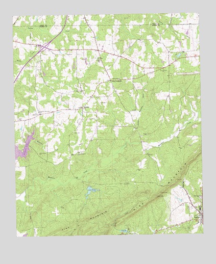
Pine Mountain SW, GA USGS Topographic Map
Click on map above to begin viewing in our Map Viewer.

This topographic map contains these locations and features:
Feature Name Type Latitude Longitude GNIS ID View Map
Beech SpringsPopulated PlaceN32.7974°W84.9577°350934View Map
Beech Springs CemeteryCemeteryN32.7954°W84.9574°350935View Map
Beech Springs ChurchChurchN32.7962°W84.9574°354530View Map
Bugg CemeteryCemeteryN32.8323°W84.9538°350946View Map
City of HamiltonCivilN32.7645°W84.8760°2403786View Map
Copeland (historical)Populated PlaceN32.7946°W84.9635°350955View Map
Foundation LakeReservoirN32.8335°W84.8893°340486View Map
Foundation Lake DamDamN32.8318°W84.8883°340485View Map
Geter CemeteryCemeteryN32.7957°W84.9108°314571View Map
Hadley CemeteryCemeteryN32.8085°W84.9602°315005View Map
Hadley CemeteryCemeteryN32.8161°W84.9969°315006View Map
Hall CemeteryCemeteryN32.8729°W84.9213°315036View Map
Harris CemeteryCemeteryN32.7876°W84.9158°315181View Map
Harris County AirportAirportN32.8422°W84.8792°326829View Map
Harris County Lookout TowerTowerN32.7718°W84.9052°344250View Map
Harris County Middle SchoolSchoolN32.7640°W84.8766°355021View Map
HopewellPopulated PlaceN32.8226°W84.9541°315638View Map
Hopewell ChurchChurchN32.8221°W84.9538°350974View Map
Hopewell Volunteer Fire DepartmentBuildingN32.8382°W84.9273°2604460View Map
Lake FlorenceLakeN32.7779°W84.9502°314235View Map
Lake FlorenceReservoirN32.7757°W84.9500°338441View Map
Lake Florence DamDamN32.7779°W84.9502°338440View Map
Lake IdaReservoirN32.7524°W84.9280°315876View Map
Lake Ida DamDamN32.7518°W84.9260°338486View Map
Little Mountain CreekStreamN32.7993°W84.9288°317123View Map
Mack Miller ParkParkN32.7710°W84.8763°317580View Map
Midway ChurchChurchN32.8193°W84.9844°318121View Map
Nelson CemeteryCemeteryN32.8071°W84.9113°319248View Map
New Hopewell CemeteryCemeteryN32.8221°W84.9535°350991View Map
Old Hopewell CemeteryCemeteryN32.8432°W84.8991°319989View Map
Old Hopewell Methodist Church (historical)ChurchN32.8440°W84.8994°350992View Map
Old Hopewell School (historical)SchoolN32.8440°W84.8994°350993View Map
Pine Mountain Chalet LakeReservoirN32.8512°W84.8891°340480View Map
Pine Mountain Chalet Lake DamDamN32.8518°W84.8883°340479View Map
Smith-Hattox CemeteryCemeteryN32.7971°W84.9835°323151View Map
Smiths ChapelChurchN32.8387°W84.9291°323159View Map
Smiths CrossroadsPopulated PlaceN32.8376°W84.9341°326519View Map
Solomon Grove ChurchChurchN32.8324°W84.9538°323216View Map
Spear CemeteryCemeteryN32.7796°W84.9269°323331View Map
Sunnyside Community ClubLocaleN32.8207°W84.9835°344352View Map
Tabernacle Camp LakeReservoirN32.8518°W84.9199°340689View Map
Tabernacle Camp Lake DamDamN32.8518°W84.9199°340688View Map
White CemeteryCemeteryN32.8529°W84.9638°325143View Map
Wisdoms Store (historical)Populated PlaceN32.8529°W84.9663°351007View Map
Wright CemeteryCemeteryN32.8165°W84.9458°325571View Map

Note: Coordinates in the location and feature list above are referenced to NAD83 datum.


Copyright (C) 2008-2024 Ryan Niemi / Sunset Dynamics ... All Rights Reserved