TopoQuest Logo
Do you find TopoQuest useful?
Help keep TopoQuest running and adding new maps/features by donating!
Bitcoin:  19c7KJd3qBynnjoSw5npx9KScwjBe4ifkT
Litecoin:  LXs6TkuXGGXo1vDsWCkWVdjQX94eUKd6ui
Home View Maps Find Maps Find Places Resources & Links


Pinehurst, Georgia Topographic Map

USGS Map Title: Pinehurst, GA
USGS Map MRC: 32083B7
DRG (GeoTIFF) Download: o32083b7.tif


Neighboring USGS Topographic Map Quads:


  Marshallville SW, GA  
32083C8
 

  Henderson, GA  
32083C7
 

  Unadilla, GA  
32083C6
 

  Byromville, GA  
32083B8
 

  Pinehurst, GA  
32083B7
 

  Pineview NW, GA  
32083B6
 

  Drayton, GA  
32083A8
 

  Vienna, GA  
32083A7
 

  Pineview SW, GA  
32083A6


Map MRC Location:

N33°
W84°
N33°
W83°
H8 H7 H6 H5 H4 H3 H2 H1
G8 G7 G6 G5 G4 G3 G2 G1
F8 F7 F6 F5 F4 F3 F2 F1
E8 E7 E6 E5 E4 E3 E2 E1
D8 D7 D6 D5 D4 D3 D2 D1
C8 C7 C6 C5 C4 C3 C2 C1
B8 B7 B6 B5 B4 B3 B2 B1
A8 A7 A6 A5 A4 A3 A2 A1
N32°
W84°
N32°
W83°

Pinehurst, GA USGS 1:24K Topographic Map Preview:
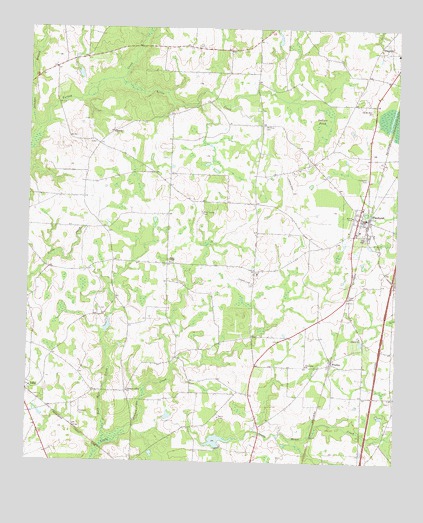
Pinehurst, GA USGS Topographic Map
Click on map above to begin viewing in our Map Viewer.

This topographic map contains these locations and features:
Feature Name Type Latitude Longitude GNIS ID View Map
City of PinehurstCivilN32.1956°W83.7597°2404522View Map
Dooly CountyCivilN32.1572°W83.7988°351608View Map
Dooly County Fire Department Pinehurst StationBuildingN32.1957°W83.7615°2604329View Map
Dooly County JailBuildingN32.1926°W83.7534°2734106View Map
Dooly County Sheriff OfficeBuildingN32.1927°W83.7536°2733771View Map
Double Churches (historical)ChurchN32.2216°W83.7955°335205View Map
Evergreen CemeteryCemeteryN32.2071°W83.7596°314005View Map
Everidge AirportAirportN32.2218°W83.8560°2625410View Map
FindlayPopulated PlaceN32.1541°W83.7716°355794View Map
First Missionary ChurchChurchN32.1279°W83.7974°335213View Map
Forehand CemeteryCemeteryN32.1390°W83.8568°314260View Map
Forehand CemeteryCemeteryN32.1913°W83.8482°335214View Map
Forest ChapelChurchN32.1827°W83.8266°314265View Map
Forest Chapel CemeteryCemeteryN32.1827°W83.8263°335215View Map
Forest Chapel School (historical)SchoolN32.1827°W83.8271°335216View Map
Friendship Methodist ChurchChurchN32.1532°W83.7799°355929View Map
Jalappa BranchStreamN32.2204°W83.8713°316033View Map
Liberty CemeteryCemeteryN32.1618°W83.7627°335227View Map
Liberty ChurchChurchN32.1616°W83.7618°316808View Map
Little CreekStreamN32.2354°W83.8441°317032View Map
Macks Field (historical)AirportN32.1713°W83.7557°351876View Map
Midway CemeteryCemeteryN32.1688°W83.8493°335233View Map
Midway ChurchChurchN32.1718°W83.8449°335234View Map
Mount Olive CemeteryCemeteryN32.2221°W83.7955°318720View Map
Oakbin PondLakeN32.2229°W83.7760°319854View Map
Old Mount Zion ChurchChurchN32.2268°W83.7588°320002View Map
Pennington Field (historical)AirportN32.1774°W83.8027°1672978View Map
PinehurstPopulated PlaceN32.1960°W83.7630°320662View Map
Pinehurst Baptist ChurchChurchN32.1954°W83.7632°335247View Map
Pinehurst City CemeteryCemeteryN32.1899°W83.7604°335248View Map
Pinehurst Police DepartmentBuildingN32.1949°W83.7610°2733661View Map
Pleasant Valley ChurchChurchN32.1454°W83.8402°320935View Map
Red Hill ChurchChurchN32.2199°W83.8460°321385View Map
Rock Hill CreekStreamN32.1296°W83.8491°321736View Map
Rock Spring CemeteryCemeteryN32.1974°W83.8163°321750View Map
Rock Spring Church (historical)ChurchN32.1979°W83.8157°335256View Map
Roney Farms AirportAirportN32.1497°W83.8610°351824View Map
Ryner PondReservoirN32.1313°W83.8101°341606View Map
Ryner Pond DamDamN32.1285°W83.8099°341605View Map
Sandy Mount Church (historical)ChurchN32.1313°W83.7541°335261View Map
Sandy Mount School (historical)SchoolN32.1438°W83.7518°335262View Map
Smiths Store (historical)LocaleN32.2415°W83.8557°335264View Map
Swearinger CemeteryCemeteryN32.1357°W83.8593°335267View Map
Wolf Pond (historical)LakeN32.1971°W83.7764°335279View Map
Wrights FieldAirportN32.2060°W83.7869°351875View Map
WWWN-AM (Vienna)TowerN32.1291°W83.7960°352585View Map

Note: Coordinates in the location and feature list above are referenced to NAD83 datum.


Copyright (C) 2008-2024 Ryan Niemi / Sunset Dynamics ... All Rights Reserved