TopoQuest Logo
Do you find TopoQuest useful?
Help keep TopoQuest running and adding new maps/features by donating!
Bitcoin:  19c7KJd3qBynnjoSw5npx9KScwjBe4ifkT
Litecoin:  LXs6TkuXGGXo1vDsWCkWVdjQX94eUKd6ui
Home View Maps Find Maps Find Places Resources & Links


Unadilla, Georgia Topographic Map

USGS Map Title: Unadilla, GA
USGS Map MRC: 32083C6
DRG (GeoTIFF) Download: o32083c6.tif


Neighboring USGS Topographic Map Quads:


  Perry West, GA  
32083D7
 

  Perry East, GA  
32083D6
 

  Hayneville, GA  
32083D5
 

  Henderson, GA  
32083C7
 

  Unadilla, GA  
32083C6
 

  Klondike, GA  
32083C5
 

  Pinehurst, GA  
32083B7
 

  Pineview NW, GA  
32083B6
 

  Finleyson West, GA  
32083B5


Map MRC Location:

N33°
W84°
N33°
W83°
H8 H7 H6 H5 H4 H3 H2 H1
G8 G7 G6 G5 G4 G3 G2 G1
F8 F7 F6 F5 F4 F3 F2 F1
E8 E7 E6 E5 E4 E3 E2 E1
D8 D7 D6 D5 D4 D3 D2 D1
C8 C7 C6 C5 C4 C3 C2 C1
B8 B7 B6 B5 B4 B3 B2 B1
A8 A7 A6 A5 A4 A3 A2 A1
N32°
W84°
N32°
W83°

Unadilla, GA USGS 1:24K Topographic Map Preview:
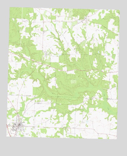
Unadilla, GA USGS Topographic Map
Click on map above to begin viewing in our Map Viewer.

This topographic map contains these locations and features:
Feature Name Type Latitude Longitude GNIS ID View Map
Bloodworth DamDamN32.3735°W83.6982°336209View Map
Bloodworth LakeReservoirN32.3734°W83.6986°336210View Map
Brannen LakeReservoirN32.2975°W83.7288°340973View Map
Brannen Lake DamDamN32.2985°W83.7299°340972View Map
Burnham BranchStreamN32.3002°W83.6549°312054View Map
Butler Hill School (historical)SchoolN32.2596°W83.6627°335196View Map
Camp CreekStreamN32.2815°W83.6396°312217View Map
Catna CreekStreamN32.3002°W83.6463°312431View Map
City of UnadillaCivilN32.2583°W83.7356°2405623View Map
County Line ChurchChurchN32.2890°W83.6535°334842View Map
Dooly State PrisonBuildingN32.2809°W83.7163°2604691View Map
ElkoPopulated PlaceN32.3310°W83.7063°313909View Map
Elko CemeteryCemeteryN32.3354°W83.7074°1671659View Map
Elko CreekStreamN32.3149°W83.7266°313910View Map
Exit 40CrossingN32.2607°W83.7496°1672974View Map
Green Grove ChurchChurchN32.3146°W83.6352°314839View Map
Green Grove School (historical)SchoolN32.3146°W83.6343°1671682View Map
Griggs North DamDamN32.2668°W83.6599°340252View Map
Griggs North LakeReservoirN32.2662°W83.6589°340253View Map
GrovaniaPopulated PlaceN32.3660°W83.6632°331877View Map
Grovania Methodist ChurchChurchN32.3677°W83.6607°1671804View Map
Harmon ParkParkN32.2674°W83.7341°335220View Map
Hayneville ChurchChurchN32.3721°W83.6252°334851View Map
Holmes CemeteryCemeteryN32.3671°W83.6930°315580View Map
J Lane Greenhouses and NurseryBuildingN32.2583°W83.6819°2674802View Map
Kersey LakeReservoirN32.3052°W83.7449°340971View Map
Kersey Lake DamDamN32.3052°W83.7449°340970View Map
Means Lane CemeteryCemeteryN32.3618°W83.7313°317987View Map
Middlebrooks CemeteryCemeteryN32.2899°W83.7293°318093View Map
Neale BranchStreamN32.3202°W83.6432°319222View Map
Oak Grove ChurchChurchN32.3643°W83.7335°319789View Map
Perfect DamDamN32.3318°W83.6899°336211View Map
Perfect LakeReservoirN32.3306°W83.6914°336212View Map
Richards LakeReservoirN32.3536°W83.7043°336218View Map
Richards Lake DamDamN32.3535°W83.7032°336217View Map
Saint Johns CemeteryCemeteryN32.2663°W83.6643°335257View Map
Saint Johns ChurchChurchN32.2654°W83.6646°322121View Map
South Prong Elko CreekStreamN32.3404°W83.7371°323276View Map
Southside SchoolSchoolN32.3518°W83.7105°323305View Map
Spring CreekStreamN32.3174°W83.6652°323374View Map
Spring Creek ChurchChurchN32.3360°W83.6755°323395View Map
Spring Hill ChurchChurchN32.3129°W83.7427°323423View Map
Spring Hill School (historical)SchoolN32.3129°W83.7424°1671778View Map
Sugar HillPopulated PlaceN32.2890°W83.6538°333151View Map
Sugar HillSummitN32.2893°W83.6557°333153View Map
UnadillaPopulated PlaceN32.2615°W83.7366°333297View Map
Unadilla Baptist ChurchChurchN32.2607°W83.7330°335268View Map
Unadilla Elementary SchoolSchoolN32.2590°W83.7432°335269View Map
Unadilla Fire and Rescue Station 1BuildingN32.2593°W83.7369°2604021View Map
Unadilla Fire and Rescue Station 2BuildingN32.2680°W83.7334°2604019View Map
Unadilla Fire and Rescue Station 3BuildingN32.2615°W83.7370°2604020View Map
Unadilla High SchoolSchoolN32.2621°W83.7402°335270View Map
Unadilla Police DepartmentBuildingN32.2628°W83.7398°2733784View Map
Unadilla Post OfficePost OfficeN32.2618°W83.7363°1705295View Map
Walnut CemeteryCemeteryN32.2579°W83.7321°324803View Map

Note: Coordinates in the location and feature list above are referenced to NAD83 datum.


Copyright (C) 2008-2025 Ryan Niemi / Sunset Dynamics ... All Rights Reserved