TopoQuest Logo
Do you find TopoQuest useful?
Help keep TopoQuest running and adding new maps/features by donating!
Bitcoin:  19c7KJd3qBynnjoSw5npx9KScwjBe4ifkT
Litecoin:  LXs6TkuXGGXo1vDsWCkWVdjQX94eUKd6ui
Home View Maps Find Maps Find Places Resources & Links


Piney Grove, Arkansas Topographic Map

USGS Map Title: Piney Grove, AR
USGS Map MRC: 33093H4
DRG (GeoTIFF) Download: o33093h4.tif


Neighboring USGS Topographic Map Quads:


  Delight, AR  
34093A5
 

  Antoine, AR  
34093A4
 

  Okolona North, AR  
34093A3
 

  Pisgah, AR  
33093H5
 

  Piney Grove, AR  
33093H4
 

  Okolona South, AR  
33093H3
 

  Blevins, AR  
33093G5
 

  Prescott West, AR  
33093G4
 

  Prescott East, AR  
33093G3


Map MRC Location:

N34°
W94°
N34°
W93°
H8 H7 H6 H5 H4 H3 H2 H1
G8 G7 G6 G5 G4 G3 G2 G1
F8 F7 F6 F5 F4 F3 F2 F1
E8 E7 E6 E5 E4 E3 E2 E1
D8 D7 D6 D5 D4 D3 D2 D1
C8 C7 C6 C5 C4 C3 C2 C1
B8 B7 B6 B5 B4 B3 B2 B1
A8 A7 A6 A5 A4 A3 A2 A1
N33°
W94°
N33°
W93°

Piney Grove, AR USGS 1:24K Topographic Map Preview:
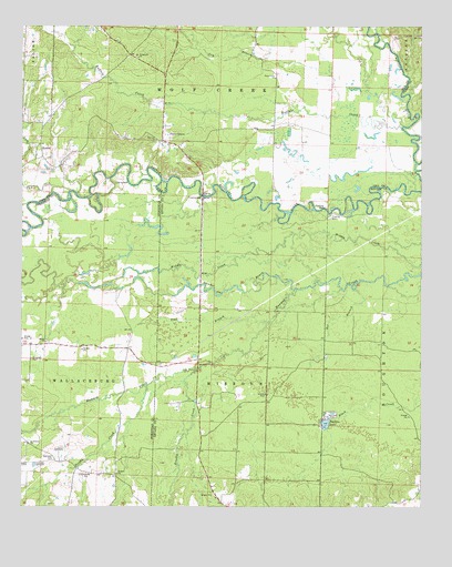
Piney Grove, AR USGS Topographic Map
Click on map above to begin viewing in our Map Viewer.

This topographic map contains these locations and features:
Feature Name Type Latitude Longitude GNIS ID View Map
Bee BranchStreamN33.9318°W93.3960°46296View Map
Bethel ChurchChurchN33.9179°W93.4927°46441View Map
Bethel School (historical)SchoolN33.9171°W93.4927°61434View Map
BowenPopulated PlaceN33.9693°W93.4943°56936View Map
Brushy CreekStreamN33.9107°W93.4452°47074View Map
Buffalo CreekStreamN33.9732°W93.3813°47156View Map
Crossroads ChurchChurchN33.9921°W93.4638°48221View Map
Dry BranchStreamN33.9793°W93.3993°48628View Map
Ebenezer CemeteryCemeteryN33.8879°W93.4893°48797View Map
Ebenezer Church (historical)ChurchN33.8873°W93.4893°61435View Map
Elizabeth CemeteryCemeteryN33.9134°W93.4968°48848View Map
Fairhills Fire DepartmentBuildingN33.8770°W93.4377°2116421View Map
Fairview Baptist ChurchChurchN33.9707°W93.4580°76902View Map
Flat BranchStreamN33.9234°W93.4243°49089View Map
Gum CreekStreamN33.9565°W93.4907°49709View Map
Number One BayouStreamN33.9321°W93.4135°52862View Map
Pine Grove ChurchChurchN33.9868°W93.4210°53426View Map
Piney GrovePopulated PlaceN33.9715°W93.4560°58386View Map
Saint Thomas ChurchChurchN33.8915°W93.4980°54480View Map
Suckles LakeLakeN33.8967°W93.4049°75859View Map
Tribble CreekStreamN33.9065°W93.4607°55646View Map

Note: Coordinates in the location and feature list above are referenced to NAD83 datum.


Copyright (C) 2008-2024 Ryan Niemi / Sunset Dynamics ... All Rights Reserved