TopoQuest Logo
Do you find TopoQuest useful?
Help keep TopoQuest running and adding new maps/features by donating!
Bitcoin:  19c7KJd3qBynnjoSw5npx9KScwjBe4ifkT
Litecoin:  LXs6TkuXGGXo1vDsWCkWVdjQX94eUKd6ui
Home View Maps Find Maps Find Places Resources & Links


Prescott East, Arkansas Topographic Map

USGS Map Title: Prescott East, AR
USGS Map MRC: 33093G3
DRG (GeoTIFF) Download: o33093g3.tif


Neighboring USGS Topographic Map Quads:


  Piney Grove, AR  
33093H4
 

  Okolona South, AR  
33093H3
 

  Gurdon, AR  
33093H2
 

  Prescott West, AR  
33093G4
 

  Prescott East, AR  
33093G3
 

  Whelen Springs, AR  
33093G2
 

  Emmet, AR  
33093F4
 

  Laneburg, AR  
33093F3
 

  Bluff City, AR  
33093F2


Map MRC Location:

N34°
W94°
N34°
W93°
H8 H7 H6 H5 H4 H3 H2 H1
G8 G7 G6 G5 G4 G3 G2 G1
F8 F7 F6 F5 F4 F3 F2 F1
E8 E7 E6 E5 E4 E3 E2 E1
D8 D7 D6 D5 D4 D3 D2 D1
C8 C7 C6 C5 C4 C3 C2 C1
B8 B7 B6 B5 B4 B3 B2 B1
A8 A7 A6 A5 A4 A3 A2 A1
N33°
W94°
N33°
W93°

Prescott East, AR USGS 1:24K Topographic Map Preview:
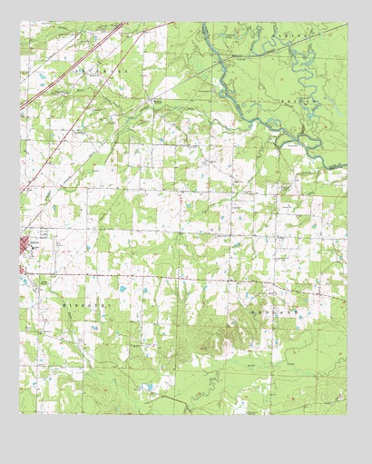
Prescott East, AR USGS Topographic Map
Click on map above to begin viewing in our Map Viewer.

This topographic map contains these locations and features:
Feature Name Type Latitude Longitude GNIS ID View Map
Beaver SloughStreamN33.8387°W93.2688°46277View Map
Boggy CreekStreamN33.8654°W93.2632°76395View Map
BoughtonPopulated PlaceN33.8501°W93.3257°46849View Map
Boughton Baptist ChurchChurchN33.8515°W93.3277°60338View Map
Boughton School (historical)SchoolN33.8654°W93.3277°60339View Map
Britt (historical)Populated PlaceN33.8743°W93.2521°65015View Map
Buchanan CemeteryCemeteryN33.8401°W93.3549°47112View Map
Cecil School (historical)SchoolN33.8362°W93.3213°60343View Map
Center School (historical)SchoolN33.7937°W93.3277°60344View Map
Cox CreekStreamN33.8382°W93.2771°48126View Map
Craven CemeteryCemeteryN33.7723°W93.3279°48148View Map
Craving Church (historical)ChurchN33.7793°W93.3154°60347View Map
Cypress BrakeSwampN33.8705°W93.2989°48294View Map
Garland CreekStreamN33.8432°W93.2874°49342View Map
Grand BranchStreamN33.8287°W93.2582°49541View Map
Heathlake DamDamN33.7901°W93.3352°80221View Map
Heathlake ReservoirReservoirN33.7902°W93.3357°80222View Map
Kizer FieldAirportN33.8025°W93.3622°83818View Map
Liberty ChurchChurchN33.8059°W93.2774°60365View Map
Liberty School (historical)SchoolN33.8032°W93.2779°60366View Map
Lick BranchStreamN33.8443°W93.2674°51126View Map
Macedonia ChurchChurchN33.8584°W93.3466°51567View Map
McRae Middle SchoolSchoolN33.8036°W93.3708°2039335View Map
McRae ParkParkN33.8007°W93.3718°51883View Map
Moore CreekStreamN33.8440°W93.3327°52164View Map
Moscow ChurchChurchN33.7765°W93.3666°52231View Map
Mount Caney ChurchChurchN33.7507°W93.2879°52269View Map
New Union School (historical)SchoolN33.7512°W93.2668°60379View Map
Piney Grove ChurchChurchN33.8354°W93.3113°78020View Map
Prescott Middle SchoolSchoolN33.8029°W93.3702°60387View Map
Providence CemeteryCemeteryN33.8720°W93.3427°53822View Map
RedlandPopulated PlaceN33.8068°W93.2777°58478View Map
Redland Fire DepartmentBuildingN33.7904°W93.2785°2117023View Map
Shady Grove ChurchChurchN33.8071°W93.2949°54704View Map
Washington Hill CemeteryCemeteryN33.8520°W93.3588°56078View Map
Winding SloughStreamN33.8707°W93.2782°56455View Map

Note: Coordinates in the location and feature list above are referenced to NAD83 datum.


Copyright (C) 2008-2025 Ryan Niemi / Sunset Dynamics ... All Rights Reserved