TopoQuest Logo
Do you find TopoQuest useful?
Help keep TopoQuest running and adding new maps/features by donating!
Bitcoin:  19c7KJd3qBynnjoSw5npx9KScwjBe4ifkT
Litecoin:  LXs6TkuXGGXo1vDsWCkWVdjQX94eUKd6ui
Home View Maps Find Maps Find Places Resources & Links


Pisgah, Arkansas Topographic Map

USGS Map Title: Pisgah, AR
USGS Map MRC: 33093H5
DRG (GeoTIFF) Download: o33093h5.tif


Neighboring USGS Topographic Map Quads:


  Murfreesboro, AR  
34093A6
 

  Delight, AR  
34093A5
 

  Antoine, AR  
34093A4
 

  McCaskill, AR  
33093H6
 

  Pisgah, AR  
33093H5
 

  Piney Grove, AR  
33093H4
 

  Washington, AR  
33093G6
 

  Blevins, AR  
33093G5
 

  Prescott West, AR  
33093G4


Map MRC Location:

N34°
W94°
N34°
W93°
H8 H7 H6 H5 H4 H3 H2 H1
G8 G7 G6 G5 G4 G3 G2 G1
F8 F7 F6 F5 F4 F3 F2 F1
E8 E7 E6 E5 E4 E3 E2 E1
D8 D7 D6 D5 D4 D3 D2 D1
C8 C7 C6 C5 C4 C3 C2 C1
B8 B7 B6 B5 B4 B3 B2 B1
A8 A7 A6 A5 A4 A3 A2 A1
N33°
W94°
N33°
W93°

Pisgah, AR USGS 1:24K Topographic Map Preview:
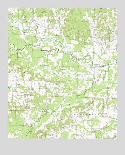
Pisgah, AR USGS Topographic Map
Click on map above to begin viewing in our Map Viewer.

This topographic map contains these locations and features:
Feature Name Type Latitude Longitude GNIS ID View Map
Baldon BranchStreamN33.9890°W93.5674°46050View Map
Ball ChapelChurchN33.9268°W93.6160°46054View Map
Bell BluffCliffN33.9807°W93.5918°46343View Map
Bell Bluff CemeteryCemeteryN33.9854°W93.5946°46344View Map
Bills School (historical)SchoolN33.9876°W93.5796°64602View Map
BillstownPopulated PlaceN33.9809°W93.5710°76349View Map
Billstown CemeteryCemeteryN33.9873°W93.5799°46625View Map
Blackland BranchStreamN33.9607°W93.5349°46687View Map
Blevins High SchoolSchoolN33.8753°W93.5719°61453View Map
Blue BranchStreamN33.9029°W93.5805°61431View Map
Bruce Memorial United Methodist ChurchChurchN33.9373°W93.5680°76436View Map
Camel BranchStreamN33.9657°W93.5007°47303View Map
Clear CreekStreamN33.9821°W93.6021°47828View Map
Collins BayouStreamN33.9296°W93.5274°47930View Map
DotsonPopulated PlaceN33.9226°W93.5985°56996View Map
Dotson Station (historical)Populated PlaceN33.9104°W93.6155°61430View Map
Dry BranchStreamN33.9896°W93.5957°48629View Map
Friendship United Methodist ChurchChurchN33.9123°W93.6024°76982View Map
Harris CemeteryCemeteryN33.9304°W93.5841°49893View Map
Hickory CreekStreamN33.9579°W93.5630°50048View Map
Horseshoe LakeLakeN33.9368°W93.5197°61433View Map
Kilgore (historical)Populated PlaceN33.9012°W93.5891°61429View Map
Lick CreekStreamN33.9804°W93.6027°51148View Map
Macedonia ChurchChurchN33.8957°W93.5382°51569View Map
Marlbrook CreekStreamN33.8818°W93.5188°51679View Map
Maxwell BridgeBridgeN33.8818°W93.6002°61428View Map
Nash CemeteryCemeteryN33.9970°W93.5760°52576View Map
Ozan CreekStreamN33.9457°W93.5096°53120View Map
PisgahPopulated PlaceN33.9793°W93.5260°53506View Map
Pleasant Springs Baptist ChurchChurchN33.9162°W93.6077°78061View Map
Saline CreekStreamN33.9632°W93.5613°54509View Map
Simpsons CreekStreamN33.9554°W93.5318°54867View Map
Stony CreekStreamN33.9596°W93.6177°55248View Map
Township of SalineCivilN33.9895°W93.5572°68968View Map
Township of WallaceburgCivilN33.8871°W93.5217°66649View Map
Vaughn CreekStreamN33.9821°W93.6018°55893View Map
WallaceburgPopulated PlaceN33.8932°W93.5474°78674View Map
Wallaceburg Bridge (historical)BridgeN33.9007°W93.5738°61432View Map

Note: Coordinates in the location and feature list above are referenced to NAD83 datum.


Copyright (C) 2008-2024 Ryan Niemi / Sunset Dynamics ... All Rights Reserved