TopoQuest Logo
Do you find TopoQuest useful?
Help keep TopoQuest running and adding new maps/features by donating!
Bitcoin:  19c7KJd3qBynnjoSw5npx9KScwjBe4ifkT
Litecoin:  LXs6TkuXGGXo1vDsWCkWVdjQX94eUKd6ui
Home View Maps Find Maps Find Places Resources & Links


Piney River, Virginia Topographic Map

USGS Map Title: Piney River, VA
USGS Map MRC: 37079F1
DRG (GeoTIFF) Download: o37079f1.tif


Neighboring USGS Topographic Map Quads:


  Montebello, VA  
37079G2
 

  Massies Mill, VA  
37079G1
 

  Horseshoe Mountain, VA  
37078G8
 

  Forks of Buffalo, VA  
37079F2
 

  Piney River, VA  
37079F1
 

  Arrington, VA  
37078F8
 

  Tobacco Row Mountain, VA  
37079E2
 

  Amherst, VA  
37079E1
 

  Buffalo Ridge, VA  
37078E8


Map MRC Location:

N38°
W80°
N38°
W79°
H8 H7 H6 H5 H4 H3 H2 H1
G8 G7 G6 G5 G4 G3 G2 G1
F8 F7 F6 F5 F4 F3 F2 F1
E8 E7 E6 E5 E4 E3 E2 E1
D8 D7 D6 D5 D4 D3 D2 D1
C8 C7 C6 C5 C4 C3 C2 C1
B8 B7 B6 B5 B4 B3 B2 B1
A8 A7 A6 A5 A4 A3 A2 A1
N37°
W80°
N37°
W79°

Piney River, VA USGS 1:24K Topographic Map Preview:
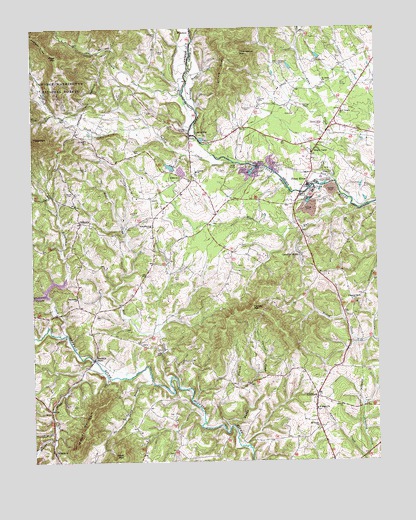
Piney River, VA USGS Topographic Map
Click on map above to begin viewing in our Map Viewer.

This topographic map contains these locations and features:
Feature Name Type Latitude Longitude GNIS ID View Map
Beard CemeteryCemeteryN37.7024°W79.1103°1481537View Map
Beaver CreekStreamN37.6543°W79.1031°1481563View Map
Buffalo River Dam Number ThreeDamN37.6735°W79.1197°1489152View Map
Camden CemeteryCemeteryN37.7404°W79.0217°1482240View Map
Campbell CemeteryCemeteryN37.7476°W79.0786°1482286View Map
Canodys StoreLocaleN37.6843°W79.0270°1482309View Map
Carpenter CemeteryCemeteryN37.7093°W79.1053°1482329View Map
Cash CemeteryCemeteryN37.6874°W79.0495°1482362View Map
Central Baptist ChurchChurchN37.7085°W79.0650°1482431View Map
CliffordPopulated PlaceN37.6435°W79.0222°1482575View Map
Clifford Baptist ChurchChurchN37.6410°W79.0128°1482576View Map
Clifford Post OfficePost OfficeN37.6448°W79.0222°2766348View Map
Crawford CreekStreamN37.6260°W79.0053°1482816View Map
England RidgeRidgeN37.7482°W79.1248°1483309View Map
Fulcher CemeteryCemeteryN37.7204°W79.0681°1483554View Map
Fulcher Family Farms AirportAirportN37.7238°W79.0984°2675594View Map
GidsvillePopulated PlaceN37.6940°W79.1078°1483619View Map
Giles CemeteryCemeteryN37.7046°W79.0092°1483621View Map
Harewood CemeteryCemeteryN37.7399°W79.0347°1483939View Map
Harvey CemeteryCemeteryN37.7290°W79.0420°1483965View Map
Henley CemeteryCemeteryN37.7326°W79.0206°1484037View Map
Henleys StoreLocaleN37.6549°W79.1022°1484041View Map
Holy Temple ChurchChurchN37.7263°W79.0120°1484173View Map
Indian CreekStreamN37.7113°W79.0517°1484319View Map
Ivy Hill Baptist ChurchChurchN37.7176°W79.1050°1484374View Map
Jerusalem ChurchChurchN37.6721°W79.1089°1484436View Map
Little MountainSummitN37.7368°W79.0545°1484939View Map
Little Piney RiverStreamN37.7313°W79.0695°1484959View Map
Long BranchStreamN37.6476°W79.0820°1485047View Map
Loving CemeteryCemeteryN37.6968°W79.0892°1485104View Map
LowesvillePopulated PlaceN37.7190°W79.0647°1496998View Map
Maple RunStreamN37.6985°W79.0095°1485174View Map
Mays CemeteryCemeteryN37.7429°W79.0784°1485242View Map
Mill CreekStreamN37.6496°W79.0756°1485419View Map
Mobley MountainSummitN37.6299°W79.1095°1485504View Map
Mount Moriah Church (historical)ChurchN37.6676°W79.1028°1707607View Map
Muddy BranchStreamN37.6346°W79.0542°1485735View Map
Page MountainSummitN37.7418°W79.1156°1486036View Map
Parr CemeteryCemeteryN37.6779°W79.0736°1486070View Map
Piney RiverPopulated PlaceN37.7051°W79.0231°1497093View Map
Piney River Post OfficePost OfficeN37.7146°W79.0224°2766409View Map
Piney River QuarryMineN37.7078°W79.0489°2724869View Map
Piney River Volunteer Fire DepartmentBuildingN37.7155°W79.0265°2086127View Map
Pleasant Grove ChurchChurchN37.6710°W79.0084°1486288View Map
Pleasant Grove School (historical)SchoolN37.6818°W79.0131°1707616View Map
Saint James ChurchChurchN37.7340°W79.0178°1486851View Map
Saint Mark Baptist ChurchChurchN37.6279°W79.1178°1486868View Map
Saint Marks ChurchChurchN37.6401°W79.0222°1486869View Map
Saint Mary Baptist ChurchChurchN37.7068°W79.0700°1486872View Map
Saint Marys School (historical)SchoolN37.7068°W79.0706°1707624View Map
Saint Peters Baptist ChurchChurchN37.6349°W79.0222°1486884View Map
Saint Peters School (historical)SchoolN37.6354°W79.0220°1707626View Map
Scott BranchStreamN37.7251°W79.1161°1486972View Map
Scott MountainSummitN37.6268°W79.0931°1486985View Map
Shady LanePopulated PlaceN37.7146°W79.0225°1497133View Map
Steele CemeteryCemeteryN37.7215°W79.0756°1487548View Map
Stonehouse CreekStreamN37.6621°W79.1131°1487605View Map
Stonewall CreekStreamN37.6726°W79.1197°1487608View Map
Temperance Elementary SchoolSchoolN37.6931°W79.0818°1487807View Map
Thomas CreekStreamN37.6465°W79.0456°1487865View Map
Thompson CemeteryCemeteryN37.7274°W79.0461°1487880View Map
Thompson MountainSummitN37.7429°W79.0486°1487885View Map
Tucker CemeteryCemeteryN37.7146°W79.0859°1488003View Map
Turkey MountainSummitN37.6688°W79.0456°1488027View Map
Whiteoak BranchStreamN37.7268°W79.0650°1488328View Map
Winton Country Club DamDamN37.6318°W79.0264°1489159View Map

Note: Coordinates in the location and feature list above are referenced to NAD83 datum.


Copyright (C) 2008-2025 Ryan Niemi / Sunset Dynamics ... All Rights Reserved