TopoQuest Logo
Do you find TopoQuest useful?
Help keep TopoQuest running and adding new maps/features by donating!
Bitcoin:  19c7KJd3qBynnjoSw5npx9KScwjBe4ifkT
Litecoin:  LXs6TkuXGGXo1vDsWCkWVdjQX94eUKd6ui
Home View Maps Find Maps Find Places Resources & Links


Amherst, Virginia Topographic Map

USGS Map Title: Amherst, VA
USGS Map MRC: 37079E1
DRG (GeoTIFF) Download: o37079e1.tif


Neighboring USGS Topographic Map Quads:


  Forks of Buffalo, VA  
37079F2
 

  Piney River, VA  
37079F1
 

  Arrington, VA  
37078F8
 

  Tobacco Row Mountain, VA  
37079E2
 

  Amherst, VA  
37079E1
 

  Buffalo Ridge, VA  
37078E8
 

  Lynchburg, VA  
37079D2
 

  Kelly, VA  
37079D1
 

  Stonewall, VA  
37078D8


Map MRC Location:

N38°
W80°
N38°
W79°
H8 H7 H6 H5 H4 H3 H2 H1
G8 G7 G6 G5 G4 G3 G2 G1
F8 F7 F6 F5 F4 F3 F2 F1
E8 E7 E6 E5 E4 E3 E2 E1
D8 D7 D6 D5 D4 D3 D2 D1
C8 C7 C6 C5 C4 C3 C2 C1
B8 B7 B6 B5 B4 B3 B2 B1
A8 A7 A6 A5 A4 A3 A2 A1
N37°
W80°
N37°
W79°

Amherst, VA USGS 1:24K Topographic Map Preview:
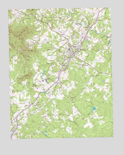
Amherst, VA USGS Topographic Map
Click on map above to begin viewing in our Map Viewer.

This topographic map contains these locations and features:
Feature Name Type Latitude Longitude GNIS ID View Map
AmherstPopulated PlaceN37.5851°W79.0514°1498447View Map
Amherst CemeteryCemeteryN37.5965°W79.0364°1462445View Map
Amherst County High SchoolSchoolN37.5701°W79.0584°1707561View Map
Amherst County Public LibraryBuildingN37.5821°W79.0577°2519891View Map
Amherst County Sheriff's OfficeBuildingN37.5853°W79.0497°2767001View Map
Amherst County Sheriffs OfficeBuildingN37.5853°W79.0500°2075633View Map
Amherst Elementary SchoolSchoolN37.5877°W79.0455°1707562View Map
Amherst Life Saving and First Aid CrewBuildingN37.5847°W79.0472°2075626View Map
Amherst Middle SchoolSchoolN37.5695°W79.0321°2498601View Map
Amherst Police DepartmentBuildingN37.5855°W79.0521°2767052View Map
Amherst Post OfficePost OfficeN37.5881°W79.0512°2766149View Map
Amherst Training SchoolSchoolN37.5688°W79.0361°1462446View Map
Amherst Volunteer Fire DepartmentBuildingN37.5846°W79.0506°2075629View Map
AngeloPopulated PlaceN37.5440°W79.0742°1492472View Map
Anne Gary Pannell CenterBuildingN37.5561°W79.0800°2110418View Map
Babcock Fine Arts CenterBuildingN37.5556°W79.0847°2110419View Map
Benedict BuildingBuildingN37.5561°W79.0808°2110420View Map
Berkley ChurchChurchN37.5779°W79.1214°1463094View Map
Boxwood Alumnae HouseBuildingN37.5575°W79.0819°2110421View Map
Buffalo HillPopulated PlaceN37.6129°W79.0167°1492668View Map
Campbell CemeteryCemeteryN37.5037°W79.1172°1464369View Map
Carl Grammer HallBuildingN37.5551°W79.0800°1707567View Map
Carson DormitoryBuildingN37.5563°W79.0800°1707568View Map
Carson Residence HallBuildingN37.5564°W79.0806°2110423View Map
Carter BranchStreamN37.5418°W79.1225°1464469View Map
Central Elementary SchoolSchoolN37.5694°W79.0362°2498615View Map
Central High SchoolSchoolN37.5690°W79.0314°1464692View Map
Christian Aid CemeteryCemeteryN37.5754°W79.0575°1464887View Map
Cochran LibraryBuildingN37.5567°W79.0811°2110424View Map
CoolwellPopulated PlaceN37.5276°W79.0906°1492805View Map
Coolwell ChurchChurchN37.5204°W79.0825°1465208View Map
Cox BranchStreamN37.6099°W79.0806°1465356View Map
Dew Residence HallBuildingN37.5550°W79.0808°2110425View Map
Dorothy J Sales BuildingBuildingN37.5572°W79.0811°2110426View Map
Early DamDamN37.5271°W79.0206°1489143View Map
Early LakeReservoirN37.5276°W79.0238°1502007View Map
Ebenezer Baptist ChurchChurchN37.5382°W79.0470°1466148View Map
Elston Inn and Conference CenterBuildingN37.5569°W79.0767°2110427View Map
Faulconer CemeteryCemeteryN37.5351°W79.1064°1466504View Map
FaulconervillePopulated PlaceN37.5324°W79.1003°1492933View Map
Fergus Reid HallBuildingN37.5551°W79.0809°1707579View Map
First Baptist Church of CoolwellChurchN37.5324°W79.0903°1707580View Map
Five ForksPopulated PlaceN37.5182°W79.1209°1466627View Map
Fletcher BuildingBuildingN37.5564°W79.0817°2110428View Map
Fletcher HallBuildingN37.5565°W79.0814°1707581View Map
Graduate Student HousingBuildingN37.5575°W79.0811°2110429View Map
Grammer Residence HallBuildingN37.5550°W79.0803°2110430View Map
Gray DormitoryBuildingN37.5563°W79.0806°1707583View Map
Guion Science CenterBuildingN37.5564°W79.0853°2110432View Map
Harrison CemeteryCemeteryN37.6143°W79.0611°1467788View Map
Higginbotham CreekStreamN37.5710°W79.0520°1468002View Map
Hockey FieldLocaleN37.5589°W79.0839°2110433View Map
Huff CreekStreamN37.6168°W79.0478°1468352View Map
Izaak Walton DamDamN37.5035°W79.0797°1489144View Map
Izaak Walton ParkParkN37.5057°W79.0814°1468566View Map
Izaak Walton PondReservoirN37.5037°W79.0815°1489145View Map
Kentucky MountainSummitN37.5796°W79.1095°1468966View Map
Lake Tennis CourtsParkN37.5589°W79.0847°2110434View Map
Manson HallBuildingN37.5563°W79.0797°1707598View Map
Manson Residence HallBuildingN37.5561°W79.0797°2110435View Map
Mary Clark Rogers Garden CottageBuildingN37.5572°W79.0828°2110436View Map
Mary Harley Student Health CenterBuildingN37.5544°W79.0800°2110437View Map
Mary Helen Cochran LibraryBuildingN37.5568°W79.0811°1707601View Map
Meta Glass Residence HallBuildingN37.5547°W79.0803°2110439View Map
MonitorPopulated PlaceN37.6174°W79.0834°1477547View Map
Monroe Educational CenterSchoolN37.5074°W79.1224°2498644View Map
Morriss CemeteryCemeteryN37.5187°W79.0245°1470768View Map
Mount Airy SchoolSchoolN37.5338°W79.0889°1470804View Map
Mount Olive Baptist ChurchChurchN37.5863°W79.0542°1707608View Map
Mud CreekStreamN37.5521°W79.1231°1471210View Map
Paul MountainSummitN37.5596°W79.1022°1472116View Map
Prothro HallBuildingN37.5544°W79.0808°2110440View Map
Prothro NatatoriumBuildingN37.5553°W79.0839°2110441View Map
Randolph HallBuildingN37.5560°W79.0797°1707620View Map
Randolph Residence HallBuildingN37.5558°W79.0778°2110442View Map
Reid Residence HallBuildingN37.5550°W79.0808°2110443View Map
Richardson MountainSummitN37.6021°W79.1056°1473188View Map
Riding Hunt CourseParkN37.5594°W79.0828°2110444View Map
Rutledge CreekStreamN37.5882°W79.0011°1473665View Map
SardisPopulated PlaceN37.6215°W79.1128°1477718View Map
Sardis United Methodist ChurchChurchN37.6218°W79.1125°1707629View Map
Strode MountainSummitN37.5851°W79.0789°1475252View Map
Student Commons CourtyardLocaleN37.5547°W79.0808°2110445View Map
Sweet Briar CollegeSchoolN37.5557°W79.0797°1475380View Map
Sweet Briar HouseBuildingN37.5572°W79.0831°2110446View Map
Sweet Briar MuseumBuildingN37.5575°W79.0819°2110447View Map
Sweet Briar StationPopulated PlaceN37.5529°W79.0664°1493679View Map
Sweetbriar College Lower DamDamN37.5651°W79.0797°1489160View Map
Sweetbriar College Upper DamDamN37.5601°W79.0831°1489162View Map
Sweetbriar LakeReservoirN37.5637°W79.0827°1489161View Map
Timberdoodle AirportAirportN37.5358°W79.0234°2675595View Map
Town of AmherstCivilN37.5816°W79.0508°2390702View Map
Train Station and CabooseBuildingN37.5561°W79.0867°2110448View Map
Tribulation CreekStreamN37.6082°W79.0372°1475854View Map
Union HillPopulated PlaceN37.5582°W79.0200°1493729View Map
Union Hill Baptist ChurchChurchN37.5585°W79.0209°1707635View Map
Virginia State Police Division 3 Area 20 OfficeBuildingN37.5762°W79.0565°2767150View Map
WAMV-AM (Amherst)TowerN37.5399°W79.0914°1498915View Map
Williams CemeteryCemeteryN37.5507°W79.0947°1476757View Map
Williams CreekStreamN37.5724°W79.0534°1476762View Map
Williams GymnasiumBuildingN37.5553°W79.0839°2110449View Map
Wilson CemeteryCemeteryN37.5462°W79.0239°1476816View Map
WUDZ-FM (Sweet Briar)TowerN37.5551°W79.0806°1499009View Map

Note: Coordinates in the location and feature list above are referenced to NAD83 datum.


Copyright (C) 2008-2025 Ryan Niemi / Sunset Dynamics ... All Rights Reserved