TopoQuest Logo
Do you find TopoQuest useful?
Help keep TopoQuest running and adding new maps/features by donating!
Bitcoin:  19c7KJd3qBynnjoSw5npx9KScwjBe4ifkT
Litecoin:  LXs6TkuXGGXo1vDsWCkWVdjQX94eUKd6ui
Home View Maps Find Maps Find Places Resources & Links


Horseshoe Mountain, Virginia Topographic Map

USGS Map Title: Horseshoe Mountain, VA
USGS Map MRC: 37078G8
DRG (GeoTIFF) Download: o37078g8.tif


Neighboring USGS Topographic Map Quads:


  Big Levels, VA  
37079H1
 

  Sherando, VA  
37078H8
 

  Greenfield, VA  
37078H7
 

  Massies Mill, VA  
37079G1
 

  Horseshoe Mountain, VA  
37078G8
 

  Lovingston, VA  
37078G7
 

  Piney River, VA  
37079F1
 

  Arrington, VA  
37078F8
 

  Shipman, VA  
37078F7


Map MRC Location:

N38°
W79°
N38°
W78°
H8 H7 H6 H5 H4 H3 H2 H1
G8 G7 G6 G5 G4 G3 G2 G1
F8 F7 F6 F5 F4 F3 F2 F1
E8 E7 E6 E5 E4 E3 E2 E1
D8 D7 D6 D5 D4 D3 D2 D1
C8 C7 C6 C5 C4 C3 C2 C1
B8 B7 B6 B5 B4 B3 B2 B1
A8 A7 A6 A5 A4 A3 A2 A1
N37°
W79°
N37°
W78°

Horseshoe Mountain, VA USGS 1:24K Topographic Map Preview:
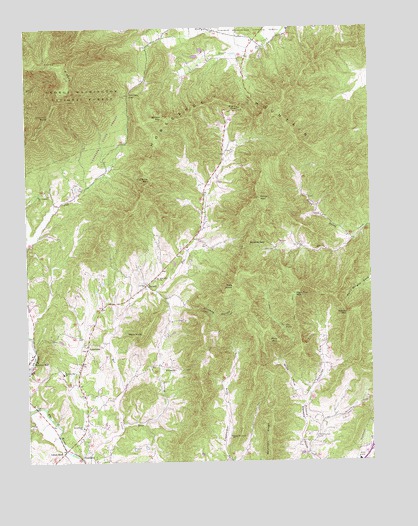
Horseshoe Mountain, VA USGS Topographic Map
Click on map above to begin viewing in our Map Viewer.

This topographic map contains these locations and features:
Feature Name Type Latitude Longitude GNIS ID View Map
Becknors RidgeRidgeN37.7565°W78.9128°1481580View Map
Beech Grove Christian ChurchChurchN37.8746°W78.9347°1500920View Map
Bethlehem CemeteryCemeteryN37.7599°W78.9803°1500921View Map
Bethlehem ChurchChurchN37.7599°W78.9800°1481672View Map
Bolton MountainSummitN37.8493°W78.9503°1481921View Map
Brent GapGapN37.8515°W78.9225°1481978View Map
BryantPopulated PlaceN37.8010°W78.9564°1482085View Map
Cat Rock MountainSummitN37.8310°W78.9550°1482374View Map
Chimney RockSummitN37.8499°W78.9914°1482520View Map
Cow HollowValleyN37.7610°W78.9975°1482750View Map
East Branch Hat CreekStreamN37.7607°W78.9656°1483198View Map
Fleetwood-Massies Mill Elementary SchoolSchoolN37.7754°W78.9875°1485219View Map
Fortunes CoveValleyN37.7669°W78.8996°1483507View Map
FreshwaterPopulated PlaceN37.7504°W78.9270°1500926View Map
Ginseng HollowValleyN37.7989°W78.9534°1483646View Map
Harpers Creek ShelterLocaleN37.8568°W78.9992°1488521View Map
High Top MountainSummitN37.7979°W78.9034°1495687View Map
Horseshoe MountainSummitN37.8418°W78.9006°1484231View Map
JonesboroPopulated PlaceN37.7835°W78.9784°1495767View Map
Jonesboro Baptist ChurchChurchN37.7838°W78.9786°1500927View Map
Jonesboro CemeteryCemeteryN37.7826°W78.9797°1500928View Map
Lanes FordPopulated PlaceN37.7535°W78.9861°1484659View Map
Lesesne State ForestForestN37.8440°W78.9775°1488519View Map
Lovingston Elementary SchoolSchoolN37.7504°W78.8797°1500930View Map
Mars KnobSummitN37.7865°W78.9584°1485195View Map
Massie Memorial ChurchChurchN37.7574°W78.9264°1485218View Map
Massies Mill Presbyterian ChurchChurchN37.7790°W78.9984°1500932View Map
Mill Dam CreekStreamN37.7807°W78.9970°1485440View Map
Mills MountainSummitN37.7846°W78.9089°1495951View Map
Mount Pleasant ChurchChurchN37.8271°W78.9956°1485633View Map
Nelson CountyCivilN37.7874°W78.8868°1500936View Map
North Prong Davis CreekStreamN37.8151°W78.8795°1485914View Map
Pats KnobSummitN37.8001°W78.9253°1486083View Map
RamseyPopulated PlaceN37.8549°W78.9622°1488518View Map
Ramsey GapGapN37.8560°W78.9622°1486501View Map
Roseland Post OfficePost OfficeN37.7652°W78.9790°2766288View Map
Roseland Rescue SquadBuildingN37.7633°W78.9789°2086129View Map
Roseland Rescue Squad HeliportAirportN37.7632°W78.9789°1498804View Map
Shaeffer HollowValleyN37.7765°W78.9510°1487020View Map
Shields GapGapN37.8126°W78.9195°1487192View Map
Stevens Cove CemeteryCemeteryN37.7562°W78.8956°1487563View Map
Stevens Cove Church (historical)ChurchN37.7565°W78.8953°1500953View Map
Stevens Helicopters HeliportAirportN37.7568°W78.8959°1498716View Map
The FallsFallsN37.7888°W78.9075°1487824View Map
Three RidgesRidgeN37.8585°W78.9842°1487899View Map
Three Ridges WildernessReserveN37.8636°W78.9923°2035324View Map
White MountainSummitN37.8257°W78.9147°1488287View Map
Wills CoveValleyN37.7670°W78.8996°1488406View Map
Wintergreen School (historical)SchoolN37.8657°W78.9175°1500959View Map
Woods MountainSummitN37.7921°W78.8836°1488481View Map
Zion Hill ChurchChurchN37.8029°W78.9525°1487142View Map

Note: Coordinates in the location and feature list above are referenced to NAD83 datum.


Copyright (C) 2008-2025 Ryan Niemi / Sunset Dynamics ... All Rights Reserved