TopoQuest Logo
Do you find TopoQuest useful?
Help keep TopoQuest running and adding new maps/features by donating!
Bitcoin:  19c7KJd3qBynnjoSw5npx9KScwjBe4ifkT
Litecoin:  LXs6TkuXGGXo1vDsWCkWVdjQX94eUKd6ui
Home View Maps Find Maps Find Places Resources & Links


Bethpage, Tennessee Topographic Map

USGS Map Title: Bethpage, TN
USGS Map MRC: 36086D3
DRG (GeoTIFF) Download: o36086d3.tif


Neighboring USGS Topographic Map Quads:


  Fountain Head, TN  
36086E4
 

  Turners Station, TN  
36086E3
 

  Westmoreland, TN  
36086E2
 

  Gallatin, TN  
36086D4
 

  Bethpage, TN  
36086D3
 

  Hartsville, TN  
36086D2
 

  Laguardo, TN  
36086C4
 

  Hunters Point, TN  
36086C3
 

  Bellwood, TN  
36086C2


Map MRC Location:

N37°
W87°
N37°
W86°
H8 H7 H6 H5 H4 H3 H2 H1
G8 G7 G6 G5 G4 G3 G2 G1
F8 F7 F6 F5 F4 F3 F2 F1
E8 E7 E6 E5 E4 E3 E2 E1
D8 D7 D6 D5 D4 D3 D2 D1
C8 C7 C6 C5 C4 C3 C2 C1
B8 B7 B6 B5 B4 B3 B2 B1
A8 A7 A6 A5 A4 A3 A2 A1
N36°
W87°
N36°
W86°

Bethpage, TN USGS 1:24K Topographic Map Preview:
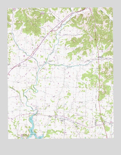
Bethpage, TN USGS Topographic Map
Click on map above to begin viewing in our Map Viewer.

This topographic map contains these locations and features:
Feature Name Type Latitude Longitude GNIS ID View Map
Bates BranchStreamN36.3803°W86.3453°1276461View Map
BethpagePopulated PlaceN36.4817°W86.3119°1277178View Map
Bethpage Census Designated PlaceCensusN36.4843°W86.3085°2584571View Map
Bethpage Division (historical)CensusN36.4712°W86.3408°1648971View Map
Bethpage Elementary SchoolSchoolN36.4809°W86.3128°1320589View Map
Bethpage Post OfficePost OfficeN36.4835°W86.3111°1651561View Map
Bethpage Station (historical)LocaleN36.4739°W86.3125°1320590View Map
Bethpage United Methodist ChurchChurchN36.4820°W86.3119°1320730View Map
Bethpape CemeteryCemeteryN36.4923°W86.3000°1646688View Map
Bledsoe Creek Camping State ParkParkN36.3767°W86.3555°1320591View Map
Bledsoe SchoolSchoolN36.3967°W86.3258°1277684View Map
Brush ForkStreamN36.4828°W86.3097°1278689View Map
Brushy Fork CreekStreamN36.4834°W86.3105°1278704View Map
Campbell HollowValleyN36.4843°W86.3700°1647557View Map
Castalian SpringsPopulated PlaceN36.3937°W86.3080°1305723View Map
Castalian Springs Census Designated PlaceCensusN36.4012°W86.3068°2584574View Map
Castalian Springs Division (historical)CensusN36.3795°W86.3264°1648972View Map
Castalian Springs Post OfficePost OfficeN36.3965°W86.3124°1651531View Map
Castalian Springs United Methodist ChurchChurchN36.3939°W86.3094°1320601View Map
ChipmanPopulated PlaceN36.4487°W86.2792°1314839View Map
Commissioner District 3CivilN36.4266°W86.3699°2464200View Map
DeshaPopulated PlaceN36.4292°W86.3642°1314944View Map
Deshea CreekStreamN36.4092°W86.3533°1306333View Map
Dry ForkStreamN36.4423°W86.3372°1304744View Map
Dry ForkStreamN36.4420°W86.3369°1282968View Map
Durham ChapelChurchN36.4725°W86.3303°1646690View Map
Durham Chapel CemeteryCemeteryN36.4723°W86.3305°1646689View Map
Durham's Chapel SchoolSchoolN36.4714°W86.3311°1283229View Map
East Fork Bledsoe CreekStreamN36.4464°W86.3303°1283331View Map
Enon ChurchChurchN36.3914°W86.2639°1283815View Map
Harris Mill (historical)LocaleN36.4650°W86.3164°1320641View Map
Hartsville JunctionPopulated PlaceN36.4495°W86.3267°1315200View Map
Hickory GrovePopulated PlaceN36.3864°W86.2928°1315230View Map
Hickory Grove School (historical)SchoolN36.3864°W86.2922°1320648View Map
Hog HollowValleyN36.4476°W86.2552°1647263View Map
Hopewell ChurchChurchN36.4098°W86.2867°1288319View Map
Kansas SchoolSchoolN36.4473°W86.3744°1289906View Map
Lick CreekStreamN36.3789°W86.3336°1291208View Map
Mutton BranchStreamN36.4689°W86.3144°1295171View Map
Mutton HollowValleyN36.4720°W86.3121°1647561View Map
OaklandPopulated PlaceN36.3978°W86.3408°1311945View Map
Old BethpagePopulated PlaceN36.4948°W86.2983°1311948View Map
Old Hopewell CemeteryCemeteryN36.4439°W86.3050°1646691View Map
Old Hopewell ChurchChurchN36.4442°W86.3044°1306864View Map
Old Union ChurchChurchN36.3984°W86.3411°1296390View Map
Paynes StorePopulated PlaceN36.3887°W86.2625°1297025View Map
Philippi ChurchChurchN36.3898°W86.2550°1297315View Map
Pryor BranchStreamN36.4759°W86.3692°1298631View Map
Red Chief OrchardLocaleN36.3958°W86.3433°2678192View Map
Rocky Creek SubdivisionPopulated PlaceN36.3909°W86.2522°1647262View Map
RoganaPopulated PlaceN36.4450°W86.3336°1315836View Map
Rogues Fork CreekStreamN36.4848°W86.2972°1269915View Map
Shady Cove ResortLocaleN36.3945°W86.3453°1320695View Map
Shiloh Presbyterian ChurchChurchN36.4453°W86.3614°1303590View Map
Sideview (historical)Populated PlaceN36.4459°W86.3611°1311963View Map
Southeast Community Fire DepartmentBuildingN36.4895°W86.3082°2653644View Map
Sumner County QuarryMineN36.4994°W86.3667°2633421View Map

Note: Coordinates in the location and feature list above are referenced to NAD83 datum.


Copyright (C) 2008-2024 Ryan Niemi / Sunset Dynamics ... All Rights Reserved