TopoQuest Logo
Do you find TopoQuest useful?
Help keep TopoQuest running and adding new maps/features by donating!
Bitcoin:  19c7KJd3qBynnjoSw5npx9KScwjBe4ifkT
Litecoin:  LXs6TkuXGGXo1vDsWCkWVdjQX94eUKd6ui
Home View Maps Find Maps Find Places Resources & Links


Westmoreland, Tennessee Topographic Map

USGS Map Title: Westmoreland, TN
USGS Map MRC: 36086E2
DRG (GeoTIFF) Download: o36086e2.tif


Neighboring USGS Topographic Map Quads:


  Adolphus, KY  
36086F3
 

  Petroleum, KY  
36086F2
 

  Holland, KY  
36086F1
 

  Turners Station, TN  
36086E3
 

  Westmoreland, TN  
36086E2
 

  Lafayette, TN  
36086E1
 

  Bethpage, TN  
36086D3
 

  Hartsville, TN  
36086D2
 

  Hillsdale, TN  
36086D1


Map MRC Location:

N37°
W87°
N37°
W86°
H8 H7 H6 H5 H4 H3 H2 H1
G8 G7 G6 G5 G4 G3 G2 G1
F8 F7 F6 F5 F4 F3 F2 F1
E8 E7 E6 E5 E4 E3 E2 E1
D8 D7 D6 D5 D4 D3 D2 D1
C8 C7 C6 C5 C4 C3 C2 C1
B8 B7 B6 B5 B4 B3 B2 B1
A8 A7 A6 A5 A4 A3 A2 A1
N36°
W87°
N36°
W86°

Westmoreland, TN USGS 1:24K Topographic Map Preview:
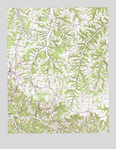
Westmoreland, TN USGS Topographic Map
Click on map above to begin viewing in our Map Viewer.

This topographic map contains these locations and features:
Feature Name Type Latitude Longitude GNIS ID View Map
Alvis - Shrum CemeteryCemeteryN36.5467°W86.1558°2084457View Map
Black Oak CemeteryCemeteryN36.5997°W86.1497°2084538View Map
Brown CemeteryCemeteryN36.6086°W86.2361°1278566View Map
Buffalo SpringSpringN36.5186°W86.2458°1278918View Map
Caldwell CemeteryCemeteryN36.6217°W86.2447°1279315View Map
Carman CemeteryCemeteryN36.5478°W86.1711°1279683View Map
Carter CemeteryCemeteryN36.5778°W86.2297°1279809View Map
Chestnut Grove CemeteryCemeteryN36.5058°W86.1881°2084501View Map
Clines SchoolSchoolN36.5684°W86.1661°1280753View Map
Coleman HollowValleyN36.5556°W86.1362°1280952View Map
Commissioner District 11CivilN36.6087°W86.1663°2464341View Map
Commissioner District 20CivilN36.5545°W86.1950°2463991View Map
Commissioner District 5CivilN36.5057°W86.1656°2464471View Map
Commissioner District 6CivilN36.5865°W86.1567°2464556View Map
Copper HollowValleyN36.5652°W86.1912°1281260View Map
Cross LanesPopulated PlaceN36.5223°W86.1494°1281703View Map
Cross RoadsPopulated PlaceN36.6134°W86.1530°1281711View Map
Cross Roads School (historical)SchoolN36.6137°W86.1536°1320129View Map
Davis BranchStreamN36.5725°W86.2172°1282128View Map
Doss HollowValleyN36.6199°W86.1927°1282665View Map
EuliaPopulated PlaceN36.5245°W86.1728°1283880View Map
Eulia ChurchChurchN36.5309°W86.1758°1644063View Map
FairviewPopulated PlaceN36.5112°W86.1780°1315044View Map
Fairview CemeteryCemeteryN36.5122°W86.1781°2084526View Map
G T Dalton CemeteryCemeteryN36.5911°W86.1517°2084518View Map
Garrett Creek ChurchChurchN36.6248°W86.2380°1285198View Map
Gilliam HollowValleyN36.6176°W86.2350°1285413View Map
Hawkins CemeteryCemeteryN36.5398°W86.2141°1287183View Map
Hawkins HollowValleyN36.6003°W86.1987°1287190View Map
Henson HollowValleyN36.5070°W86.2385°1287482View Map
Hicks HollowValleyN36.5149°W86.2122°1287668View Map
Hodge CemeteryCemeteryN36.5242°W86.2197°1287950View Map
Holman CemeteryCemeteryN36.5253°W86.1608°1288125View Map
Hoskins HollowValleyN36.6092°W86.1919°1288473View Map
Janey BranchStreamN36.6225°W86.2369°1289299View Map
Leaths BranchStreamN36.5159°W86.2111°1647338View Map
Leaths ChapelChurchN36.5184°W86.2486°1290896View Map
Leaths Chapel HollowValleyN36.5175°W86.2443°1290897View Map
Leaths Chapel SchoolSchoolN36.5464°W86.2033°1290898View Map
Leaths HollowValleyN36.5161°W86.2113°1290899View Map
Lewis Minick CemeteryCemeteryN36.5547°W86.1694°2084580View Map
Love - Ladd CemeteryCemeteryN36.5133°W86.1814°2084558View Map
Mack HollowValleyN36.6028°W86.1969°1292446View Map
Millers ChapelChurchN36.5442°W86.1436°1293971View Map
Millers Chapel CemeteryCemeteryN36.5442°W86.1444°2084579View Map
Morrison BranchStreamN36.5853°W86.2008°1294443View Map
Mount Pleasant CemeteryCemeteryN36.6067°W86.1733°2084583View Map
New Liberty ChurchChurchN36.5556°W86.1753°1295591View Map
New ZionPopulated PlaceN36.5698°W86.1733°1295667View Map
Pearson HollowValleyN36.5182°W86.2387°1297082View Map
Pike CemeteryCemeteryN36.5481°W86.2325°1297460View Map
Pisgah ChurchChurchN36.5173°W86.1389°1297721View Map
Pleasant GrovePopulated PlaceN36.6000°W86.2253°1297800View Map
Pleasant Grove Baptist ChurchChurchN36.6006°W86.2236°1320679View Map
Pleasant Grove CemeteryCemeteryN36.6006°W86.2236°1646728View Map
Pleasant Grove SchoolSchoolN36.6028°W86.2200°1297840View Map
Pop BranchStreamN36.6198°W86.1925°1647339View Map
Rocky MoundPopulated PlaceN36.6075°W86.1658°1299911View Map
Rocky Mound Baptist ChurchChurchN36.6059°W86.1630°1644079View Map
Rouse HollowValleyN36.5091°W86.2021°1300189View Map
Saltpeter Cave HollowValleyN36.5716°W86.1317°1300610View Map
SiloamPopulated PlaceN36.5462°W86.2128°1270272View Map
Siloam Baptist ChurchChurchN36.5464°W86.2133°1644081View Map
Siloam Census Designated PlaceCensusN36.5624°W86.2062°2586081View Map
Siloam Division (historical)CensusN36.5642°W86.1661°1648852View Map
Simmons BranchStreamN36.5981°W86.1975°1270294View Map
Simmons CemeteryCemeteryN36.5812°W86.1575°1270311View Map
Sloan HollowValleyN36.5229°W86.2096°1270537View Map
Stillhouse HollowValleyN36.5935°W86.1975°1271426View Map
Sugar Camp HollowValleyN36.6147°W86.1901°1271655View Map
Taylor HollowValleyN36.5221°W86.2327°1272240View Map
Tooley BranchStreamN36.5737°W86.1955°1272771View Map
Town of WestmorelandCivilN36.5605°W86.2443°2406869View Map
Union Hill ChurchChurchN36.5909°W86.1383°1304255View Map
Walden-Walrond CemeteryCemeteryN36.5567°W86.1269°1273555View Map
WestmorelandPopulated PlaceN36.5620°W86.2480°1304492View Map
Westmoreland Civil Defense and Volunteer Fire DepartmentBuildingN36.5627°W86.2485°2653820View Map
Westmoreland First Baptist ChurchChurchN36.5634°W86.2458°1320722View Map
Westmoreland Police DepartmentBuildingN36.5624°W86.2463°2765974View Map
Westmoreland Post OfficePost OfficeN36.5622°W86.2469°1651558View Map
Westside Elementary SchoolSchoolN36.5259°W86.1744°1316357View Map
William Galbraith CemeteryCemeteryN36.5164°W86.1267°2084531View Map
Williams HollowValleyN36.6229°W86.2365°1274708View Map
Wix BranchStreamN36.5553°W86.2228°1274923View Map
WixtownPopulated PlaceN36.5414°W86.1386°1274924View Map

Note: Coordinates in the location and feature list above are referenced to NAD83 datum.


Copyright (C) 2008-2025 Ryan Niemi / Sunset Dynamics ... All Rights Reserved