TopoQuest Logo
Do you find TopoQuest useful?
Help keep TopoQuest running and adding new maps/features by donating!
Bitcoin:  19c7KJd3qBynnjoSw5npx9KScwjBe4ifkT
Litecoin:  LXs6TkuXGGXo1vDsWCkWVdjQX94eUKd6ui
Home View Maps Find Maps Find Places Resources & Links


Hartsville, Tennessee Topographic Map

USGS Map Title: Hartsville, TN
USGS Map MRC: 36086D2
DRG (GeoTIFF) Download: o36086d2.tif


Neighboring USGS Topographic Map Quads:


  Turners Station, TN  
36086E3
 

  Westmoreland, TN  
36086E2
 

  Lafayette, TN  
36086E1
 

  Bethpage, TN  
36086D3
 

  Hartsville, TN  
36086D2
 

  Hillsdale, TN  
36086D1
 

  Hunters Point, TN  
36086C3
 

  Bellwood, TN  
36086C2
 

  Dixon Springs, TN  
36086C1


Map MRC Location:

N37°
W87°
N37°
W86°
H8 H7 H6 H5 H4 H3 H2 H1
G8 G7 G6 G5 G4 G3 G2 G1
F8 F7 F6 F5 F4 F3 F2 F1
E8 E7 E6 E5 E4 E3 E2 E1
D8 D7 D6 D5 D4 D3 D2 D1
C8 C7 C6 C5 C4 C3 C2 C1
B8 B7 B6 B5 B4 B3 B2 B1
A8 A7 A6 A5 A4 A3 A2 A1
N36°
W87°
N36°
W86°

Hartsville, TN USGS 1:24K Topographic Map Preview:
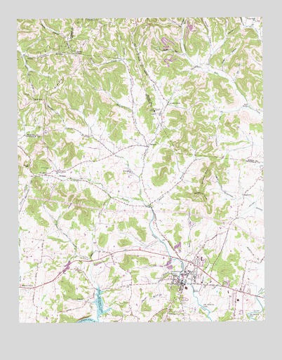
Hartsville, TN USGS Topographic Map
Click on map above to begin viewing in our Map Viewer.

This topographic map contains these locations and features:
Feature Name Type Latitude Longitude GNIS ID View Map
Browning BranchStreamN36.4245°W86.1869°1278610View Map
Carr BranchStreamN36.4614°W86.1903°1279715View Map
Cedar BluffPopulated PlaceN36.4967°W86.1305°1647334View Map
Cedar Bluff ChurchChurchN36.4981°W86.1280°1305751View Map
Charlton CemeteryCemeteryN36.4617°W86.1778°2084499View Map
Church of Christ of HartsvilleChurchN36.4006°W86.1608°1323614View Map
Church of the First BornChurchN36.3928°W86.1664°1646067View Map
Clampit HollowValleyN36.4866°W86.1496°1280582View Map
Commissioner District 4CivilN36.4184°W86.1514°2464092View Map
Commissioner District 5CivilN36.4110°W86.2464°2464498View Map
Commissioner District 7CivilN36.3918°W86.2086°2464648View Map
Commissioner District 8CivilN36.4474°W86.2048°2464702View Map
Commissioner District 9CivilN36.3931°W86.1535°2464748View Map
Creasy HollowValleyN36.4963°W86.1333°1281590View Map
Dalton HollowValleyN36.4006°W86.1658°1281992View Map
Darwin BranchStreamN36.3870°W86.1611°1282068View Map
East Main Street Missionary Baptist ChurchChurchN36.3909°W86.1625°1646070View Map
Echo SpringSpringN36.4634°W86.1322°1283493View Map
First Methodist Church of HartsvilleChurchN36.3881°W86.1675°1646072View Map
Fred A Vaught Memorial LibraryBuildingN36.3948°W86.1617°1309982View Map
Friendship ChurchChurchN36.4364°W86.1922°1284946View Map
Gap HollowValleyN36.4982°W86.1291°1285149View Map
Gifford HollowValleyN36.4296°W86.1463°1285363View Map
Gravel Hill School (historical)SchoolN36.4959°W86.2125°1320132View Map
Gravely HillSummitN36.4806°W86.2197°1285949View Map
Green Chapel Methodist ChurchChurchN36.3906°W86.1705°1646073View Map
Green GrovePopulated PlaceN36.4648°W86.1730°1315150View Map
Green Grove United Methodist ChurchChurchN36.4648°W86.1722°1644066View Map
Green Williams HollowValleyN36.4853°W86.2465°1286133View Map
Hall HollowValleyN36.4745°W86.1401°1286594View Map
HalltownPopulated PlaceN36.4273°W86.1350°1315181View Map
Harris BranchStreamN36.4225°W86.1833°1286947View Map
HartsvillePopulated PlaceN36.3909°W86.1672°1287064View Map
Hartsville / Trousdale Ambulance ServiceBuildingN36.3796°W86.1734°2697405View Map
Hartsville Baptist ChurchChurchN36.3914°W86.1680°1643674View Map
Hartsville Christian Fellowship ChurchChurchN36.3898°W86.1680°1323615View Map
Hartsville Church of ChristChurchN36.3923°W86.1717°1646074View Map
Hartsville City HallBuildingN36.3923°W86.1667°1309978View Map
Hartsville Division (historical)CensusN36.3942°W86.1592°1648985View Map
Hartsville Police DepartmentBuildingN36.3924°W86.1666°2765773View Map
Hartsville Post OfficePost OfficeN36.3908°W86.1679°1650181View Map
Hartsville/Trousdale CountyCivilN36.3920°W86.1568°2405085View Map
Hawkins BranchStreamN36.4348°W86.1883°1287173View Map
Honey BranchStreamN36.4625°W86.1758°1288193View Map
Jim HollowValleyN36.4832°W86.1956°1289435View Map
Kelly LakeReservoirN36.3991°W86.2099°1302571View Map
Kelly Lake DamDamN36.3984°W86.2117°1302570View Map
Knight HollowValleyN36.4782°W86.1452°1290371View Map
Leaths ChapelChurchN36.4859°W86.2203°1290895View Map
Love HollowValleyN36.4842°W86.1642°1269770View Map
Millstone KnobSummitN36.4325°W86.1555°1294008View Map
Morrison Street Church of ChristChurchN36.3909°W86.1719°1646077View Map
Prock HollowValleyN36.4652°W86.1747°1298555View Map
Saint Johns Missionary Baptist ChurchChurchN36.3898°W86.1550°1646079View Map
Sandstone KnobSummitN36.4273°W86.1594°1300727View Map
Scruggs HollowValleyN36.4966°W86.1656°1300981View Map
Second CreekStreamN36.3753°W86.2103°1301018View Map
Shephard HollowValleyN36.4565°W86.2137°1647266View Map
Skillet CreekStreamN36.4459°W86.1847°1270432View Map
Sloan HollowValleyN36.4852°W86.1654°1270536View Map
Smith Chapel Methodist ChurchChurchN36.4473°W86.2353°1646081View Map
Snake HollowValleyN36.4342°W86.2329°1647264View Map
Stovall GapGapN36.4398°W86.2442°1271552View Map
TemplowPopulated PlaceN36.4359°W86.2369°1314387View Map
Tobacco BowlParkN36.3917°W86.1653°1309984View Map
Trousdale CountyCivilN36.3920°W86.1568°1648581View Map
Trousdale County CourthouseBuildingN36.3906°W86.1672°1309980View Map
Trousdale County Elementary SchoolSchoolN36.3839°W86.1386°1309981View Map
Trousdale County Fire Department HartsvilleBuildingN36.3924°W86.1666°2654500View Map
Trousdale County High SchoolSchoolN36.3937°W86.1605°1309983View Map
Trousdale County Sheriff's OfficeBuildingN36.3923°W86.1666°2765757View Map
Trousdale Medical CenterHospitalN36.3878°W86.1681°1309979View Map
Vaden HillSummitN36.4770°W86.2078°1647265View Map
Walnut GrovePopulated PlaceN36.3898°W86.2417°1273714View Map
Ward High SchoolSchoolN36.3939°W86.1714°1304373View Map
Welch BranchStreamN36.3931°W86.1686°1274064View Map
White HollowValleyN36.4941°W86.1259°1274381View Map
WillardPopulated PlaceN36.4473°W86.1833°1274608View Map
Willard School (historical)SchoolN36.4478°W86.1836°1323618View Map
Willow Grove CemeteryCemeteryN36.4387°W86.2339°1274759View Map
Willow Grove ChurchChurchN36.4373°W86.2308°1304621View Map
WJKM-AM (Hartsville)TowerN36.3881°W86.1653°1639983View Map
Wolf HillSummitN36.4662°W86.2380°1274963View Map
Wolf Hill CemeteryCemeteryN36.4689°W86.2436°1274964View Map

Note: Coordinates in the location and feature list above are referenced to NAD83 datum.


Copyright (C) 2008-2024 Ryan Niemi / Sunset Dynamics ... All Rights Reserved