TopoQuest Logo
Do you find TopoQuest useful?
Help keep TopoQuest running and adding new maps/features by donating!
Bitcoin:  19c7KJd3qBynnjoSw5npx9KScwjBe4ifkT
Litecoin:  LXs6TkuXGGXo1vDsWCkWVdjQX94eUKd6ui
Home View Maps Find Maps Find Places Resources & Links


Plainfield, Ohio Topographic Map

USGS Map Title: Plainfield, OH
USGS Map MRC: 40081B6
DRG (GeoTIFF) Download: o40081b6.tif


Neighboring USGS Topographic Map Quads:


  Coshocton, OH  
40081C7
 

  Fresno, OH  
40081C6
 

  Newcomerstown, OH  
40081C5
 

  Wills Creek, OH  
40081B7
 

  Plainfield, OH  
40081B6
 

  Kimbolton, OH  
40081B5
 

  Otsego, OH  
40081A7
 

  Bloomfield, OH  
40081A6
 

  Cambridge, OH  
40081A5


Map MRC Location:

N41°
W82°
N41°
W81°
H8 H7 H6 H5 H4 H3 H2 H1
G8 G7 G6 G5 G4 G3 G2 G1
F8 F7 F6 F5 F4 F3 F2 F1
E8 E7 E6 E5 E4 E3 E2 E1
D8 D7 D6 D5 D4 D3 D2 D1
C8 C7 C6 C5 C4 C3 C2 C1
B8 B7 B6 B5 B4 B3 B2 B1
A8 A7 A6 A5 A4 A3 A2 A1
N40°
W82°
N40°
W81°

Plainfield, OH USGS 1:24K Topographic Map Preview:
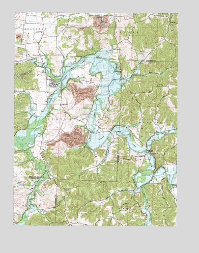
Plainfield, OH USGS Topographic Map
Click on map above to begin viewing in our Map Viewer.

This topographic map contains these locations and features:
Feature Name Type Latitude Longitude GNIS ID View Map
Bacon RunStreamN40.2103°W81.7143°1037569View Map
Banker CemeteryCemeteryN40.1791°W81.6407°1963704View Map
Birds RunPopulated PlaceN40.1690°W81.6473°1064439View Map
Birds RunStreamN40.1690°W81.6504°1038056View Map
Birds Run Methodist Episcopal CemeteryCemeteryN40.1660°W81.6506°1963709View Map
Birds Run Post Office (historical)Post OfficeN40.1695°W81.6471°1988767View Map
Block School (historical)SchoolN40.2323°W81.7318°1050384View Map
Bucker School (historical)SchoolN40.1351°W81.7382°1054504View Map
Carr School (historical)SchoolN40.1615°W81.6840°1050385View Map
Center CreekStreamN40.2173°W81.7262°1038937View Map
Community ChurchChurchN40.1659°W81.6504°1080403View Map
Cooks CornersLocaleN40.1959°W81.7143°1050381View Map
Darrow LakeReservoirN40.1827°W81.6278°1079360View Map
Darrow Lake DamDamN40.1851°W81.6265°1079478View Map
Darrow Pond DamDamN40.1851°W81.6265°1079359View Map
Flat RidgePopulated PlaceN40.1303°W81.6732°1064654View Map
Flat Ridge CemeteryCemeteryN40.1290°W81.6698°1963720View Map
Flat Ridge Post Office (historical)Post OfficeN40.1306°W81.6735°1988925View Map
Forney CemeteryCemeteryN40.1777°W81.6529°1963721View Map
Indian Camp RunStreamN40.1487°W81.6501°1066762View Map
Lake LilaReservoirN40.2156°W81.6726°1080402View Map
Lawyers CornersLocaleN40.1467°W81.7110°1054661View Map
Linton MillsPopulated PlaceN40.1740°W81.6935°1065004View Map
Linton Mills Post Office (historical)Post OfficeN40.1737°W81.6929°1967436View Map
Little Indian School (historical)SchoolN40.1403°W81.6812°1054660View Map
Low GapPopulated PlaceN40.2445°W81.6310°1062860View Map
Low Gap School (historical)SchoolN40.2437°W81.6318°1050390View Map
Marlatt School (historical)SchoolN40.2240°W81.6493°1050389View Map
McCune School (historical)SchoolN40.2303°W81.6721°1050387View Map
Miskimen Family CemeteryCemeteryN40.2069°W81.6852°1964121View Map
Morrison CornersLocaleN40.2481°W81.6743°1050388View Map
North Bend School (historical)SchoolN40.2101°W81.6893°1050386View Map
Peabody Coal Company Pond 0115-011ReservoirN40.1486°W81.7438°1079401View Map
Peabody Coal Company Pond 0115-011 DamDamN40.1484°W81.7432°1079400View Map
PlainfieldPopulated PlaceN40.2095°W81.7196°1061548View Map
Plainfield CemeteryCemeteryN40.2073°W81.7221°1964128View Map
Plainfield CemeteryCemeteryN40.2245°W81.7310°1044516View Map
Plainfield Elementary SchoolSchoolN40.2076°W81.7173°1050383View Map
Plainfield Grange HallBuildingN40.2245°W81.7307°1964129View Map
Plainfield Post OfficePost OfficeN40.2095°W81.7198°1964092View Map
Plainfield United Methodist ChurchChurchN40.2078°W81.7207°1063397View Map
Red Brush School (historical)SchoolN40.1328°W81.6360°1054659View Map
Roahrig HillSummitN40.1778°W81.7132°1050380View Map
Sandbank School (historical)SchoolN40.1734°W81.7285°1050379View Map
Schweitzer CemeteryCemeteryN40.2260°W81.6513°1046033View Map
Stringtown (historical)Populated PlaceN40.1876°W81.7040°1068265View Map
Toledoville (historical)Populated PlaceN40.1623°W81.6465°1054658View Map
Township of LintonCivilN40.1891°W81.7384°1085920View Map
Tri-City AirportAirportN40.2484°W81.7409°1083109View Map
Twomile RunStreamN40.1767°W81.6779°1047254View Map
Union Hill CemeteryCemeteryN40.2071°W81.6418°1047327View Map
Union Hill School (historical)SchoolN40.2073°W81.6443°1054657View Map
Village of PlainfieldCivilN40.2051°W81.7182°2399683View Map
White Eyes CreekStreamN40.1737°W81.7473°1047872View Map
Williams School (historical)SchoolN40.1903°W81.7373°1050382View Map
Windsor Heights Police DepartmentBuildingN40.1925°W81.6611°2727886View Map
Wolf RunStreamN40.1498°W81.6290°1048050View Map
Worthing CemeteryCemeteryN40.1623°W81.6498°1963745View Map

Note: Coordinates in the location and feature list above are referenced to NAD83 datum.


Copyright (C) 2008-2024 Ryan Niemi / Sunset Dynamics ... All Rights Reserved