TopoQuest Logo
Do you find TopoQuest useful?
Help keep TopoQuest running and adding new maps/features by donating!
Bitcoin:  19c7KJd3qBynnjoSw5npx9KScwjBe4ifkT
Litecoin:  LXs6TkuXGGXo1vDsWCkWVdjQX94eUKd6ui
Home View Maps Find Maps Find Places Resources & Links


Worland, Missouri Topographic Map

USGS Map Title: Worland, MO
USGS Map MRC: 38094B5
DRG (GeoTIFF) Download: o38094b5.tif


Neighboring USGS Topographic Map Quads:


  Boicourt, KS  
38094C6
 

  Amoret, MO  
38094C5
 

  Virginia, MO  
38094C4
 

  Pleasanton, KS  
38094B6
 

  Worland, MO  
38094B5
 

  New Home, MO  
38094B4
 

  Prescott, KS  
38094A6
 

  Hume, MO  
38094A5
 

  Sprague, MO  
38094A4


Map MRC Location:

N39°
W95°
N39°
W94°
H8 H7 H6 H5 H4 H3 H2 H1
G8 G7 G6 G5 G4 G3 G2 G1
F8 F7 F6 F5 F4 F3 F2 F1
E8 E7 E6 E5 E4 E3 E2 E1
D8 D7 D6 D5 D4 D3 D2 D1
C8 C7 C6 C5 C4 C3 C2 C1
B8 B7 B6 B5 B4 B3 B2 B1
A8 A7 A6 A5 A4 A3 A2 A1
N38°
W95°
N38°
W94°

Worland, MO USGS 1:24K Topographic Map Preview:
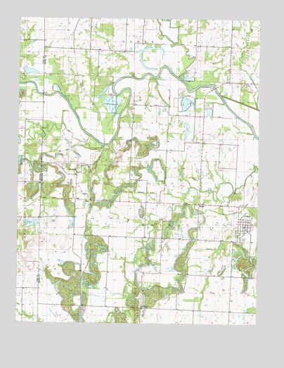
Worland, MO USGS Topographic Map
Click on map above to begin viewing in our Map Viewer.

This topographic map contains these locations and features:
Feature Name Type Latitude Longitude GNIS ID View Map
Cottonwood CreekStreamN38.1400°W94.5683°716358View Map
FosterPopulated PlaceN38.1661°W94.5075°729889View Map
Foster Post OfficePost OfficeN38.1681°W94.5085°2783005View Map
Foster School (historical)SchoolN38.1620°W94.5096°746030View Map
Foster Volunteer Fire DepartmentBuildingN38.1678°W94.5079°2620299View Map
Gillum CreekStreamN38.1792°W94.5127°718458View Map
Greenview School (historical)SchoolN38.1972°W94.5288°748375View Map
Harmonia (historical)LocaleN38.1875°W94.6211°482536View Map
Hays CemeteryCemeteryN38.2481°W94.6241°477938View Map
Independence ChurchChurchN38.1314°W94.5602°720093View Map
Independence School (historical)SchoolN38.1306°W94.5502°748385View Map
Johnson School (historical)SchoolN38.2267°W94.5913°748390View Map
Klondike School (historical)SchoolN38.1306°W94.5150°748394View Map
Marble BridgeBridgeN38.2222°W94.5236°755304View Map
Mine CreekStreamN38.1984°W94.5811°477935View Map
Mokan (historical)LocaleN38.1942°W94.6122°745668View Map
Mount Zion School (historical)SchoolN38.1964°W94.5666°748419View Map
Mulberry CreekStreamN38.2259°W94.5422°723051View Map
Old Walnut School (historical)SchoolN38.1595°W94.5516°748425View Map
Pecan CreekStreamN38.2131°W94.5008°724162View Map
RuckerPopulated PlaceN38.1739°W94.5305°741219View Map
Salem CemeteryCemeteryN38.1597°W94.5088°725922View Map
Standish School (historical)SchoolN38.1320°W94.5875°748458View Map
State Line BridgeBridgeN38.2186°W94.6125°755412View Map
TigerLocaleN38.1753°W94.5877°746462View Map
Township of WalnutCivilN38.1685°W94.5517°766310View Map
Victory School (historical)SchoolN38.2397°W94.5627°748470View Map
Village of FosterCivilN38.1664°W94.5079°2398906View Map
WardLocaleN38.1784°W94.5602°740276View Map
Woofin CemeteryCemeteryN38.1847°W94.5313°729139View Map
WorlandPopulated PlaceN38.1878°W94.5919°729146View Map
Worland School (historical)SchoolN38.1867°W94.5952°746031View Map

Note: Coordinates in the location and feature list above are referenced to NAD83 datum.


Copyright (C) 2008-2025 Ryan Niemi / Sunset Dynamics ... All Rights Reserved