TopoQuest Logo
Do you find TopoQuest useful?
Help keep TopoQuest running and adding new maps/features by donating!
Bitcoin:  19c7KJd3qBynnjoSw5npx9KScwjBe4ifkT
Litecoin:  LXs6TkuXGGXo1vDsWCkWVdjQX94eUKd6ui
Home View Maps Find Maps Find Places Resources & Links


Pocket Prairie, Arkansas Topographic Map

USGS Map Title: Pocket Prairie, AR
USGS Map MRC: 34091G7
DRG (GeoTIFF) Download: o34091g7.tif


Neighboring USGS Topographic Map Quads:


  Oak Grove, AR  
34091H8
 

  Wattensaw, AR  
34091H7
 

  Hickory Plains, AR  
34091H6
 

  Lonoke, AR  
34091G8
 

  Pocket Prairie, AR  
34091G7
 

  Carlisle, AR  
34091G6
 

  Pettus, AR  
34091F8
 

  Culler, AR  
34091F7
 

  Parkers Corner, AR  
34091F6


Map MRC Location:

N35°
W92°
N35°
W91°
H8 H7 H6 H5 H4 H3 H2 H1
G8 G7 G6 G5 G4 G3 G2 G1
F8 F7 F6 F5 F4 F3 F2 F1
E8 E7 E6 E5 E4 E3 E2 E1
D8 D7 D6 D5 D4 D3 D2 D1
C8 C7 C6 C5 C4 C3 C2 C1
B8 B7 B6 B5 B4 B3 B2 B1
A8 A7 A6 A5 A4 A3 A2 A1
N34°
W92°
N34°
W91°

Pocket Prairie, AR USGS 1:24K Topographic Map Preview:
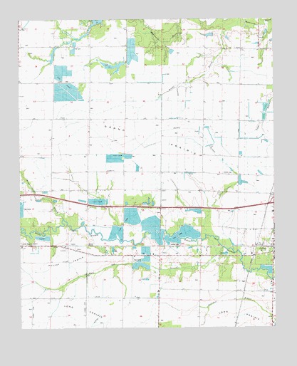
Pocket Prairie, AR USGS Topographic Map
Click on map above to begin viewing in our Map Viewer.

This topographic map contains these locations and features:
Feature Name Type Latitude Longitude GNIS ID View Map
Brooks BranchStreamN34.8720°W91.7737°69543View Map
Brownsville BranchStreamN34.7945°W91.8537°69910View Map
Carlisle CemeteryCemeteryN34.8040°W91.7512°69545View Map
Chambers ChurchChurchN34.8137°W91.8324°69546View Map
Chambers School (historical)SchoolN34.8137°W91.8321°61353View Map
Interchange 183CrossingN34.8004°W91.7504°69913View Map
Marson ClubLocaleN34.8118°W91.7676°69549View Map
Marson School (historical)SchoolN34.8129°W91.7860°61354View Map
McCreanorPopulated PlaceN34.7834°W91.7951°69550View Map
Pocket PrairieFlatN34.7765°W91.8529°69911View Map
Rickey BranchStreamN34.7876°W91.7843°69912View Map
SisemorePopulated PlaceN34.7837°W91.8515°69552View Map
Smith's Strip Airport (historical)AirportN34.7619°W91.8510°83758View Map
Sniders PondReservoirN34.8139°W91.7712°79607View Map
Sniders Pond DamDamN34.8134°W91.7701°79606View Map
Sunset Memorial GardensCemeteryN34.7845°W91.8746°69909View Map
Township of ClevelandCivilN34.8621°W91.8593°68813View Map
Union Grove SchoolLocaleN34.8643°W91.8046°69553View Map
White Oak BranchStreamN34.7809°W91.7774°69554View Map

Note: Coordinates in the location and feature list above are referenced to NAD83 datum.


Copyright (C) 2008-2025 Ryan Niemi / Sunset Dynamics ... All Rights Reserved