TopoQuest Logo
Do you find TopoQuest useful?
Help keep TopoQuest running and adding new maps/features by donating!
Bitcoin:  19c7KJd3qBynnjoSw5npx9KScwjBe4ifkT
Litecoin:  LXs6TkuXGGXo1vDsWCkWVdjQX94eUKd6ui
Home View Maps Find Maps Find Places Resources & Links


Pettus, Arkansas Topographic Map

USGS Map Title: Pettus, AR
USGS Map MRC: 34091F8
DRG (GeoTIFF) Download: o34091f8.tif


Neighboring USGS Topographic Map Quads:


  Jacksonville, AR  
34092G1
 

  Lonoke, AR  
34091G8
 

  Pocket Prairie, AR  
34091G7
 

  Scott, AR  
34092F1
 

  Pettus, AR  
34091F8
 

  Culler, AR  
34091F7
 

  Keo, AR  
34092E1
 

  England, AR  
34091E8
 

  Humnoke, AR  
34091E7


Map MRC Location:

N35°
W92°
N35°
W91°
H8 H7 H6 H5 H4 H3 H2 H1
G8 G7 G6 G5 G4 G3 G2 G1
F8 F7 F6 F5 F4 F3 F2 F1
E8 E7 E6 E5 E4 E3 E2 E1
D8 D7 D6 D5 D4 D3 D2 D1
C8 C7 C6 C5 C4 C3 C2 C1
B8 B7 B6 B5 B4 B3 B2 B1
A8 A7 A6 A5 A4 A3 A2 A1
N34°
W92°
N34°
W91°

Pettus, AR USGS 1:24K Topographic Map Preview:
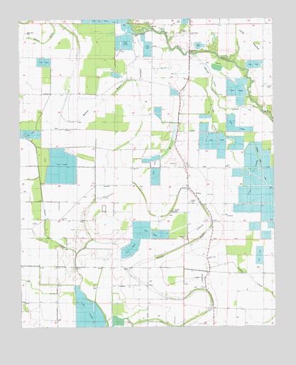
Pettus, AR USGS Topographic Map
Click on map above to begin viewing in our Map Viewer.

This topographic map contains these locations and features:
Feature Name Type Latitude Longitude GNIS ID View Map
Bailey SchoolSchoolN34.7251°W91.9174°46022View Map
Bains Chapel (historical)ChurchN34.6284°W91.9376°61372View Map
Bishops ChapelChurchN34.6490°W91.9465°61177View Map
Brushy SloughGutN34.7204°W91.9046°47095View Map
Caney Creek Baptist ChurchChurchN34.6529°W91.9076°61181View Map
Eagle SchoolSchoolN34.7268°W91.9504°48735View Map
Green Olive CemeteryCemeteryN34.7448°W91.9968°61188View Map
Green Olive ChurchChurchN34.7448°W91.9974°49644View Map
Hanson School (historical)SchoolN34.6265°W91.9376°61373View Map
Litton School (historical)SchoolN34.6873°W91.9588°61374View Map
New Zion ChurchChurchN34.6898°W91.9451°78831View Map
Oak Grove ChurchChurchN34.6690°W91.9807°61197View Map
Oak Grove SchoolSchoolN34.6695°W91.9804°52922View Map
Oldham School (historical)SchoolN34.6515°W91.9082°77917View Map
Oldham School (historical)SchoolN34.6715°W91.9179°81885View Map
PettusPopulated PlaceN34.6773°W91.9126°57155View Map
Saint James ChurchChurchN34.6962°W91.9226°54342View Map
Saint Johns Church (historical)ChurchN34.6687°W91.9082°61376View Map
Steel Bridge Baptist ChurchChurchN34.7434°W91.9165°78454View Map
Sullivan CemeteryCemeteryN34.6720°W91.9243°61204View Map
Township of RichwoodsCivilN34.7052°W91.9326°68832View Map
Township of WallsCivilN34.6671°W91.9841°68835View Map
Union Star Church (historical)ChurchN34.7198°W91.9601°61375View Map
Union Star SchoolSchoolN34.7204°W91.9599°55833View Map
Walker Store (historical)LocaleN34.6334°W91.9051°61377View Map
Weedon CemeteryCemeteryN34.6611°W91.9186°61208View Map

Note: Coordinates in the location and feature list above are referenced to NAD83 datum.


Copyright (C) 2008-2025 Ryan Niemi / Sunset Dynamics ... All Rights Reserved