TopoQuest Logo
Do you find TopoQuest useful?
Help keep TopoQuest running and adding new maps/features by donating!
Bitcoin:  19c7KJd3qBynnjoSw5npx9KScwjBe4ifkT
Litecoin:  LXs6TkuXGGXo1vDsWCkWVdjQX94eUKd6ui
Home View Maps Find Maps Find Places Resources & Links


Culler, Arkansas Topographic Map

USGS Map Title: Culler, AR
USGS Map MRC: 34091F7
DRG (GeoTIFF) Download: o34091f7.tif


Neighboring USGS Topographic Map Quads:


  Lonoke, AR  
34091G8
 

  Pocket Prairie, AR  
34091G7
 

  Carlisle, AR  
34091G6
 

  Pettus, AR  
34091F8
 

  Culler, AR  
34091F7
 

  Parkers Corner, AR  
34091F6
 

  England, AR  
34091E8
 

  Humnoke, AR  
34091E7
 

  Geridge, AR  
34091E6


Map MRC Location:

N35°
W92°
N35°
W91°
H8 H7 H6 H5 H4 H3 H2 H1
G8 G7 G6 G5 G4 G3 G2 G1
F8 F7 F6 F5 F4 F3 F2 F1
E8 E7 E6 E5 E4 E3 E2 E1
D8 D7 D6 D5 D4 D3 D2 D1
C8 C7 C6 C5 C4 C3 C2 C1
B8 B7 B6 B5 B4 B3 B2 B1
A8 A7 A6 A5 A4 A3 A2 A1
N34°
W92°
N34°
W91°

Culler, AR USGS 1:24K Topographic Map Preview:
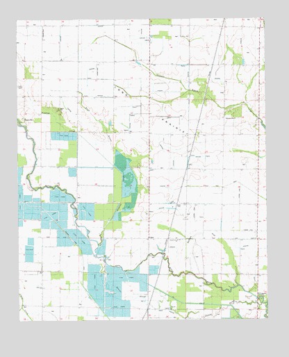
Culler, AR USGS Topographic Map
Click on map above to begin viewing in our Map Viewer.

This topographic map contains these locations and features:
Feature Name Type Latitude Longitude GNIS ID View Map
Bayou MetoPopulated PlaceN34.7087°W91.8715°61176View Map
Bayou Meto ChurchChurchN34.7093°W91.8712°61379View Map
Beechwood School (historical)SchoolN34.6593°W91.8049°76286View Map
Broadview SchoolSchoolN34.7020°W91.7887°46971View Map
Buffalo FlatFlatN34.6612°W91.7826°61180View Map
Caney School (historical)SchoolN34.6306°W91.8649°61378View Map
Cottonwood School (historical)SchoolN34.6340°W91.7821°76685View Map
CullerPopulated PlaceN34.6590°W91.8096°61184View Map
Eagle BranchStreamN34.6898°W91.8271°61185View Map
Fishtrap SloughStreamN34.6570°W91.8346°76928View Map
James BridgeBridgeN34.7023°W91.8704°61380View Map
James SchoolSchoolN34.7090°W91.8721°50582View Map
Legate CemeteryCemeteryN34.7134°W91.8545°61193View Map
Long PrairieFlatN34.6756°W91.7696°77550View Map
Perry BridgeBridgeN34.6501°W91.8318°61381View Map
Pinewood SchoolSchoolN34.6573°W91.7546°53475View Map
Pleasant Grove ChurchChurchN34.6584°W91.7951°53542View Map
Polecat SloughStreamN34.6323°W91.7535°53658View Map
Prairie Longue SchoolSchoolN34.7301°W91.7668°53775View Map
Richwood ChurchChurchN34.6390°W91.8637°61201View Map
Robinson CemeteryCemeteryN34.7084°W91.7657°61202View Map
Roe BridgeBridgeN34.6418°W91.7821°61383View Map
Scotts School (historical)SchoolN34.6923°W91.8093°61382View Map
Shiloh ChurchChurchN34.6590°W91.8182°54791View Map
Township of ScottCivilN34.6955°W91.8085°68833View Map

Note: Coordinates in the location and feature list above are referenced to NAD83 datum.


Copyright (C) 2008-2025 Ryan Niemi / Sunset Dynamics ... All Rights Reserved