TopoQuest Logo
Do you find TopoQuest useful?
Help keep TopoQuest running and adding new maps/features by donating!
Bitcoin:  19c7KJd3qBynnjoSw5npx9KScwjBe4ifkT
Litecoin:  LXs6TkuXGGXo1vDsWCkWVdjQX94eUKd6ui
Home View Maps Find Maps Find Places Resources & Links


New Market, Indiana Topographic Map

USGS Map Title: New Market, IN
USGS Map MRC: 39086H8
DRG (GeoTIFF) Download: o39086h8.tif


Neighboring USGS Topographic Map Quads:


  Waynetown, IN  
40087A1
 

  Crawfordsville, IN  
40086A8
 

  Darlington, IN  
40086A7
 

  Alamo, IN  
39087H1
 

  New Market, IN  
39086H8
 

  Ladoga, IN  
39086H7
 

  Bellmore, IN  
39087G1
 

  Russellville, IN  
39086G8
 

  Roachdale, IN  
39086G7


Map MRC Location:

N40°
W87°
N40°
W86°
H8 H7 H6 H5 H4 H3 H2 H1
G8 G7 G6 G5 G4 G3 G2 G1
F8 F7 F6 F5 F4 F3 F2 F1
E8 E7 E6 E5 E4 E3 E2 E1
D8 D7 D6 D5 D4 D3 D2 D1
C8 C7 C6 C5 C4 C3 C2 C1
B8 B7 B6 B5 B4 B3 B2 B1
A8 A7 A6 A5 A4 A3 A2 A1
N39°
W87°
N39°
W86°

New Market, IN USGS 1:24K Topographic Map Preview:
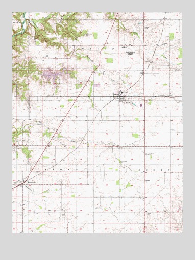
New Market, IN USGS Topographic Map
Click on map above to begin viewing in our Map Viewer.

This topographic map contains these locations and features:
Feature Name Type Latitude Longitude GNIS ID View Map
Browns ValleyPopulated PlaceN39.9031°W86.9920°431643View Map
Coons CemeteryCemeteryN39.9850°W86.9542°432939View Map
Crawfordsville Municipal AirportAirportN39.9805°W86.9168°449134View Map
Finley Chapel CemeteryCemeteryN39.9668°W86.8806°434490View Map
Galey CemeteryCemeteryN39.9879°W86.9463°434924View Map
Holiday Lake DamDamN39.9650°W86.9770°447431View Map
Indian Creek CemeteryCemeteryN39.9239°W86.9279°436752View Map
Indian Creek Hill CemeteryCemeteryN39.9334°W86.9679°436757View Map
Jones CemeteryCemeteryN39.8853°W86.9639°437082View Map
Lake HolidayReservoirN39.9646°W86.9689°446926View Map
Lake HolidayPopulated PlaceN39.9671°W86.9671°2629896View Map
Lake Holiday Census Designated PlaceCensusN39.9642°W86.9607°2629867View Map
LaplandPopulated PlaceN39.9050°W86.9028°437629View Map
Lutheran CemeteryCemeteryN39.9817°W86.8897°438417View Map
Lydick CemeteryCemeteryN39.9030°W86.9971°438422View Map
New MarketPopulated PlaceN39.9525°W86.9214°449700View Map
New Market Elementary SchoolSchoolN39.9556°W86.9208°447345View Map
New Market Volunteer Fire DepartmentBuildingN39.9520°W86.9232°2626215View Map
North UnionPopulated PlaceN39.9656°W86.9033°440302View Map
Offield CreekStreamN39.9953°W86.9808°440514View Map
Old Hickory CemeteryCemeteryN39.9377°W86.9784°440569View Map
Old Pottinger CemeteryCemeteryN39.9156°W86.9206°440583View Map
Parker FieldAirportN39.9724°W86.9972°2717331View Map
Rattlesnake CreekStreamN39.9967°W86.9903°441786View Map
S - W Rescue ServicesBuildingN39.9520°W86.9216°2719333View Map
Town of New MarketCivilN39.9526°W86.9216°2396803View Map
Union ChapelChurchN39.9748°W86.9736°445087View Map
Wasson CemeteryCemeteryN39.9100°W86.9825°445529View Map
Wasson CemeteryCemeteryN39.8857°W86.9012°445530View Map
Weir CemeteryCemeteryN39.9943°W86.9879°445642View Map
Wilhite CemeteryCemeteryN39.9911°W86.9022°446036View Map

Note: Coordinates in the location and feature list above are referenced to NAD83 datum.


Copyright (C) 2008-2025 Ryan Niemi / Sunset Dynamics ... All Rights Reserved