TopoQuest Logo
Do you find TopoQuest useful?
Help keep TopoQuest running and adding new maps/features by donating!
Bitcoin:  19c7KJd3qBynnjoSw5npx9KScwjBe4ifkT
Litecoin:  LXs6TkuXGGXo1vDsWCkWVdjQX94eUKd6ui
Home View Maps Find Maps Find Places Resources & Links


Point Washington, Florida Topographic Map

USGS Map Title: Point Washington, FL
USGS Map MRC: 30086C1
DRG (GeoTIFF) Download: o30086c1.tif


Neighboring USGS Topographic Map Quads:


  Freeport, FL  
30086D2
 

  Bunker, FL  
30086D1


  Grayton Beach, FL  
30086C2
 

  Point Washington, FL  
30086C1


Map MRC Location:

N31°
W87°
N31°
W86°
H8 H7 H6 H5 H4 H3 H2 H1
G8 G7 G6 G5 G4 G3 G2 G1
F8 F7 F6 F5 F4 F3 F2 F1
E8 E7 E6 E5 E4 E3 E2 E1
D8 D7 D6 D5 D4 D3 D2 D1
C8 C7 C6 C5 C4 C3 C2 C1
B8 B7 B6 B5 B4 B3 B2 B1
A8 A7 A6 A5 A4 A3 A2 A1
N30°
W87°
N30°
W86°

Point Washington, FL USGS 1:24K Topographic Map Preview:
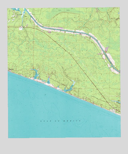
Point Washington, FL USGS Topographic Map
Click on map above to begin viewing in our Map Viewer.

This topographic map contains these locations and features:
Feature Name Type Latitude Longitude GNIS ID View Map
Alys BeachPopulated PlaceN30.2835°W86.0305°2054880View Map
Alys BeachBeachN30.2828°W86.0311°2071613View Map
Bay Elementary SchoolSchoolN30.3671°W86.1188°299358View Map
Camp CreekStreamN30.2963°W86.0686°279885View Map
Camp Creek LakeLakeN30.2983°W86.0547°279893View Map
ChoctawPopulated PlaceN30.3674°W86.1061°295193View Map
Deer LakeLakeN30.3046°W86.0795°281450View Map
Deer Lake State ParkParkN30.3044°W86.0791°1946065View Map
Devils SwampSwampN30.3723°W86.0631°281540View Map
Eastern LakeLakeN30.3105°W86.0930°282040View Map
Inlet BeachPopulated PlaceN30.2769°W86.0080°284551View Map
Ninemile BranchStreamN30.3646°W86.0016°287738View Map
Peach CreekStreamN30.3735°W86.1049°288614View Map
Point WashingtonPopulated PlaceN30.3702°W86.1149°289134View Map
Point WashingtonCapeN30.3738°W86.1199°295054View Map
Point Washington Methodist ChurchChurchN30.3683°W86.1166°301775View Map
Red Fish LakeLakeN30.3419°W86.0966°308461View Map
Rosemary BeachPopulated PlaceN30.2800°W86.0161°1955359View Map
SeacrestPopulated PlaceN30.2874°W86.0418°1955358View Map
South Walton Fire District Station 1BuildingN30.2802°W86.0084°2644039View Map

Note: Coordinates in the location and feature list above are referenced to NAD83 datum.


Copyright (C) 2008-2025 Ryan Niemi / Sunset Dynamics ... All Rights Reserved