TopoQuest Logo
Do you find TopoQuest useful?
Help keep TopoQuest running and adding new maps/features by donating!
Bitcoin:  19c7KJd3qBynnjoSw5npx9KScwjBe4ifkT
Litecoin:  LXs6TkuXGGXo1vDsWCkWVdjQX94eUKd6ui
Home View Maps Find Maps Find Places Resources & Links


Poker Butte, Wyoming Topographic Map

USGS Map Title: Poker Butte, WY
USGS Map MRC: 43106E8
DRG (GeoTIFF) Download: o43106e8.tif


Neighboring USGS Topographic Map Quads:


  Turk Springs, WY  
43107F1
 

  Barnum, WY  
43106F8
 

  Red Fork Powder River, WY  
43106F7
 

  Gordon Creek, WY  
43107E1
 

  Poker Butte, WY  
43106E8
 

  Hole-in-the-Wall, WY  
43106E7
 

  First Water Draw, WY  
43107D1
 

  Roughlock Hill, WY  
43106D8
 

  Willow Creek School, WY  
43106D7


Map MRC Location:

N44°
W107°
N44°
W106°
H8 H7 H6 H5 H4 H3 H2 H1
G8 G7 G6 G5 G4 G3 G2 G1
F8 F7 F6 F5 F4 F3 F2 F1
E8 E7 E6 E5 E4 E3 E2 E1
D8 D7 D6 D5 D4 D3 D2 D1
C8 C7 C6 C5 C4 C3 C2 C1
B8 B7 B6 B5 B4 B3 B2 B1
A8 A7 A6 A5 A4 A3 A2 A1
N43°
W107°
N43°
W106°

Poker Butte, WY USGS 1:24K Topographic Map Preview:
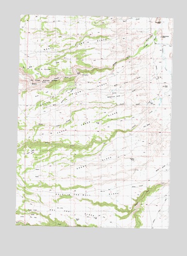
Poker Butte, WY USGS Topographic Map
Click on map above to begin viewing in our Map Viewer.

This topographic map contains these locations and features:
Feature Name Type Latitude Longitude GNIS ID View Map
Bar C RanchLocaleN43.6097°W106.8759°1585104View Map
Bedground DrawValleyN43.5786°W106.9028°1585347View Map
Dry Vee CabinLocaleN43.5044°W106.9456°1587880View Map
Dry Vee SlopeFlatN43.5089°W106.9501°1596814View Map
Dry Vee WindmillLocaleN43.5025°W106.9120°1587881View Map
Eagle Creek ParksFlatN43.5077°W106.9820°1587977View Map
Ghent ParksFlatN43.5302°W106.9803°1588873View Map
Ghent SlopeFlatN43.5380°W106.9239°1588874View Map
Hole-in-the-Wall SlopeFlatN43.5183°W106.9259°1589624View Map
Hole-in-the-Wall WindmillLocaleN43.5219°W106.9145°1589625View Map
Johnson RanchLocaleN43.6211°W106.9378°1590198View Map
North River SlopeFlatN43.6058°W106.9573°1592266View Map
Old Man SpringSpringN43.5419°W106.8942°1592397View Map
Poker Creek ParksFlatN43.5447°W106.9814°1592918View Map
Poker Creek SlopeFlatN43.5580°W106.9476°1592920View Map
South River SlopeFlatN43.5841°W106.9276°1594728View Map
Spangler CabinLocaleN43.5555°W106.8912°1594757View Map
Spring CreekStreamN43.6147°W106.8773°1594842View Map
The MesaSummitN43.5600°W106.8851°1595444View Map
The TrapBendN43.5344°W106.8928°1595478View Map
Wild Horse DrawValleyN43.5908°W106.8764°1596365View Map

Note: Coordinates in the location and feature list above are referenced to NAD83 datum.


Copyright (C) 2008-2024 Ryan Niemi / Sunset Dynamics ... All Rights Reserved