TopoQuest Logo
Do you find TopoQuest useful?
Help keep TopoQuest running and adding new maps/features by donating!
Bitcoin:  19c7KJd3qBynnjoSw5npx9KScwjBe4ifkT
Litecoin:  LXs6TkuXGGXo1vDsWCkWVdjQX94eUKd6ui
Home View Maps Find Maps Find Places Resources & Links


Hole-in-the-Wall, Wyoming Topographic Map

USGS Map Title: Hole-in-the-Wall, WY
USGS Map MRC: 43106E7
DRG (GeoTIFF) Download: o43106e7.tif


Neighboring USGS Topographic Map Quads:


  Barnum, WY  
43106F8
 

  Red Fork Powder River, WY  
43106F7
 

  Kaycee, WY  
43106F6
 

  Poker Butte, WY  
43106E8
 

  Hole-in-the-Wall, WY  
43106E7
 

  TTT Ranch, WY  
43106E6
 

  Roughlock Hill, WY  
43106D8
 

  Willow Creek School, WY  
43106D7
 

  Broken Horn Creek, WY  
43106D6


Map MRC Location:

N44°
W107°
N44°
W106°
H8 H7 H6 H5 H4 H3 H2 H1
G8 G7 G6 G5 G4 G3 G2 G1
F8 F7 F6 F5 F4 F3 F2 F1
E8 E7 E6 E5 E4 E3 E2 E1
D8 D7 D6 D5 D4 D3 D2 D1
C8 C7 C6 C5 C4 C3 C2 C1
B8 B7 B6 B5 B4 B3 B2 B1
A8 A7 A6 A5 A4 A3 A2 A1
N43°
W107°
N43°
W106°

Hole-in-the-Wall, WY USGS 1:24K Topographic Map Preview:
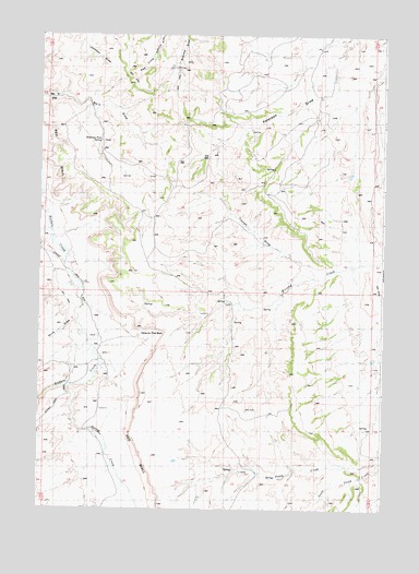
Hole-in-the-Wall, WY USGS Topographic Map
Click on map above to begin viewing in our Map Viewer.

This topographic map contains these locations and features:
Feature Name Type Latitude Longitude GNIS ID View Map
Albert Number 2 DamDamN43.5716°W106.7956°1606498View Map
Albert Number 2 ReservoirReservoirN43.5716°W106.7956°1606499View Map
Bar C DrawValleyN43.6069°W106.8601°1585102View Map
Bar C GapGapN43.6083°W106.8612°1585103View Map
Buffalo CreekStreamN43.5911°W106.8606°1586050View Map
Buffalo CreekStreamN43.6116°W106.8742°1596782View Map
Castle RockSummitN43.6219°W106.8748°1586447View Map
Elmer Rinker HomesteadLocaleN43.6227°W106.7551°1588273View Map
Ghent HomesteadLocaleN43.5655°W106.8531°1588872View Map
Hole-in-the-WallValleyN43.5450°W106.8350°1589623View Map
Keith ReservoirReservoirN43.6002°W106.7834°1590306View Map
Lea DitchCanalN43.6055°W106.8656°1590609View Map
Murphy Creek Area MineMineN43.5514°W106.7687°1726521View Map
North Poker CreekStreamN43.5766°W106.8698°1592247View Map
Peterson Draw MineMineN43.5514°W106.7689°1726523View Map
Poker ButteSummitN43.5839°W106.8670°1592917View Map
Poker CreekStreamN43.5827°W106.8603°1596882View Map
Poker Creek RanchLocaleN43.5766°W106.8717°1592919View Map
Rocky DrawValleyN43.5855°W106.8731°1593597View Map
Shearing Pens SpringSpringN43.5969°W106.8389°1594176View Map
Shirk DrawValleyN43.5494°W106.8464°1594266View Map
Spring CreekStreamN43.5322°W106.8476°1596937View Map
Spring Creek MineMineN43.5236°W106.8459°1726527View Map
Steamboat RockSummitN43.6133°W106.8703°1595013View Map
Taylor SpringSpringN43.6002°W106.7834°1595335View Map
Trough DrawValleyN43.5641°W106.7598°1595713View Map

Note: Coordinates in the location and feature list above are referenced to NAD83 datum.


Copyright (C) 2008-2025 Ryan Niemi / Sunset Dynamics ... All Rights Reserved