TopoQuest Logo
Do you find TopoQuest useful?
Help keep TopoQuest running and adding new maps/features by donating!
Bitcoin:  19c7KJd3qBynnjoSw5npx9KScwjBe4ifkT
Litecoin:  LXs6TkuXGGXo1vDsWCkWVdjQX94eUKd6ui
Home View Maps Find Maps Find Places Resources & Links


Pole Mountain, Utah Topographic Map

USGS Map Title: Pole Mountain, UT
USGS Map MRC: 38112D5
DRG (GeoTIFF) Download: o38112d5.tif


Neighboring USGS Topographic Map Quads:


  Cinder Crater, UT  
38112E6
 

  Cove Fort, UT  
38112E5
 

  Trail Mountain, UT  
38112E4
 

  Gillies Hill, UT  
38112D6
 

  Pole Mountain, UT  
38112D5
 

  Mount Belknap, UT  
38112D4
 

  Beaver, UT  
38112C6
 

  Black Ridge, UT  
38112C5
 

  Shelly Baldy Peak, UT  
38112C4


Map MRC Location:

N39°
W113°
N39°
W112°
H8 H7 H6 H5 H4 H3 H2 H1
G8 G7 G6 G5 G4 G3 G2 G1
F8 F7 F6 F5 F4 F3 F2 F1
E8 E7 E6 E5 E4 E3 E2 E1
D8 D7 D6 D5 D4 D3 D2 D1
C8 C7 C6 C5 C4 C3 C2 C1
B8 B7 B6 B5 B4 B3 B2 B1
A8 A7 A6 A5 A4 A3 A2 A1
N38°
W113°
N38°
W112°

Pole Mountain, UT USGS 1:24K Topographic Map Preview:
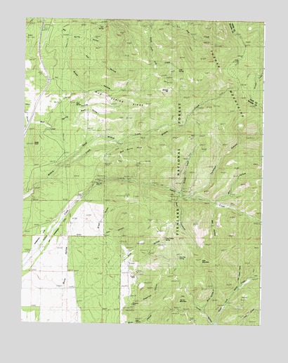
Pole Mountain, UT USGS Topographic Map
Click on map above to begin viewing in our Map Viewer.

This topographic map contains these locations and features:
Feature Name Type Latitude Longitude GNIS ID View Map
Bell SpringSpringN38.4975°W112.5848°1450209View Map
Bell Spring HollowValleyN38.4941°W112.6024°1438581View Map
Birch Spring CreekStreamN38.3764°W112.5233°1438811View Map
Black HollowValleyN38.4583°W112.5977°1438851View Map
Briggs HollowValleyN38.4175°W112.5841°1439106View Map
Brush HollowValleyN38.4897°W112.6058°1439194View Map
Cedar KnollSummitN38.4483°W112.6199°1439577View Map
Cold SpringSpringN38.4792°W112.5453°1439865View Map
Drag HollowValleyN38.3997°W112.5730°1440544View Map
Drag Hollow SpringSpringN38.4102°W112.5508°1448350View Map
Drag Hollow SpringSpringN38.4100°W112.5516°1450208View Map
Glider MineMineN38.3758°W112.5627°1441336View Map
Grassy CreekStreamN38.4289°W112.5433°1441439View Map
Hell CanyonValleyN38.4116°W112.5816°1441669View Map
Indian Creek Grand Station (historical)LocaleN38.4241°W112.5180°1441994View Map
Last Chance HollowValleyN38.3922°W112.5116°1442452View Map
Manderfield DitchCanalN38.4108°W112.6136°1443123View Map
Mill HollowValleyN38.4264°W112.5233°1443453View Map
Mud SpringSpringN38.4643°W112.5983°1448710View Map
Mud Spring RidgeRidgeN38.4647°W112.5605°1443720View Map
North Wildcat CreekStreamN38.4397°W112.6036°1443990View Map
Old Manderfield DitchCanalN38.4050°W112.6124°1444073View Map
Pine Hen SpringSpringN38.4022°W112.5433°1444384View Map
Pole CanyonValleyN38.4266°W112.5444°1444568View Map
Pole MountainSummitN38.4011°W112.5330°1444559View Map
Red Butte HillsRidgeN38.4455°W112.5733°1444769View Map
Rob Roy MineMineN38.4322°W112.5886°1445015View Map
Salt HollowValleyN38.4911°W112.5994°1445284View Map
Sheeprock CanyonValleyN38.3855°W112.5655°1445512View Map
Sheeprock MineMineN38.3816°W112.5677°1445514View Map
Sunday MineMineN38.3950°W112.5660°1446250View Map
Tanner HollowValleyN38.3805°W112.5316°1446332View Map
Tanner MountainSummitN38.3858°W112.5422°1440996View Map
Twitchell CanyonValleyN38.4277°W112.5380°1446814View Map
Wet HollowValleyN38.4233°W112.5241°1447198View Map
White Cliff MineMineN38.4325°W112.5563°1447243View Map
White Cliff Mine (historical)MineN38.4319°W112.5569°1450210View Map
Wittwer HillSummitN38.4714°W112.5497°1447494View Map

Note: Coordinates in the location and feature list above are referenced to NAD83 datum.


Copyright (C) 2008-2025 Ryan Niemi / Sunset Dynamics ... All Rights Reserved