TopoQuest Logo
Do you find TopoQuest useful?
Help keep TopoQuest running and adding new maps/features by donating!
Bitcoin:  19c7KJd3qBynnjoSw5npx9KScwjBe4ifkT
Litecoin:  LXs6TkuXGGXo1vDsWCkWVdjQX94eUKd6ui
Home View Maps Find Maps Find Places Resources & Links


Pollock, Louisiana Topographic Map

USGS Map Title: Pollock, LA
USGS Map MRC: 31092E4
DRG (GeoTIFF) Download: o31092e4.tif


Neighboring USGS Topographic Map Quads:


  Williana, LA  
31092F5
 

  Mudville, LA  
31092F4
 

  Little Creek, LA  
31092F3
 

  Dry Prong, LA  
31092E5
 

  Pollock, LA  
31092E4
 

  Fishville, LA  
31092E3
 

  Rock Hill, LA  
31092D5
 

  Ball, LA  
31092D4
 

  Green Gables, LA  
31092D3


Map MRC Location:

N32°
W93°
N32°
W92°
H8 H7 H6 H5 H4 H3 H2 H1
G8 G7 G6 G5 G4 G3 G2 G1
F8 F7 F6 F5 F4 F3 F2 F1
E8 E7 E6 E5 E4 E3 E2 E1
D8 D7 D6 D5 D4 D3 D2 D1
C8 C7 C6 C5 C4 C3 C2 C1
B8 B7 B6 B5 B4 B3 B2 B1
A8 A7 A6 A5 A4 A3 A2 A1
N31°
W93°
N31°
W92°

Pollock, LA USGS 1:24K Topographic Map Preview:
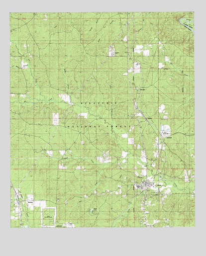
Pollock, LA USGS Topographic Map
Click on map above to begin viewing in our Map Viewer.

This topographic map contains these locations and features:
Feature Name Type Latitude Longitude GNIS ID View Map
AntoniaPopulated PlaceN31.5643°W92.4093°546980View Map
Antonia Lookout TowerTowerN31.6016°W92.4204°558732View Map
Bear BranchStreamN31.5938°W92.4868°547032View Map
BentleyPopulated PlaceN31.5157°W92.4882°547056View Map
Bentley Post OfficePost OfficeN31.5155°W92.4954°1630312View Map
Big Creek Baptist ChurchChurchN31.5499°W92.4515°553638View Map
Big Creek School (historical)SchoolN31.5499°W92.4521°545743View Map
Big Rock ChurchChurchN31.6105°W92.4007°547086View Map
Camp Grant WalkerLocaleN31.5202°W92.3768°553865View Map
Catahoula Lookout TowerTowerN31.5160°W92.4685°558751View Map
Catahoula Ranger District OfficeBuildingN31.5230°W92.4087°548260View Map
Church of God State CampLocaleN31.5641°W92.4182°545754View Map
Dry ProngStreamN31.5743°W92.4757°547327View Map
Dyson CreekStreamN31.5430°W92.4185°547331View Map
FarmlandPopulated PlaceN31.5530°W92.3940°541541View Map
Flem BranchStreamN31.5602°W92.4304°547365View Map
Grant Parish District 5 Volunteer Fire DepartmentBuildingN31.5243°W92.4208°2672794View Map
Guynes CemeteryCemeteryN31.5546°W92.4346°547430View Map
Haw CreekStreamN31.5360°W92.4374°547452View Map
Koins BluffCliffN31.6196°W92.3849°547554View Map
Parish Governing Authority District 7CivilN31.5422°W92.3824°1930188View Map
Pleasant Hill ChurchChurchN31.5035°W92.4110°547858View Map
PollockPopulated PlaceN31.5257°W92.4071°555697View Map
Pollock Baptist ChurchChurchN31.5260°W92.4079°545794View Map
Pollock CemeteryCemeteryN31.5166°W92.3965°547863View Map
Pollock Elementary SchoolSchoolN31.5240°W92.4137°545795View Map
Pollock High School (historical)SchoolN31.5235°W92.4137°545796View Map
Pollock Police DepartmentBuildingN31.5255°W92.4060°2755224View Map
Pollock Post OfficePost OfficeN31.5258°W92.4081°1630343View Map
Sand SpurPopulated PlaceN31.5796°W92.4135°555968View Map
Sandy CreekStreamN31.5271°W92.3951°547964View Map
Socia BranchStreamN31.5713°W92.4549°548007View Map
Stuart LakeReservoirN31.5106°W92.4450°541540View Map
Stuart Lake DamDamN31.5113°W92.4451°556795View Map
Stuart Lake Recreation SiteLocaleN31.5093°W92.4440°548259View Map
Stuart Pine Seed OrchardLocaleN31.5066°W92.4746°556656View Map
Sugar BranchStreamN31.5305°W92.4035°548043View Map

Note: Coordinates in the location and feature list above are referenced to NAD83 datum.


Copyright (C) 2008-2025 Ryan Niemi / Sunset Dynamics ... All Rights Reserved