TopoQuest Logo
Do you find TopoQuest useful?
Help keep TopoQuest running and adding new maps/features by donating!
Bitcoin:  19c7KJd3qBynnjoSw5npx9KScwjBe4ifkT
Litecoin:  LXs6TkuXGGXo1vDsWCkWVdjQX94eUKd6ui
Home View Maps Find Maps Find Places Resources & Links


Fishville, Louisiana Topographic Map

USGS Map Title: Fishville, LA
USGS Map MRC: 31092E3
DRG (GeoTIFF) Download: o31092e3.tif


Neighboring USGS Topographic Map Quads:


  Mudville, LA  
31092F4
 

  Little Creek, LA  
31092F3
 

  Jena West, LA  
31092F2
 

  Pollock, LA  
31092E4
 

  Fishville, LA  
31092E3
 

  Nebo, LA  
31092E2
 

  Ball, LA  
31092D4
 

  Green Gables, LA  
31092D3
 

  Holloway, LA  
31092D2


Map MRC Location:

N32°
W93°
N32°
W92°
H8 H7 H6 H5 H4 H3 H2 H1
G8 G7 G6 G5 G4 G3 G2 G1
F8 F7 F6 F5 F4 F3 F2 F1
E8 E7 E6 E5 E4 E3 E2 E1
D8 D7 D6 D5 D4 D3 D2 D1
C8 C7 C6 C5 C4 C3 C2 C1
B8 B7 B6 B5 B4 B3 B2 B1
A8 A7 A6 A5 A4 A3 A2 A1
N31°
W93°
N31°
W92°

Fishville, LA USGS 1:24K Topographic Map Preview:
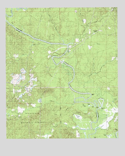
Fishville, LA USGS Topographic Map
Click on map above to begin viewing in our Map Viewer.

This topographic map contains these locations and features:
Feature Name Type Latitude Longitude GNIS ID View Map
Alligator BendBendN31.5418°W92.2801°541547View Map
Alligator BrakeSwampN31.5266°W92.2590°546968View Map
Backbone RidgeRidgeN31.5243°W92.2882°546989View Map
Big BendBendN31.6146°W92.3710°547071View Map
Big BranchStreamN31.6018°W92.2876°547077View Map
Big CreekStreamN31.5349°W92.2979°547079View Map
Blue Hole SloughLakeN31.5255°W92.2857°548271View Map
Blue Hole SloughSwampN31.5270°W92.2864°541545View Map
Camp Mary LeeLocaleN31.5224°W92.3724°545752View Map
Camp WindywoodLocaleN31.5177°W92.3743°545753View Map
Duck LakeLakeN31.5315°W92.2801°547328View Map
Eden Fellowship Volunteer Fire Department Station 2BuildingN31.6034°W92.2797°2673146View Map
FishvillePopulated PlaceN31.5216°W92.3621°554416View Map
Fishville Post Office (historical)Post OfficeN31.5216°W92.3621°1926487View Map
Fool RiverLakeN31.5321°W92.2688°541549View Map
Fool River BendBendN31.5291°W92.2701°541548View Map
Friendship Baptist ChurchChurchN31.5388°W92.3615°554487View Map
Friendship CemeteryCemeteryN31.5382°W92.3618°545767View Map
Goose LakeLakeN31.5314°W92.2823°556522View Map
Gotch BranchStreamN31.5907°W92.3093°547411View Map
Hardwater LakeLakeN31.5161°W92.2908°554656View Map
Hurricane CreekStreamN31.5435°W92.2835°547495View Map
Jena Band of Choctaw Tribal Designated Statistical Area (historical)CensusN31.6129°W92.3278°2418634View Map
Kitterlin BayBayN31.5127°W92.2643°547552View Map
Kitterlin CreekStreamN31.5085°W92.2757°547553View Map
Leckie CemeteryCemeteryN31.5041°W92.3337°548270View Map
Lick Branch Hurricane CreekStreamN31.5591°W92.2812°547581View Map
Lind LakeReservoirN31.5366°W92.3371°541543View Map
Long BrakeSwampN31.5685°W92.3057°541544View Map
Long BranchStreamN31.5321°W92.3021°547625View Map
Lynn Lake DamDamN31.5355°W92.3357°556902View Map
Mack BranchStreamN31.6224°W92.2568°547641View Map
Manistee (historical)Populated PlaceN31.5752°W92.3607°545781View Map
Mill CreekStreamN31.5907°W92.3226°547713View Map
Parish Governing Authority District 8CivilN31.6228°W92.2580°1930239View Map
Pelican PointCapeN31.5274°W92.2760°541546View Map
Thompson FerryLocaleN31.5777°W92.3243°548078View Map
Thompsons Ferry (historical)CrossingN31.5766°W92.3235°545982View Map
Trout CreekStreamN31.5896°W92.3054°548091View Map
Walkers FerryLocaleN31.5091°W92.2501°556348View Map
Whatley CemeteryCemeteryN31.5877°W92.2987°548137View Map
White Sulphur SpringSpringN31.6007°W92.2763°545993View Map
White Sulphur SpringsPopulated PlaceN31.6016°W92.2732°548145View Map

Note: Coordinates in the location and feature list above are referenced to NAD83 datum.


Copyright (C) 2008-2025 Ryan Niemi / Sunset Dynamics ... All Rights Reserved