TopoQuest Logo
Do you find TopoQuest useful?
Help keep TopoQuest running and adding new maps/features by donating!
Bitcoin:  19c7KJd3qBynnjoSw5npx9KScwjBe4ifkT
Litecoin:  LXs6TkuXGGXo1vDsWCkWVdjQX94eUKd6ui
Home View Maps Find Maps Find Places Resources & Links


Wolf Run, Oregon Topographic Map

USGS Map Title: Wolf Run, OR
USGS Map MRC: 45121D3
DRG (GeoTIFF) Download: o45121d3.tif


Neighboring USGS Topographic Map Quads:


  Ketchum Reservoir, OR  
45121E4
 

  Brown Creek, OR  
45121E3
 

  The Dalles South, OR  
45121E2
 

  Fivemile Butte, OR  
45121D4
 

  Wolf Run, OR  
45121D3
 

  Dufur West, OR  
45121D2
 

  Flag Point, OR  
45121C4
 

  Friend, OR  
45121C3
 

  Postage Stamp Butte, OR  
45121C2


Map MRC Location:

N46°
W122°
N46°
W121°
H8 H7 H6 H5 H4 H3 H2 H1
G8 G7 G6 G5 G4 G3 G2 G1
F8 F7 F6 F5 F4 F3 F2 F1
E8 E7 E6 E5 E4 E3 E2 E1
D8 D7 D6 D5 D4 D3 D2 D1
C8 C7 C6 C5 C4 C3 C2 C1
B8 B7 B6 B5 B4 B3 B2 B1
A8 A7 A6 A5 A4 A3 A2 A1
N45°
W122°
N45°
W121°

Wolf Run, OR USGS 1:24K Topographic Map Preview:
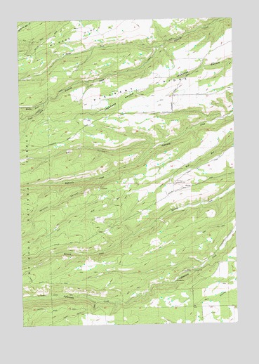
Wolf Run, OR USGS Topographic Map
Click on map above to begin viewing in our Map Viewer.

This topographic map contains these locations and features:
Feature Name Type Latitude Longitude GNIS ID View Map
Dufur City ReservoirReservoirN45.3960°W121.2781°1141379View Map
Hesslan CanyonValleyN45.4362°W121.3245°1143520View Map
Kelly CisternReservoirN45.4887°W121.3331°1153319View Map
Liechti Pond Number OneLakeN45.4921°W121.3529°1153318View Map
Lyda Ranch Airstrip (historical)AirportN45.3894°W121.2797°2646044View Map
Marvel ReservoirReservoirN45.3804°W121.2826°1153317View Map
Middle Fork Fivemile CreekStreamN45.4660°W121.3617°1146145View Map
North Fork Fivemile CreekStreamN45.4882°W121.2940°1146954View Map
Orchard Ridge DitchCanalN45.3901°W121.2901°1157088View Map
Pleasant RidgeRidgeN45.4748°W121.3004°1147800View Map
Pleasant Ridge School (historical)SchoolN45.4832°W121.2734°1162073View Map
Rail HollowValleyN45.4485°W121.2978°1148159View Map
South Fork Fivemile CreekStreamN45.4660°W121.3615°1149971View Map
Spring GulchValleyN45.4315°W121.2948°1153316View Map
Tamarack CreekStreamN45.4335°W121.3303°1153315View Map
Tamarack SpringsSpringN45.4204°W121.3465°1158644View Map
Taylor Post Office (historical)Post OfficeN45.4001°W121.2706°1164714View Map
Taylorville (historical)LocaleN45.3998°W121.2706°1153189View Map
Wolf RunLocaleN45.4346°W121.2845°1153314View Map
Wolf Run Community HallBuildingN45.4335°W121.2867°1152601View Map
Wolf Run DitchCanalN45.4165°W121.3465°1152602View Map

Note: Coordinates in the location and feature list above are referenced to NAD83 datum.


Copyright (C) 2008-2025 Ryan Niemi / Sunset Dynamics ... All Rights Reserved