TopoQuest Logo
Do you find TopoQuest useful?
Help keep TopoQuest running and adding new maps/features by donating!
Bitcoin:  19c7KJd3qBynnjoSw5npx9KScwjBe4ifkT
Litecoin:  LXs6TkuXGGXo1vDsWCkWVdjQX94eUKd6ui
Home View Maps Find Maps Find Places Resources & Links


Stanley, New York Topographic Map

USGS Map Title: Stanley, NY
USGS Map MRC: 42077G1
DRG (GeoTIFF) Download: o42077g1.tif


Neighboring USGS Topographic Map Quads:


  Clifton Springs, NY  
42077H2
 

  Phelps, NY  
42077H1
 

  Geneva North, NY  
42076H8
 

  Rushville, NY  
42077G2
 

  Stanley, NY  
42077G1
 

  Geneva South, NY  
42076G8
 

  Potter, NY  
42077F2
 

  Penn Yan, NY  
42077F1
 

  Dresden, NY  
42076F8


Map MRC Location:

N43°
W78°
N43°
W77°
H8 H7 H6 H5 H4 H3 H2 H1
G8 G7 G6 G5 G4 G3 G2 G1
F8 F7 F6 F5 F4 F3 F2 F1
E8 E7 E6 E5 E4 E3 E2 E1
D8 D7 D6 D5 D4 D3 D2 D1
C8 C7 C6 C5 C4 C3 C2 C1
B8 B7 B6 B5 B4 B3 B2 B1
A8 A7 A6 A5 A4 A3 A2 A1
N42°
W78°
N42°
W77°

Stanley, NY USGS 1:24K Topographic Map Preview:
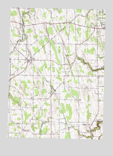
Stanley, NY USGS Topographic Map
Click on map above to begin viewing in our Map Viewer.

This topographic map contains these locations and features:
Feature Name Type Latitude Longitude GNIS ID View Map
Amberg Wine CellarsLocaleN42.8608°W77.1000°2559135View Map
Barnes CemeteryCemeteryN42.7681°W77.0030°943038View Map
BellonaPopulated PlaceN42.7570°W77.0147°943621View Map
Bellona CemeteryCemeteryN42.7587°W77.0194°2514508View Map
Bellona Fire DistrictBuildingN42.7578°W77.0155°2701206View Map
Bellona Post OfficePost OfficeN42.7570°W77.0147°2617812View Map
Billsboro CornersPopulated PlaceN42.8106°W77.0077°943982View Map
Brookside CemeteryCemeteryN42.8186°W77.0049°944870View Map
Burrell CreekStreamN42.8298°W77.0500°945283View Map
Crozier HillSummitN42.8409°W77.0547°947858View Map
Ferguson CornersLocaleN42.7576°W77.1044°949980View Map
FlintPopulated PlaceN42.8578°W77.1061°950284View Map
HallPopulated PlaceN42.7940°W77.0664°952044View Map
Hall Census Designated PlaceCensusN42.7965°W77.0680°2628166View Map
Hall Fire DepartmentBuildingN42.7897°W77.0698°2701016View Map
Hall Post OfficePost OfficeN42.7922°W77.0685°2617953View Map
Hansen Farms Landing Strip (historical)AirportN42.8217°W77.0866°978322View Map
Lawnhurst FarmsLocaleN42.7978°W77.0358°2558868View Map
Lenox ParkPopulated PlaceN42.8578°W77.0144°955202View Map
Little ChurchChurchN42.7878°W77.0933°955490View Map
Little Church CemeteryCemeteryN42.7880°W77.0932°2542301View Map
Locust HillSummitN42.7778°W77.0830°955799View Map
Mc Bride's AirportAirportN42.8532°W77.1246°978040View Map
New Number Nine CemeteryCemeteryN42.8141°W77.0505°2542303View Map
Old Number 9 ChurchChurchN42.8145°W77.0516°959297View Map
Old Number Nine CemeteryCemeteryN42.8145°W77.0520°2542302View Map
Ontario County LandfillLocaleN42.8549°W77.0819°2668659View Map
Red Jacket OrchardsLocaleN42.8561°W77.0236°2559142View Map
Saint Theresa CemeteryCemeteryN42.8330°W77.1009°964235View Map
Sand Hill CemeteryCemeteryN42.8597°W77.0727°964375View Map
School Number 10 (historical)SchoolN42.7565°W77.1022°974947View Map
School Number 12 (historical)SchoolN42.7934°W77.0686°975033View Map
School Number 2 (historical)SchoolN42.8600°W77.1122°2364585View Map
School Number 3 (historical)SchoolN42.7873°W77.0064°975266View Map
School Number 4 (historical)SchoolN42.7578°W77.0155°975344View Map
School Number 4 (historical)SchoolN42.8573°W77.0005°975356View Map
School Number 5 (historical)SchoolN42.7878°W77.0316°975419View Map
School Number 5 (historical)SchoolN42.8103°W77.0075°975422View Map
School Number 7 (historical)SchoolN42.8567°W77.0169°2364586View Map
School Number 7 (historical)SchoolN42.8603°W77.0728°2364587View Map
School Number 9 (historical)SchoolN42.8215°W77.0519°975641View Map
StanleyPopulated PlaceN42.8251°W77.0958°966220View Map
Stanley Fire DepartmentBuildingN42.8253°W77.0924°2701275View Map
Stanley Post OfficePost OfficeN42.8252°W77.0964°2618140View Map
Stape Field (historical)AirportN42.8142°W77.0630°978034View Map
Tomion FarmsLocaleN42.7567°W77.1097°2547281View Map
Town of SenecaCivilN42.8331°W77.0736°979480View Map
V And W FarmsLocaleN42.7694°W77.0119°2558874View Map
WECQ-FM (Geneva)TowerN42.8603°W77.0161°978518View Map
WGVA-AM (Geneva)TowerN42.8603°W77.0161°978429View Map

Note: Coordinates in the location and feature list above are referenced to NAD83 datum.


Copyright (C) 2008-2025 Ryan Niemi / Sunset Dynamics ... All Rights Reserved