TopoQuest Logo
Do you find TopoQuest useful?
Help keep TopoQuest running and adding new maps/features by donating!
Bitcoin:  19c7KJd3qBynnjoSw5npx9KScwjBe4ifkT
Litecoin:  LXs6TkuXGGXo1vDsWCkWVdjQX94eUKd6ui
Home View Maps Find Maps Find Places Resources & Links


Powell, Wisconsin Topographic Map

USGS Map Title: Powell, WI
USGS Map MRC: 46089A8
DRG (GeoTIFF) Download: o46089a8.tif


Neighboring USGS Topographic Map Quads:


  Mercer, WI  
46090B1
 

  Winchester, WI  
46089B8
 

  Papoose Lake, WI  
46089B7
 

  Wilson Lake, WI  
46090A1
 

  Powell, WI  
46089A8
 

  Manitowish Lake, WI  
46089A7
 

  Pike Lake, WI  
45090H1
 

  Lac du Flambeau, WI  
45089H8
 

  Fence Lake, WI  
45089H7


Map MRC Location:

N47°
W90°
N47°
W89°
H8 H7 H6 H5 H4 H3 H2 H1
G8 G7 G6 G5 G4 G3 G2 G1
F8 F7 F6 F5 F4 F3 F2 F1
E8 E7 E6 E5 E4 E3 E2 E1
D8 D7 D6 D5 D4 D3 D2 D1
C8 C7 C6 C5 C4 C3 C2 C1
B8 B7 B6 B5 B4 B3 B2 B1
A8 A7 A6 A5 A4 A3 A2 A1
N46°
W90°
N46°
W89°

Powell, WI USGS 1:24K Topographic Map Preview:
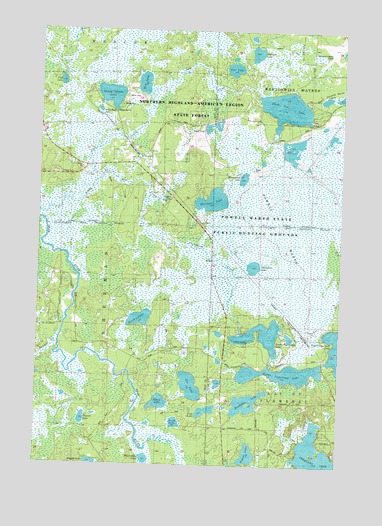
Powell, WI USGS Topographic Map
Click on map above to begin viewing in our Map Viewer.

This topographic map contains these locations and features:
Feature Name Type Latitude Longitude GNIS ID View Map
Birch LakeLakeN46.0420°W89.9576°1561812View Map
Black LakeLakeN46.0179°W89.9491°1561870View Map
Chewelah LakeLakeN46.0572°W89.9111°1562998View Map
Cub LakeLakeN46.1100°W89.9914°1563605View Map
Dead Pike LakeLakeN46.1029°W89.8989°1563776View Map
Deerfoot LakeLakeN46.1186°W89.9115°1563864View Map
Doud LakeLakeN46.0122°W89.9422°1564078View Map
Fat LakeLakeN46.0228°W89.9362°1564878View Map
Grey LakeLakeN46.0161°W89.9296°1565897View Map
Homestead LakeLakeN46.0826°W89.9159°1566642View Map
Little Bear LakeLakeN46.1019°W89.9759°1568193View Map
Lost CreekStreamN46.0822°W89.9774°1568645View Map
Lower Sugarbush LakeLakeN46.0376°W89.9070°1568757View Map
Manitowish Waters AirportAirportN46.1216°W89.8799°1582058View Map
Manitowish Waters Fire DepartmentBuildingN46.1248°W89.8767°2696804View Map
Middle Sugarbush LakeLakeN46.0266°W89.8984°1569438View Map
Mud LakeLakeN46.1096°W89.9577°1569980View Map
Munnomin LakeLakeN46.0016°W89.9544°1570032View Map
Muskesin LakeLakeN46.0181°W89.9130°1570068View Map
Negani LakeLakeN46.0002°W89.9764°1579993View Map
Pier LakeLakeN46.1140°W89.9207°1571347View Map
PowellPopulated PlaceN46.0886°W89.9585°1571852View Map
Powell MarshSwampN46.0641°W89.8802°1571855View Map
Powell Marsh State Public Hunting GroundsParkN46.0666°W89.8765°1833718View Map
Randall CreekStreamN46.0352°W89.9913°1572057View Map
Sandy Beach LakeLakeN46.1061°W89.9713°1573718View Map
Sherman LakeLakeN46.0761°W89.9285°1574029View Map
Signal LakeLakeN46.0032°W89.9119°1574093View Map
Stepping Stone Lake Number 2LakeN46.1062°W89.8754°2777586View Map
Stepping Stone Lake Number 3LakeN46.1055°W89.8823°2777587View Map
Sugarbush CreekStreamN46.0777°W89.9552°1575031View Map
Sugarbush FlowageReservoirN46.0635°W89.9459°2772186View Map
Thomas LakeLakeN46.0130°W89.9807°1575373View Map
Three Stepping Stones LakesLakeN46.1062°W89.8754°1575413View Map
Upper Sugarbush LakeLakeN46.0336°W89.8764°1575995View Map

Note: Coordinates in the location and feature list above are referenced to NAD83 datum.


Copyright (C) 2008-2025 Ryan Niemi / Sunset Dynamics ... All Rights Reserved