TopoQuest Logo
Do you find TopoQuest useful?
Help keep TopoQuest running and adding new maps/features by donating!
Bitcoin:  19c7KJd3qBynnjoSw5npx9KScwjBe4ifkT
Litecoin:  LXs6TkuXGGXo1vDsWCkWVdjQX94eUKd6ui
Home View Maps Find Maps Find Places Resources & Links


Powers, Oregon Topographic Map

USGS Map Title: Powers, OR
USGS Map MRC: 42124H1
DRG (GeoTIFF) Download: o42124h1.tif


Neighboring USGS Topographic Map Quads:


  Myrtle Point, OR  
43124A2
 

  Bridge, OR  
43124A1
 

  Remote, OR  
43123A8
 

  Dement Creek, OR  
42124H2
 

  Powers, OR  
42124H1
 

  Rasler Creek, OR  
42123H8
 

  Barklow Mountain, OR  
42124G2
 

  China Flat, OR  
42124G1
 

  Eden Valley, OR  
42123G8


Map MRC Location:

N43°
W125°
N43°
W124°
H8 H7 H6 H5 H4 H3 H2 H1
G8 G7 G6 G5 G4 G3 G2 G1
F8 F7 F6 F5 F4 F3 F2 F1
E8 E7 E6 E5 E4 E3 E2 E1
D8 D7 D6 D5 D4 D3 D2 D1
C8 C7 C6 C5 C4 C3 C2 C1
B8 B7 B6 B5 B4 B3 B2 B1
A8 A7 A6 A5 A4 A3 A2 A1
N42°
W125°
N42°
W124°

Powers, OR USGS 1:24K Topographic Map Preview:
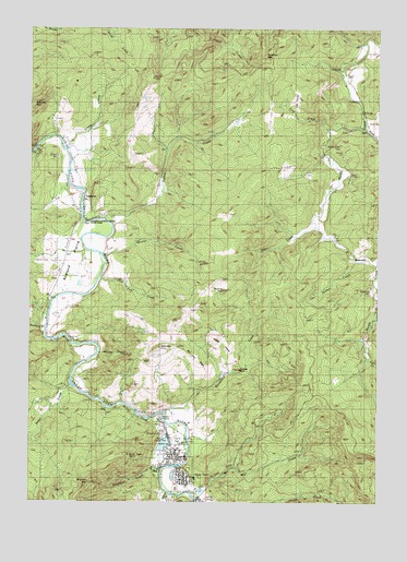
Powers, OR USGS Topographic Map
Click on map above to begin viewing in our Map Viewer.

This topographic map contains these locations and features:
Feature Name Type Latitude Longitude GNIS ID View Map
Baker CreekStreamN42.9054°W124.1104°1137428View Map
Baker Creek Boat RampLocaleN42.9064°W124.1112°2668273View Map
BancroftPopulated PlaceN42.9396°W124.0070°1137495View Map
Bancroft Post Office (historical)Post OfficeN42.9396°W124.0070°1164877View Map
Beaver CreekStreamN42.9398°W124.0998°1137802View Map
Beaver Creek Boat RampLocaleN42.9398°W124.1002°2668528View Map
Ben Grant RidgeRidgeN42.9129°W124.0665°1135674View Map
Bicentennial ParkParkN42.8814°W124.0700°2070841View Map
Bingham CreekStreamN42.8837°W124.0782°1138133View Map
Bingham MountainSummitN42.8810°W124.1032°1138136View Map
Byerle (historical)LocaleN42.9232°W124.1220°1139090View Map
Carman (historical)LocaleN42.9559°W124.1123°1166267View Map
China CreekStreamN42.8971°W124.0845°1154481View Map
City of PowersCivilN42.8859°W124.0734°2411482View Map
Coal CreekStreamN42.9737°W124.0170°1135670View Map
Colby (historical)LocaleN42.9657°W124.1154°1166268View Map
Cole CreekStreamN42.9373°W124.0029°1139978View Map
Coos Bay Timber Company DamDamN42.8898°W124.0779°1155542View Map
Coquille Myrtle Grove State ParkParkN42.9623°W124.1068°1154486View Map
Coquille Myrtle Grove State Park Boat RampLocaleN42.9581°W124.1109°2668529View Map
Etelka (historical)Populated PlaceN42.9623°W124.1095°1154488View Map
Etelka Post Office (historical)Post OfficeN42.9623°W124.1095°1165227View Map
Etelka School (historical)SchoolN42.9507°W124.1012°1141902View Map
Fensler (historical)LocaleN42.9082°W124.1123°1638031View Map
Fort Rowland (historical)LocaleN42.9359°W124.1170°1851686View Map
GaylordPopulated PlaceN42.9554°W124.1068°1142595View Map
Gaylord Post Office (historical)Post OfficeN42.9554°W124.1068°1165299View Map
Gaylord SidingLocaleN42.9346°W124.1154°1166654View Map
Grants CreekStreamN42.9693°W124.1137°1154487View Map
Hazel M Lewis Memorial LibraryBuildingN42.8817°W124.0706°2661236View Map
Hood MountainSummitN42.9151°W124.0793°1143704View Map
Hooker CreekStreamN42.9387°W124.0093°1135671View Map
King Street ParkParkN42.8919°W124.0739°2070842View Map
Long Tom CreekStreamN42.9343°W124.1009°1145451View Map
Mill CreekStreamN42.8757°W124.0643°1146222View Map
Morris CreekStreamN42.8929°W124.0776°1154482View Map
Myrtle Creek CemeteryCemeteryN42.9692°W124.0150°1156890View Map
Myrtlewood CampgroundLocaleN42.9876°W124.0154°1146718View Map
Mystic CreekStreamN42.8998°W124.1040°1154480View Map
Neal CemeteryCemeteryN42.9756°W124.1148°1156893View Map
PowersPopulated PlaceN42.8834°W124.0732°1147970View Map
Powers CemeteryCemeteryN42.8952°W124.0782°1154479View Map
Powers City HallBuildingN42.8817°W124.0707°2661384View Map
Powers County ParkParkN42.8929°W124.0782°1160700View Map
Powers Elementary SchoolSchoolN42.8807°W124.0681°2416182View Map
Powers High SchoolSchoolN42.8812°W124.0664°2416183View Map
Powers Municipal CourtBuildingN42.8817°W124.0707°2661324View Map
Powers Police DepartmentBuildingN42.8809°W124.0719°2737681View Map
Powers PondReservoirN42.8902°W124.0778°1154483View Map
Powers Post OfficePost OfficeN42.8824°W124.0714°1165814View Map
Powers Public WorksBuildingN42.8817°W124.0707°2661520View Map
Powers Ranger StationBuildingN42.8968°W124.0784°1875810View Map
Powers Sewage Treatment PlantLocaleN42.8885°W124.0693°2660731View Map
Powers Volunteer Fire and AmbulanceBuildingN42.8818°W124.0706°2576604View Map
Powers Water Treatment PlantLocaleN42.8769°W124.0646°2660749View Map
Pyramid RockSummitN42.9307°W124.0569°1135673View Map
Regal (historical)LocaleN42.9490°W124.1093°1166282View Map
Rock CreekStreamN42.9734°W124.0057°1148592View Map
Rowland CreekStreamN42.9204°W124.1198°1148813View Map
Rowland PrairieAreaN42.9332°W124.1137°1154485View Map
Salmon CreekStreamN42.8773°W124.0760°1148974View Map
Samison MountainSummitN42.9925°W124.0423°1149012View Map
Snow CreekStreamN42.9123°W124.0045°1149810View Map
Suicide RockSummitN42.9101°W124.0507°1135672View Map
Sunshine (historical)LocaleN42.9365°W124.1151°1166284View Map
Taft PrairieAreaN42.9818°W124.0312°1135669View Map
Warner GraveCemeteryN42.9331°W124.1178°1156891View Map
Waterman CemeteryCemeteryN42.9310°W124.0034°1156894View Map
Whisky CreekStreamN42.9143°W124.1007°1152199View Map
Whoorey MountainSummitN42.9804°W124.1243°1157877View Map
Wilson PrairieAreaN42.9179°W124.0568°1135675View Map
Wise CemeteryCemeteryN42.9243°W124.1173°1156892View Map
Woodward CreekStreamN42.8987°W124.0773°1152645View Map
Yellow CreekStreamN42.9490°W124.0987°1152705View Map

Note: Coordinates in the location and feature list above are referenced to NAD83 datum.


Copyright (C) 2008-2024 Ryan Niemi / Sunset Dynamics ... All Rights Reserved