TopoQuest Logo
Do you find TopoQuest useful?
Help keep TopoQuest running and adding new maps/features by donating!
Bitcoin:  19c7KJd3qBynnjoSw5npx9KScwjBe4ifkT
Litecoin:  LXs6TkuXGGXo1vDsWCkWVdjQX94eUKd6ui
Home View Maps Find Maps Find Places Resources & Links


Egypt, Mississippi Topographic Map

USGS Map Title: Egypt, MS
USGS Map MRC: 33088H6
DRG (GeoTIFF) Download: o33088h6.tif


Neighboring USGS Topographic Map Quads:


  Troy SE, MS  
34088A7
 

  Shannon, MS  
34088A6
 

  Nettleton, MS  
34088A5
 

  Buena Vista, MS  
33088H7
 

  Egypt, MS  
33088H6
 

  Wren, MS  
33088H5
 

  Trebloc, MS  
33088G7
 

  Prairie, MS  
33088G6
 

  Aberdeen, MS  
33088G5


Map MRC Location:

N34°
W89°
N34°
W88°
H8 H7 H6 H5 H4 H3 H2 H1
G8 G7 G6 G5 G4 G3 G2 G1
F8 F7 F6 F5 F4 F3 F2 F1
E8 E7 E6 E5 E4 E3 E2 E1
D8 D7 D6 D5 D4 D3 D2 D1
C8 C7 C6 C5 C4 C3 C2 C1
B8 B7 B6 B5 B4 B3 B2 B1
A8 A7 A6 A5 A4 A3 A2 A1
N33°
W89°
N33°
W88°

Egypt, MS USGS 1:24K Topographic Map Preview:
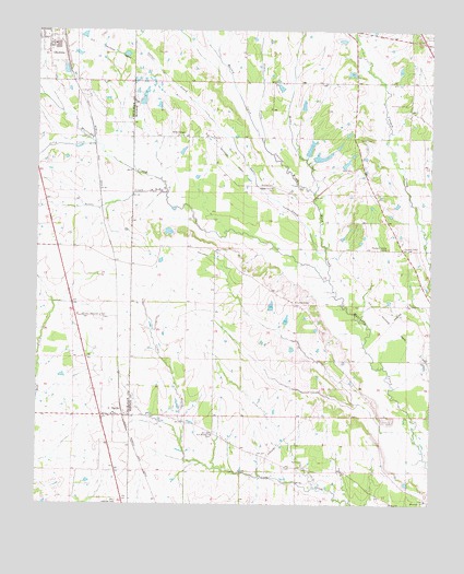
Egypt, MS USGS Topographic Map
Click on map above to begin viewing in our Map Viewer.

This topographic map contains these locations and features:
Feature Name Type Latitude Longitude GNIS ID View Map
Baker CemeteryCemeteryN33.9715°W88.6445°666469View Map
Black BeltAreaN33.9168°W88.6667°690085View Map
Chapel Grove Baptist ChurchChurchN33.9587°W88.6770°668314View Map
Church of God in ChristChurchN33.8782°W88.7223°710269View Map
Darden Chapel Baptist ChurchChurchN33.9723°W88.7059°669110View Map
EgyptPopulated PlaceN33.8984°W88.7298°669700View Map
Egypt Baptist ChurchChurchN33.8987°W88.7259°710280View Map
Egypt Hedgerow College (historical)SchoolN33.8982°W88.7317°710281View Map
Egypt High School (historical)SchoolN33.8990°W88.7253°710282View Map
Egypt Mennonite SchoolSchoolN33.8776°W88.7223°710283View Map
Egypt United Methodist ChurchChurchN33.8987°W88.7245°710285View Map
Goose Pond (historical)Populated PlaceN33.8807°W88.7203°709340View Map
Hales Lake DamDamN33.9651°W88.6617°682419View Map
Johnson CreekStreamN33.9573°W88.6634°671937View Map
Jolly CreekStreamN33.9701°W88.7320°693632View Map
Leftwich SchoolSchoolN33.9287°W88.6681°711606View Map
Leuth Flying Service Airport (historical)AirportN33.9237°W88.7306°680413View Map
Little CreekStreamN33.9573°W88.7100°672588View Map
Massey CreekStreamN33.9704°W88.6800°673230View Map
Mennonite SchoolSchoolN33.8762°W88.6264°673478View Map
Miller CreekStreamN33.9573°W88.6631°673642View Map
New Hebron Missionary Baptist ChurchChurchN33.8934°W88.6939°674645View Map
Old Union CemeteryCemeteryN33.9807°W88.6337°675270View Map
Pleasant Valley CemeteryCemeteryN33.9426°W88.6384°676129View Map
Pleasant Valley ChurchChurchN33.9429°W88.6339°676146View Map
Sadler CreekStreamN33.9348°W88.6584°676997View Map
Sloan CreekStreamN33.9704°W88.6800°677883View Map
Union Presbyterian ChurchChurchN33.9804°W88.6334°687475View Map
Walker CemeteryCemeteryN33.9593°W88.6798°679265View Map
Ware Hill CemeteryCemeteryN33.8973°W88.6364°679345View Map
Word CemeteryCemeteryN33.9632°W88.6509°679878View Map
Word CreekStreamN33.9343°W88.6575°679879View Map

Note: Coordinates in the location and feature list above are referenced to NAD83 datum.


Copyright (C) 2008-2025 Ryan Niemi / Sunset Dynamics ... All Rights Reserved