TopoQuest Logo
Do you find TopoQuest useful?
Help keep TopoQuest running and adding new maps/features by donating!
Bitcoin:  19c7KJd3qBynnjoSw5npx9KScwjBe4ifkT
Litecoin:  LXs6TkuXGGXo1vDsWCkWVdjQX94eUKd6ui
Home View Maps Find Maps Find Places Resources & Links


Butler East, Georgia Topographic Map

USGS Map Title: Butler East, GA
USGS Map MRC: 32084E2
DRG (GeoTIFF) Download: o32084e2.tif


Neighboring USGS Topographic Map Quads:


  Prattsburg, GA  
32084F3
 

  Fickling Mill, GA  
32084F2
 

  Roberta, GA  
32084F1
 

  Butler West, GA  
32084E3
 

  Butler East, GA  
32084E2
 

  Reynolds, GA  
32084E1
 

  Rupert, GA  
32084D3
 

  Ideal North, GA  
32084D2
 

  Garden Valley, GA  
32084D1


Map MRC Location:

N33°
W85°
N33°
W84°
H8 H7 H6 H5 H4 H3 H2 H1
G8 G7 G6 G5 G4 G3 G2 G1
F8 F7 F6 F5 F4 F3 F2 F1
E8 E7 E6 E5 E4 E3 E2 E1
D8 D7 D6 D5 D4 D3 D2 D1
C8 C7 C6 C5 C4 C3 C2 C1
B8 B7 B6 B5 B4 B3 B2 B1
A8 A7 A6 A5 A4 A3 A2 A1
N32°
W85°
N32°
W84°

Butler East, GA USGS 1:24K Topographic Map Preview:
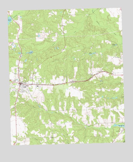
Butler East, GA USGS Topographic Map
Click on map above to begin viewing in our Map Viewer.

This topographic map contains these locations and features:
Feature Name Type Latitude Longitude GNIS ID View Map
Beaver CreekStreamN32.6188°W84.1538°310982View Map
Bethel CemeteryCemeteryN32.5363°W84.2466°344134View Map
Bethel ChurchChurchN32.5360°W84.2457°311176View Map
ButlerPopulated PlaceN32.5571°W84.2382°312093View Map
Butler DivisionCivilN32.5383°W84.2487°1936145View Map
Butler Emergency Medical ServicesBuildingN32.5567°W84.2361°2625466View Map
Butler Municipal AirportAirportN32.5674°W84.2452°351699View Map
Butler Police DepartmentBuildingN32.5562°W84.2393°2733551View Map
Church of GodChurchN32.5090°W84.1285°344138View Map
City of ButlerCivilN32.5570°W84.2377°2403960View Map
Garant LakeReservoirN32.6012°W84.2165°337395View Map
Garant Lake DamDamN32.6001°W84.2166°337394View Map
Hinton LakeReservoirN32.5785°W84.2313°340440View Map
Hinton Lake DamDamN32.5801°W84.2299°340439View Map
Hortmans PondReservoirN32.5860°W84.2257°340442View Map
Hortmans Pond DamDamN32.5868°W84.2232°340441View Map
McCants MillpondReservoirN32.6155°W84.2497°317855View Map
Minors MillpondReservoirN32.5908°W84.1320°318320View Map
Mount Pisgah CemeteryCemeteryN32.5071°W84.2060°344147View Map
Mount Pisgah ChurchChurchN32.5071°W84.2046°318812View Map
New Prospect CemeteryCemeteryN32.5793°W84.1288°344150View Map
New Prospect ChurchChurchN32.5790°W84.1288°319503View Map
New Providence ChurchChurchN32.5635°W84.1582°319512View Map
PanhandlePopulated PlaceN32.5579°W84.1816°326449View Map
Suggs MillpondReservoirN32.5831°W84.1583°323727View Map
Taylor County CourthouseBuildingN32.5571°W84.2374°344157View Map
Taylor County Elementary SchoolSchoolN32.5540°W84.2332°344158View Map
Taylor County Fire and Rescue Department Butler StationBuildingN32.5564°W84.2425°2603861View Map
Taylor County High SchoolSchoolN32.5546°W84.2191°344159View Map
Taylor County JailBuildingN32.5576°W84.2368°2734120View Map
Taylor County Sheriff's OfficeBuildingN32.5576°W84.2369°2733592View Map
Taylor Mill LakeReservoirN32.5157°W84.1295°323953View Map
The ChurchChurchN32.6063°W84.2380°344162View Map
Turners ChapelChurchN32.6099°W84.1894°324418View Map
Turners Chapel CemeteryCemeteryN32.6099°W84.1910°344164View Map

Note: Coordinates in the location and feature list above are referenced to NAD83 datum.


Copyright (C) 2008-2024 Ryan Niemi / Sunset Dynamics ... All Rights Reserved