TopoQuest Logo
Do you find TopoQuest useful?
Help keep TopoQuest running and adding new maps/features by donating!
Bitcoin:  19c7KJd3qBynnjoSw5npx9KScwjBe4ifkT
Litecoin:  LXs6TkuXGGXo1vDsWCkWVdjQX94eUKd6ui
Home View Maps Find Maps Find Places Resources & Links


Prescott, Michigan Topographic Map

USGS Map Title: Prescott, MI
USGS Map MRC: 44083B8
DRG (GeoTIFF) Download: o44083b8.tif


Neighboring USGS Topographic Map Quads:


  Selkirk, MI  
44084C1
 

  Sage Lake, MI  
44083C8
 

  Hale SE, MI  
44083C7
 

  Skidway Lake, MI  
44084B1
 

  Prescott, MI  
44083B8
 

  Whittemore, MI  
44083B7
 

  Sterling, MI  
44084A1
 

  Omer SW, MI  
44083A8
 

  Omer, MI  
44083A7


Map MRC Location:

N45°
W84°
N45°
W83°
H8 H7 H6 H5 H4 H3 H2 H1
G8 G7 G6 G5 G4 G3 G2 G1
F8 F7 F6 F5 F4 F3 F2 F1
E8 E7 E6 E5 E4 E3 E2 E1
D8 D7 D6 D5 D4 D3 D2 D1
C8 C7 C6 C5 C4 C3 C2 C1
B8 B7 B6 B5 B4 B3 B2 B1
A8 A7 A6 A5 A4 A3 A2 A1
N44°
W84°
N44°
W83°

Prescott, MI USGS 1:24K Topographic Map Preview:
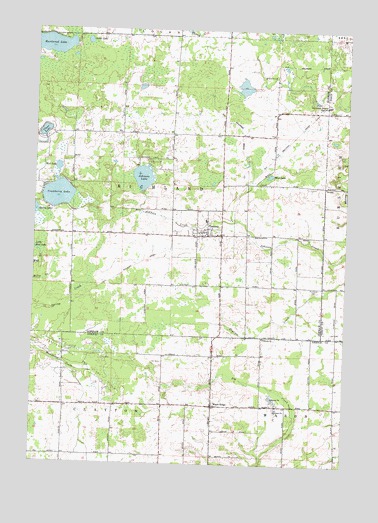
Prescott, MI USGS Topographic Map
Click on map above to begin viewing in our Map Viewer.

This topographic map contains these locations and features:
Feature Name Type Latitude Longitude GNIS ID View Map
Cedar LakeLakeN44.2465°W83.9792°622930View Map
Church of the Holy FireChurchN44.2200°W83.9250°2503013View Map
Clayton Oil and Gas FieldOilfieldN44.1525°W83.9764°1623286View Map
Clear LakeLakeN44.2203°W83.9962°623419View Map
County Line Wesleyan ChurchChurchN44.1617°W83.9078°2515060View Map
Cranberry LakeLakeN44.2021°W83.9906°623981View Map
First Presbyterian ChurchChurchN44.1422°W83.9278°2515061View Map
Hardwood LakeLakeN44.2454°W83.9948°627785View Map
Johnson LakeLakeN44.2074°W83.9568°629338View Map
Judson Baptist ChurchChurchN44.1911°W83.9361°2503012View Map
Maple RidgePopulated PlaceN44.1420°W83.9275°631483View Map
Maple Ridge Post Office (historical)Post OfficeN44.1419°W83.9275°2515124View Map
Mud LakeLakeN44.2082°W83.9058°632988View Map
Mud LakeLakeN44.2102°W83.9907°632989View Map
Ogemaw East LibraryBuildingN44.1939°W83.9300°2503008View Map
PrescottPopulated PlaceN44.1920°W83.9308°635424View Map
Prescott ClinicHospitalN44.1931°W83.9306°2503007View Map
Prescott Post OfficePost OfficeN44.1922°W83.9306°2503006View Map
Prescott Station (historical)LocaleN44.1894°W83.9344°2503005View Map
Richland CemeteryCemeteryN44.1758°W83.8875°635883View Map
Richland Logan Fire DepartmentBuildingN44.2196°W83.9267°2626728View Map
Township of RichlandCivilN44.2051°W83.9445°1626973View Map
Village of PrescottCivilN44.1916°W83.9322°2399022View Map
Whittemore-Prescott High SchoolSchoolN44.2286°W83.8830°1616403View Map
Whittemore-Prescott Junior High SchoolSchoolN44.1950°W83.9308°2503011View Map

Note: Coordinates in the location and feature list above are referenced to NAD83 datum.


Copyright (C) 2008-2024 Ryan Niemi / Sunset Dynamics ... All Rights Reserved