TopoQuest Logo
Do you find TopoQuest useful?
Help keep TopoQuest running and adding new maps/features by donating!
Bitcoin:  19c7KJd3qBynnjoSw5npx9KScwjBe4ifkT
Litecoin:  LXs6TkuXGGXo1vDsWCkWVdjQX94eUKd6ui
Home View Maps Find Maps Find Places Resources & Links


Sterling, Michigan Topographic Map

USGS Map Title: Sterling, MI
USGS Map MRC: 44084A1
DRG (GeoTIFF) Download: o44084a1.tif


Neighboring USGS Topographic Map Quads:


  Sterling NW, MI  
44084B2
 

  Skidway Lake, MI  
44084B1
 

  Prescott, MI  
44083B8
 

  Sterling SW, MI  
44084A2
 

  Sterling, MI  
44084A1
 

  Omer SW, MI  
44083A8
 

  Bentley, MI  
43084H2
 

  Mount Forest, MI  
43084H1
 

  Standish, MI  
43083H8


Map MRC Location:

N45°
W85°
N45°
W84°
H8 H7 H6 H5 H4 H3 H2 H1
G8 G7 G6 G5 G4 G3 G2 G1
F8 F7 F6 F5 F4 F3 F2 F1
E8 E7 E6 E5 E4 E3 E2 E1
D8 D7 D6 D5 D4 D3 D2 D1
C8 C7 C6 C5 C4 C3 C2 C1
B8 B7 B6 B5 B4 B3 B2 B1
A8 A7 A6 A5 A4 A3 A2 A1
N44°
W85°
N44°
W84°

Sterling, MI USGS 1:24K Topographic Map Preview:
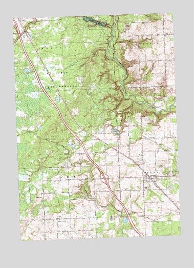
Sterling, MI USGS Topographic Map
Click on map above to begin viewing in our Map Viewer.

This topographic map contains these locations and features:
Feature Name Type Latitude Longitude GNIS ID View Map
Adams Oil FieldOilfieldN44.0022°W84.0722°1623200View Map
Alger CemeteryCemeteryN44.1153°W84.1178°619942View Map
Bear CreekStreamN44.1053°W84.0525°620823View Map
Burch CreekStreamN44.1245°W84.0442°622265View Map
Deep River Township HallBuildingN44.0336°W84.0147°2515050View Map
Interchange 195CrossingN44.0333°W84.0572°2515139View Map
Kingdom Hall of Jehovah's WitnessesChurchN44.0769°W84.0106°2515052View Map
Lake CharlyleLakeN44.0601°W84.0477°623121View Map
MelitaPopulated PlaceN44.1128°W84.0072°1617715View Map
Melita Post Office (historical)Post OfficeN44.1128°W84.0072°2515123View Map
Moores Junction Post Office (historical)Post OfficeN44.0117°W84.0956°2515122View Map
Morres JunctionPopulated PlaceN44.0117°W84.0956°1617730View Map
North Adams Oil FieldOilfieldN44.0445°W84.0861°1623529View Map
Parmalee CreekStreamN44.0761°W84.0300°634420View Map
Richter CreekStreamN44.1070°W84.0486°635892View Map
Rifle River Golf CourseLocaleN44.0647°W84.0272°2515043View Map
River View Campgrounds and Canoe LiveryLocaleN44.0836°W84.0356°2515044View Map
Saint George CemeteryCemeteryN44.0428°W84.0278°636654View Map
SterlingPopulated PlaceN44.0334°W84.0228°638795View Map
Sterling Area Fire DepartmentBuildingN44.0329°W84.0147°2627082View Map
Sterling Area Health CenterHospitalN44.0336°W84.0111°2515051View Map
Sterling CemeteryCemeteryN44.0408°W84.0297°638796View Map
Sterling Elementary SchoolSchoolN44.0339°W84.0269°2515049View Map
Sterling Oil FieldOilfieldN44.0220°W84.0708°1623654View Map
Sterling Post OfficePost OfficeN44.0336°W84.0286°2515047View Map
Sterling StationLocaleN44.0336°W84.0247°2515045View Map
Sterling United Methodist ChurchChurchN44.0325°W84.0247°2515046View Map
Sterling Wesleyan ChurchChurchN44.0308°W84.0272°2515048View Map
Township of AdamsCivilN44.0401°W84.1061°1625799View Map
Township of MoffattCivilN44.1226°W84.1070°1626751View Map
Village of SterlingCivilN44.0325°W84.0194°2399895View Map
Wells CreekStreamN44.1186°W84.0461°1615991View Map
WSTD-FM (Standish)TowerN44.0356°W84.0086°1625511View Map

Note: Coordinates in the location and feature list above are referenced to NAD83 datum.


Copyright (C) 2008-2024 Ryan Niemi / Sunset Dynamics ... All Rights Reserved