TopoQuest Logo
Do you find TopoQuest useful?
Help keep TopoQuest running and adding new maps/features by donating!
Bitcoin:  19c7KJd3qBynnjoSw5npx9KScwjBe4ifkT
Litecoin:  LXs6TkuXGGXo1vDsWCkWVdjQX94eUKd6ui
Home View Maps Find Maps Find Places Resources & Links


Selkirk, Michigan Topographic Map

USGS Map Title: Selkirk, MI
USGS Map MRC: 44084C1
DRG (GeoTIFF) Download: o44084c1.tif


Neighboring USGS Topographic Map Quads:


  Damon, MI  
44084D2
 

  Rose City, MI  
44084D1
 

  South Branch, MI  
44083D8
 

  West Branch, MI  
44084C2
 

  Selkirk, MI  
44084C1
 

  Sage Lake, MI  
44083C8
 

  Sterling NW, MI  
44084B2
 

  Skidway Lake, MI  
44084B1
 

  Prescott, MI  
44083B8


Map MRC Location:

N45°
W85°
N45°
W84°
H8 H7 H6 H5 H4 H3 H2 H1
G8 G7 G6 G5 G4 G3 G2 G1
F8 F7 F6 F5 F4 F3 F2 F1
E8 E7 E6 E5 E4 E3 E2 E1
D8 D7 D6 D5 D4 D3 D2 D1
C8 C7 C6 C5 C4 C3 C2 C1
B8 B7 B6 B5 B4 B3 B2 B1
A8 A7 A6 A5 A4 A3 A2 A1
N44°
W85°
N44°
W84°

Selkirk, MI USGS 1:24K Topographic Map Preview:
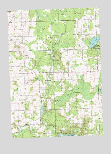
Selkirk, MI USGS Topographic Map
Click on map above to begin viewing in our Map Viewer.

This topographic map contains these locations and features:
Feature Name Type Latitude Longitude GNIS ID View Map
Ammond CreekStreamN44.3431°W84.0722°620069View Map
Bo - Te FarmsLocaleN44.3214°W84.1169°2725292View Map
Camp Lu Lay LeaPopulated PlaceN44.3370°W84.0081°622598View Map
Campbell CreekStreamN44.2584°W84.1125°622658View Map
Churchill ChurchChurchN44.3134°W84.1036°623305View Map
Churchill Township CemeteryCemeteryN44.3139°W84.0642°2503052View Map
Clear CreekStreamN44.3725°W84.0506°1619521View Map
Dedrich CreekStreamN44.2861°W84.0778°624446View Map
Dedrich SwampSwampN44.2934°W84.0397°624447View Map
Emt FarmsLocaleN44.3117°W84.0583°2725295View Map
Faith Lutheran ChurchChurchN44.2514°W84.0047°2503018View Map
Henderson LakeLakeN44.3413°W84.0081°628104View Map
Hiltz CreekStreamN44.3056°W84.0703°628339View Map
Holiness CampgroundLocaleN44.2847°W84.1061°628419View Map
Klacking CreekStreamN44.3261°W84.0697°629780View Map
O'Neil SchoolSchoolN44.3125°W84.0450°633803View Map
Ogemaw County FairgroundsLocaleN44.2708°W84.0639°2501970View Map
Peterson CreekStreamN44.2534°W84.0369°634713View Map
Prince of Peace Lutheran ChurchChurchN44.3639°W84.1172°2502999View Map
Prior CreekStreamN44.3322°W84.0669°1621318View Map
Red SchoolSchoolN44.3128°W84.1047°635724View Map
Rifle River SchoolSchoolN44.2772°W84.1047°635921View Map
Rosebrugh Dairy FarmLocaleN44.3011°W84.1064°2725298View Map
Sage Post Office (historical)Post OfficeN44.3639°W84.0244°2503033View Map
SelkirkPopulated PlaceN44.3131°W84.0672°637566View Map
Selkirk Post Office (historical)Post OfficeN44.3131°W84.0672°2503032View Map
Shepards CreekStreamN44.2978°W84.0708°637738View Map
South Branch Shepards CreekStreamN44.3078°W84.0858°638311View Map
Thompson Airport (historical)AirportN44.3129°W84.0682°1624155View Map
Township of ChurchillCivilN44.2914°W84.0652°1626082View Map
Troll Landing CampgroundLocaleN44.2550°W84.0653°2503016View Map
Withey LakeLakeN44.2939°W84.0019°1616666View Map
Withey SchoolSchoolN44.3128°W84.0042°1616667View Map

Note: Coordinates in the location and feature list above are referenced to NAD83 datum.


Copyright (C) 2008-2024 Ryan Niemi / Sunset Dynamics ... All Rights Reserved