TopoQuest Logo
Do you find TopoQuest useful?
Help keep TopoQuest running and adding new maps/features by donating!
Bitcoin:  19c7KJd3qBynnjoSw5npx9KScwjBe4ifkT
Litecoin:  LXs6TkuXGGXo1vDsWCkWVdjQX94eUKd6ui
Home View Maps Find Maps Find Places Resources & Links


Primghar, Iowa Topographic Map

USGS Map Title: Primghar, IA
USGS Map MRC: 43095A6
DRG (GeoTIFF) Download: o43095a6.tif


Neighboring USGS Topographic Map Quads:


  Sheldon, IA  
43095B7
 

  Sanborn, IA  
43095B6
 

  Plessis, IA  
43095B5
 

  Sheldon SE, IA  
43095A7
 

  Primghar, IA  
43095A6
 

  Gaza, IA  
43095A5
 

  Granville East, IA  
42095H7
 

  Paullina, IA  
42095H6
 

  Sutherland West, IA  
42095H5


Map MRC Location:

N44°
W96°
N44°
W95°
H8 H7 H6 H5 H4 H3 H2 H1
G8 G7 G6 G5 G4 G3 G2 G1
F8 F7 F6 F5 F4 F3 F2 F1
E8 E7 E6 E5 E4 E3 E2 E1
D8 D7 D6 D5 D4 D3 D2 D1
C8 C7 C6 C5 C4 C3 C2 C1
B8 B7 B6 B5 B4 B3 B2 B1
A8 A7 A6 A5 A4 A3 A2 A1
N43°
W96°
N43°
W95°

Primghar, IA USGS 1:24K Topographic Map Preview:
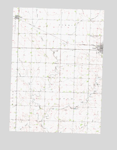
Primghar, IA USGS Topographic Map
Click on map above to begin viewing in our Map Viewer.

This topographic map contains these locations and features:
Feature Name Type Latitude Longitude GNIS ID View Map
American Reformed ChurchChurchN43.0875°W95.6256°1907093View Map
ArcherPopulated PlaceN43.1153°W95.7458°465637View Map
Archer (historical)LocaleN43.1153°W95.7458°1907141View Map
Archer Ambulance ServiceBuildingN43.1152°W95.7419°2599899View Map
Archer Cooperative Grain ElevatorLocaleN43.1153°W95.7458°1907139View Map
Archer Post OfficePost OfficeN43.1153°W95.7458°1907137View Map
Archer Public LibraryBuildingN43.1153°W95.7458°1907140View Map
Archer Reformed ChurchChurchN43.1153°W95.7458°1907138View Map
Archer Volunteer Fire DepartmentBuildingN43.1154°W95.7462°2577298View Map
Church of ChristChurchN43.0861°W95.6308°1907090View Map
City of ArcherCivilN43.1151°W95.7441°2393975View Map
D and C FarmLocaleN43.0194°W95.7217°2725358View Map
Dry RunStreamN43.0130°W95.7047°456032View Map
Hofmeyer FarmsLocaleN43.0217°W95.6622°2725347View Map
Johnson CreekStreamN43.0366°W95.7195°457969View Map
Mill Creek AreaParkN43.0550°W95.7072°1906977View Map
Nicholson and Edwards Grain Company ElevatorLocaleN43.0841°W95.6314°1907080View Map
Northwest Iowa Health CenterHospitalN43.0833°W95.6281°1907144View Map
O'Brien County CourthouseBuildingN43.0866°W95.6275°1907081View Map
O'Brien County Sheriff's OfficeBuildingN43.0875°W95.6265°1907078View Map
Pleasant Hill CemeteryCemeteryN43.0980°W95.6378°460257View Map
PrimgharPopulated PlaceN43.0869°W95.6272°460449View Map
Primghar (historical)LocaleN43.0853°W95.6325°1907096View Map
Primghar Chiropractic CenterHospitalN43.0861°W95.6278°1907088View Map
Primghar Post OfficePost OfficeN43.0853°W95.6281°1907079View Map
Saint Anthony CemeteryCemeteryN43.0986°W95.6361°460936View Map
Saint Anthony s Catholic ChurchChurchN43.0847°W95.6286°1907142View Map
South O'Brien Elementary School Primghar CenterSchoolN43.0887°W95.6280°1907094View Map
Three Flags DairyLocaleN43.0886°W95.6919°2725450View Map
Township of DaleCivilN43.0409°W95.6830°467674View Map
United Methodist ChurchChurchN43.1153°W95.7458°1907136View Map
West Branch Mill CreekStreamN43.0819°W95.6928°462816View Map

Note: Coordinates in the location and feature list above are referenced to NAD83 datum.


Copyright (C) 2008-2025 Ryan Niemi / Sunset Dynamics ... All Rights Reserved