TopoQuest Logo
Do you find TopoQuest useful?
Help keep TopoQuest running and adding new maps/features by donating!
Bitcoin:  19c7KJd3qBynnjoSw5npx9KScwjBe4ifkT
Litecoin:  LXs6TkuXGGXo1vDsWCkWVdjQX94eUKd6ui
Home View Maps Find Maps Find Places Resources & Links


Sanborn, Iowa Topographic Map

USGS Map Title: Sanborn, IA
USGS Map MRC: 43095B6
DRG (GeoTIFF) Download: o43095b6.tif


Neighboring USGS Topographic Map Quads:


  Ashton, IA  
43095C7
 

  Cloverdale, IA  
43095C6
 

  Melvin, IA  
43095C5
 

  Sheldon, IA  
43095B7
 

  Sanborn, IA  
43095B6
 

  Plessis, IA  
43095B5
 

  Sheldon SE, IA  
43095A7
 

  Primghar, IA  
43095A6
 

  Gaza, IA  
43095A5


Map MRC Location:

N44°
W96°
N44°
W95°
H8 H7 H6 H5 H4 H3 H2 H1
G8 G7 G6 G5 G4 G3 G2 G1
F8 F7 F6 F5 F4 F3 F2 F1
E8 E7 E6 E5 E4 E3 E2 E1
D8 D7 D6 D5 D4 D3 D2 D1
C8 C7 C6 C5 C4 C3 C2 C1
B8 B7 B6 B5 B4 B3 B2 B1
A8 A7 A6 A5 A4 A3 A2 A1
N43°
W96°
N43°
W95°

Sanborn, IA USGS 1:24K Topographic Map Preview:
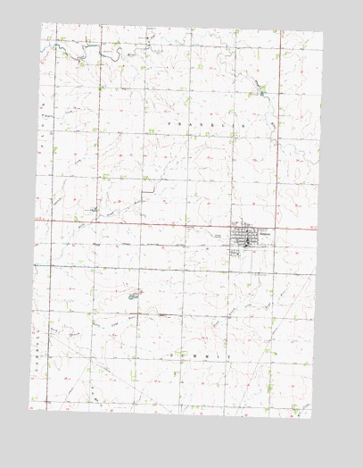
Sanborn, IA USGS Topographic Map
Click on map above to begin viewing in our Map Viewer.

This topographic map contains these locations and features:
Feature Name Type Latitude Longitude GNIS ID View Map
Allison AcresLocaleN43.2486°W95.6825°2723939View Map
B and B FarmsLocaleN43.1869°W95.6256°2723929View Map
Christian Reformed ChurchChurchN43.1822°W95.6633°1907069View Map
City of SanbornCivilN43.1814°W95.6553°2396532View Map
Cornerstone United Reformed ChurchChurchN43.1850°W95.6456°1907074View Map
Diamond H FarmsLocaleN43.1872°W95.7489°2722843View Map
Douma ParkParkN43.1625°W95.7058°1907076View Map
First Reformed ChurchChurchN43.1853°W95.6603°1907072View Map
Getting FarmsLocaleN43.2353°W95.7261°2723930View Map
Hartley - Melvin - Sanborn Middle SchoolSchoolN43.1848°W95.6562°1907067View Map
Hartog Elevator Incorporated ElevatorLocaleN43.1811°W95.6572°1907059View Map
Hofman FarmLocaleN43.1436°W95.7333°2723931View Map
North Fork Floyd RiverStreamN43.2433°W95.7025°459584View Map
Peelen FarmsLocaleN43.2050°W95.7450°2723933View Map
Prairie View Retirement HomeHospitalN43.1858°W95.6631°1907064View Map
Roseland CemeteryCemeteryN43.1853°W95.6817°460809View Map
Saint Andrews United Methodist ChurchChurchN43.1855°W95.6475°1907073View Map
Saint Cecilia Catholic ChurchChurchN43.1839°W95.6517°1907070View Map
Saint Cecilla CemeteryCemeteryN43.1711°W95.6528°460963View Map
Saint Johns Lutheran ChurchChurchN43.1816°W95.6556°1907075View Map
SanbornLocaleN43.1800°W95.6564°1907058View Map
SanbornPopulated PlaceN43.1816°W95.6556°461387View Map
Sanborn Ambulance ServiceBuildingN43.1810°W95.6500°2599684View Map
Sanborn Chiropractic ClinicHospitalN43.1822°W95.6553°1907066View Map
Sanborn Christian SchoolSchoolN43.1812°W95.6607°1907068View Map
Sanborn Golf and Country ClubLocaleN43.1741°W95.6676°1907063View Map
Sanborn Medical ClinicHospitalN43.1833°W95.6561°1907065View Map
Sanborn Post OfficePost OfficeN43.1830°W95.6553°1907061View Map
Sanborn Presbyterian ChurchChurchN43.1841°W95.6539°1907071View Map
Sanborn Public LibraryBuildingN43.1830°W95.6558°1907062View Map
Sanborn Sow FarmLocaleN43.1478°W95.6653°2723936View Map
Siouxland Farmers Co-op ElevatorLocaleN43.1816°W95.6586°1907060View Map
Solsma FarmsLocaleN43.1844°W95.6989°2723938View Map
Township of FranklinCivilN43.2150°W95.6836°467861View Map
Township of SummitCivilN43.1280°W95.6833°468763View Map
Vollink FarmsLocaleN43.1453°W95.7186°2723935View Map

Note: Coordinates in the location and feature list above are referenced to NAD83 datum.


Copyright (C) 2008-2024 Ryan Niemi / Sunset Dynamics ... All Rights Reserved