TopoQuest Logo
Do you find TopoQuest useful?
Help keep TopoQuest running and adding new maps/features by donating!
Bitcoin:  19c7KJd3qBynnjoSw5npx9KScwjBe4ifkT
Litecoin:  LXs6TkuXGGXo1vDsWCkWVdjQX94eUKd6ui
Home View Maps Find Maps Find Places Resources & Links


Sutherland West, Iowa Topographic Map

USGS Map Title: Sutherland West, IA
USGS Map MRC: 42095H5
DRG (GeoTIFF) Download: o42095h5.tif


Neighboring USGS Topographic Map Quads:


  Primghar, IA  
43095A6
 

  Gaza, IA  
43095A5
 

  Hartley SW, IA  
43095A4
 

  Paullina, IA  
42095H6
 

  Sutherland West, IA  
42095H5
 

  Sutherland East, IA  
42095H4
 

  Cleghorn, IA  
42095G6
 

  Cherokee North, IA  
42095G5
 

  Peterson SW, IA  
42095G4


Map MRC Location:

N43°
W96°
N43°
W95°
H8 H7 H6 H5 H4 H3 H2 H1
G8 G7 G6 G5 G4 G3 G2 G1
F8 F7 F6 F5 F4 F3 F2 F1
E8 E7 E6 E5 E4 E3 E2 E1
D8 D7 D6 D5 D4 D3 D2 D1
C8 C7 C6 C5 C4 C3 C2 C1
B8 B7 B6 B5 B4 B3 B2 B1
A8 A7 A6 A5 A4 A3 A2 A1
N42°
W96°
N42°
W95°

Sutherland West, IA USGS 1:24K Topographic Map Preview:
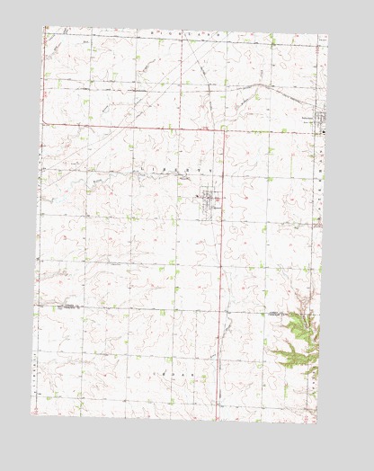
Sutherland West, IA USGS Topographic Map
Click on map above to begin viewing in our Map Viewer.

This topographic map contains these locations and features:
Feature Name Type Latitude Longitude GNIS ID View Map
Bar D Bar FarmsLocaleN42.8994°W95.5233°2740300View Map
Bierman FarmsLocaleN42.9086°W95.5258°2740299View Map
CalumetPopulated PlaceN42.9464°W95.5500°455060View Map
Calumet (historical)LocaleN42.9469°W95.5492°1907133View Map
Calumet FarmsLocaleN42.9400°W95.5656°2725356View Map
Calumet Post OfficePost OfficeN42.9464°W95.5500°1907135View Map
Calumet Volunteer Fire DepartmentBuildingN42.9467°W95.5505°2577316View Map
Church of ChristChurchN42.9733°W95.5011°1907050View Map
City of CalumetCivilN42.9450°W95.5515°2393501View Map
D and J FarmLocaleN42.9694°W95.5456°2725373View Map
Engelke FarmsLocaleN42.9639°W95.6053°2725349View Map
Erie Post Office (historical)Post OfficeN42.9236°W95.5581°466450View Map
Fisch FarmsLocaleN42.9950°W95.5592°2725446View Map
Flinders AreaParkN42.9805°W95.5239°1906983View Map
Ginger CreekStreamN42.9955°W95.6161°456907View Map
Henke FarmsLocaleN42.8936°W95.6042°2740297View Map
Lake Farm of JurgensenLocaleN42.9258°W95.6172°2725365View Map
Liberty CemeteryCemeteryN42.9243°W95.5935°458318View Map
M J H FarmsLocaleN42.9561°W95.5264°2725372View Map
Maass Angus FarmLocaleN42.9519°W95.5853°2725363View Map
Magnussen FarmLocaleN42.8942°W95.5886°2740298View Map
Mig FarmsLocaleN42.9217°W95.5847°2725346View Map
Northwest Iowa Research FarmLocaleN42.9283°W95.5392°1907041View Map
Romano Post Office (historical)Post OfficeN42.9583°W95.6142°1906991View Map
South O'Brien Middle SchoolSchoolN42.9689°W95.5011°1907051View Map
Steele Prairie State PreserveParkN42.8764°W95.5781°1907148View Map
Sutherland Methodist ChurchChurchN42.9741°W95.5006°1907049View Map
T and S FarmsLocaleN42.9317°W95.6244°2725366View Map
Township of LibertyCivilN42.9535°W95.5644°468226View Map
Zion United Church of ChristChurchN42.9464°W95.5500°1907134View Map

Note: Coordinates in the location and feature list above are referenced to NAD83 datum.


Copyright (C) 2008-2024 Ryan Niemi / Sunset Dynamics ... All Rights Reserved